
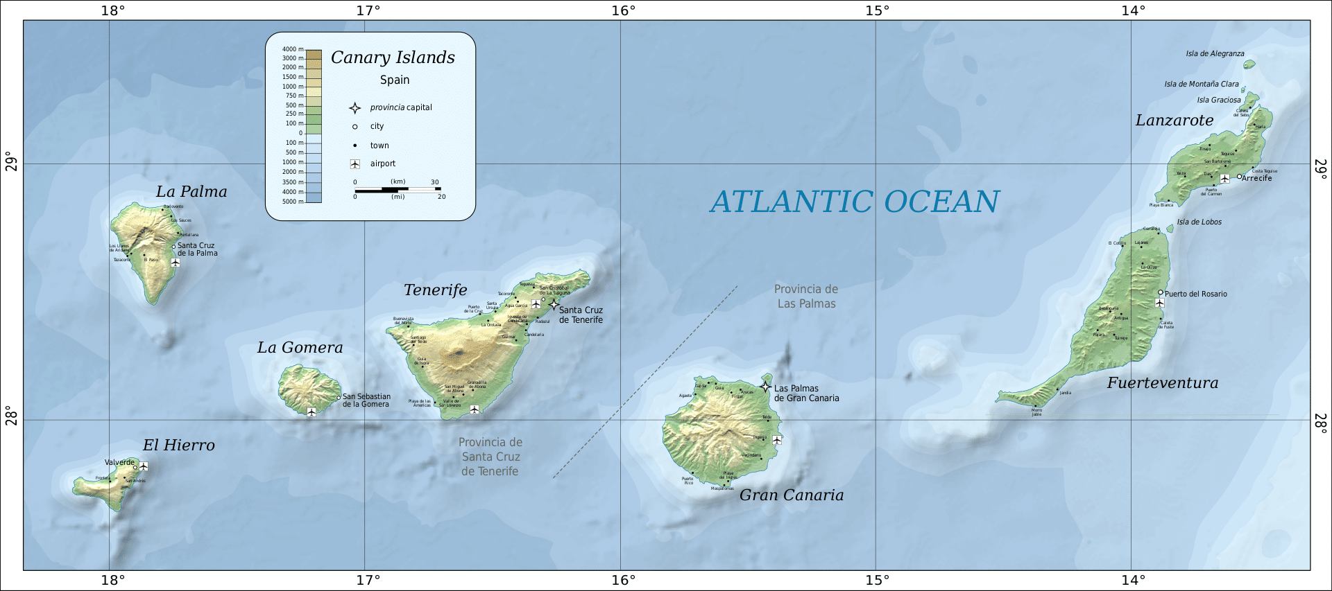
The islands form the Macaronesia ecoregion with the Azores, Cape Verde, Madeira, and the Savage Isles. The Canary Islands is the largest and most populated archipelago of the Macaronesia region. The archipelago consists of seven large and several smaller islands, all of which are volcanic in origin.
Economy:
The economy is based primarily on tourism, which makes up 32% of the GDP. The Canaries receive about 12 million tourists per year. Construction makes up nearly 20% of the GDP and tropical agriculture, primarily bananas and tobacco, are grown for export to Europe and the Americas. Ecologists are concerned that the resources, especially in the more arid islands, are being overexploited but there are still many agricultural resources like tomatoes, potatoes, onions, cochineal, sugarcane, grapes, vines, dates, oranges, lemons, figs, wheat, barley, maize, apricots, peaches and almonds.
Transportation:
The Canary Islands have eight airports altogether, two of the main ports of Spain, and an extensive network of autopistas (highways) and other roads.
Large ferry boats and fast ferries link most of the islands. Both types can transport large numbers of passengers, cargo, and vehicles.
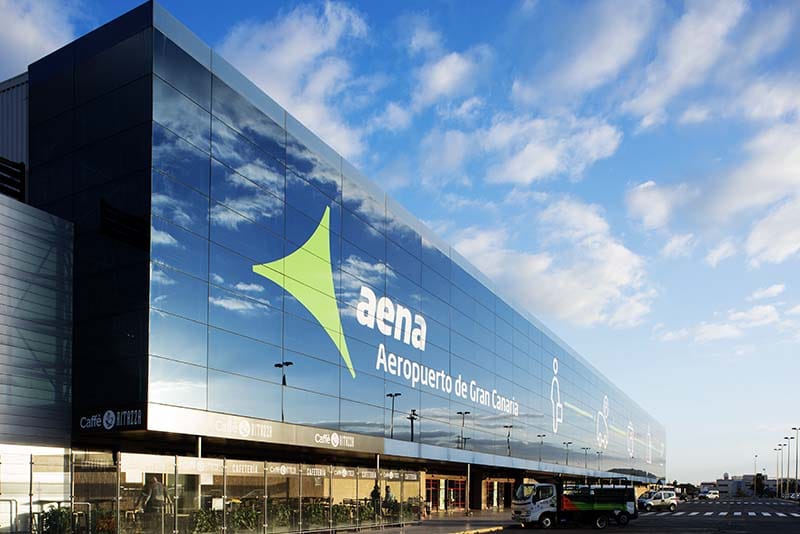
The largest airport is the Gran Canaria Airport. Tenerife has two airports, Tenerife North Airport and Tenerife South Airport. The island of Tenerife gathers the highest passenger movement of all the Canary Islands through its two airports. The two main islands (Tenerife and Gran Canaria) receive the greatest number of passengers. Tenerife 6,204,499 passengers and Gran Canaria 5,011,176 passengers.
Flag of the Canary Islands:
The flag of the Autonomous Community of the Canary Islands is a vertical tricolor of three equal bands of white, blue, and yellow. The designs were made official by the Statute of Autonomy of the Canarian Autonomous Community (Organic Law 10/82) on 16 August 1982.
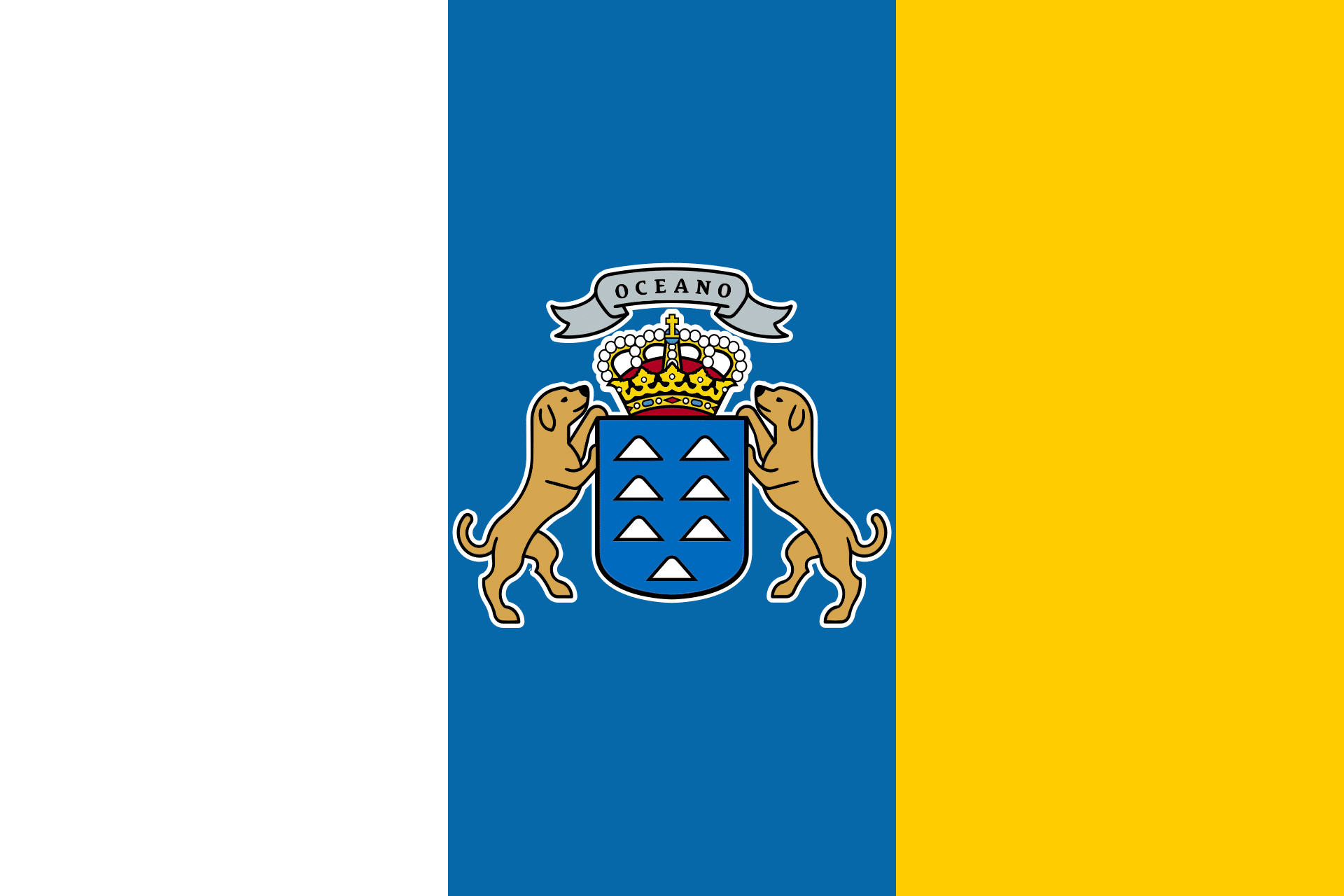
The tricolor flag has its origins in the Canarias Libre movement of the 1960s. It was designed by Carmen Sarmiento and her sons Arturo and Jesus Cantero Sarmiento, and first displayed (in paper form) on 8 September 1961. It combined the blue and white colors of the Province of Santa Cruz de Tenerife (Province of Canary Islands) with the blue and yellow colors of the Province of Las Palmas.