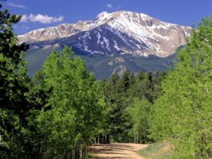
From west to east, the land of Colorado consists of desert lands, desert plateaus, alpine mountains, National Forests, relatively flat grasslands, scattered forests, buttes, and canyons in the western edge of the Great Plains. The famous Pikes Peak is located just west of Colorado Springs.

The northwestern corner of Colorado is a sparsely populated region, and it contains part of the noted Dinosaur National Monument, which is not only a paleontological area, but is also a scenic area of rocky hills, canyons, arid desert, and streambeds. Desert lands in Colorado are located in and around areas such as the Pueblo, Canon City, Florence, Great Sand Dunes National Park and Preserve, San Luis Valley, Cortez, Canyon of the Ancients National Monument, Hovenweep National Monument, Ute Mountain, Delta, Grand Junction, Colorado National Monument, and other areas surrounding the Uncompahgre Plateau and Uncompahgre National Forest.

The Western Slope of Colorado is drained by the Colorado River and its tributaries (primarily the Gunnison River, Green River, and the San Juan River), or by evaporation in its arid areas. The Colorado River flows through Glenwood Canyon, and then through an arid valley made up of desert from Rifle to Parachute, through the desert canyon of De Beque Canyon, and into the arid desert of Grand Valley, where the city of Grand Junction is located. Also prominent in or near the southern portion of the Western Slope are the Grand Mesa, which lies to the southeast of Grand Junction; the high San Juan Mountains, a rugged mountain range; and to the west of the San Juan Mountains, the Colorado Plateau, a high arid region that borders Southern Utah.
Grand Junction, Colorado is the largest city on the Western Slope. Grand Junction is located along Interstate 70, the only major highway in Western Colorado. Grand Junction is also along the major railroad of the Western Slope, the Union Pacific. This railroad also provides the tracks for Amtrak’s California Zephyr passenger train, which crosses the Rocky Mountains between Denver and Grand Junction via a route on which there are no continuous highways.
The Western Slope includes multiple notable destinations in the Colorado Rocky Mountains, including Glenwood Springs, with its resort hot springs, and the ski resorts of Aspen, Breckenridge, Vail, Crested Butte, Steamboat Springs, and Telluride.

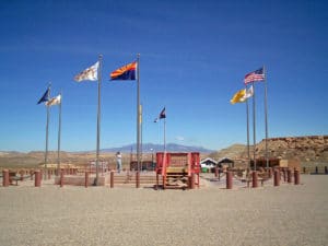
Colorado is one of four states in the United States that share a common geographic point – the Four Corners together with Arizona, New Mexico, and Utah. At this intersection, it is possible to stand in four states at once.
History:
Pre-Territorial Times:
The region that is today the state of Colorado has been inhabited by Native Americans for more than 13,000 years. The Lindenmeier Site in Larimer County contains artifacts dating from approximately 11200 BC to 3000 BC. The eastern edge of the Rocky Mountains was a major migration route that was important to the spread of early peoples throughout the Americas. The Ancient Pueblo peoples lived in the valleys and mesas of the Colorado Plateau. The Ute Nation inhabited the mountain valleys of the Southern Rocky Mountains and the Western Rocky Mountains, even as far east as the Front Range of present day. The Apache and the Comanche also inhabited Eastern and Southeastern parts of the state. At times, the Arapaho Nation and the Cheyenne Nation moved west to hunt across the High Plains.
