
The majority of Croatian voters voted in favor of country’s EU membership at the 2012 referendum. Croatia completed EU accession negotiations in 2011 and joined the European Union on 1 July 2013. Croatia was affected by the European migrant crisis in 2015 when Hungary’s closure of its borders with Serbia forced over 700,000 migrants to use Croatia as a transit country on their way to Western Europe.
Geography:
Croatia is located in Central and Southeast Europe, on the coast of the Adriatic Sea. It borders Hungary to the northeast, Serbia to the east, Bosnia and Herzegovina and Montenegro to the southeast, and Slovenia to the northwest. Part of the territory in the extreme south surrounding Dubrovnik is a practical exclave connected to the rest of the mainland by territorial waters, but separated on land by a short coastline strip belonging to Bosnia and Herzegovina around Neum.
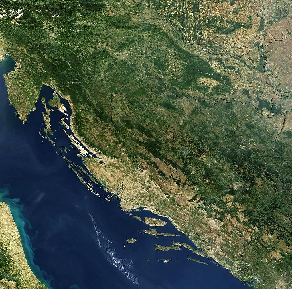
The territory covers 56,594 square kilometers (21,851 square miles), consisting of 56,414 square kilometers (21,782 square miles) of land and 128 square kilometers (49 square miles) of water. It is the 127th largest country in the world. Elevation ranges from the mountains of the Dinaric Alps with the highest point of the Dinara peak at 1,831 meters (6,007 feet) near the border with Bosnia and Herzegovina in the south to the shore of the Adriatic Sea which makes up its entire southwest border. Insular Croatia consists of over a thousand islands and islets varying in size, 48 of which are permanently inhabited. The largest islands are Cres and Krk, each of them having an area of around 405 square kilometers (156 square miles).
The hilly northern parts of Hrvatsko Zagorje and the flat plains of Slavonia in the east which is part of the Pannonian Basin are traversed by major rivers such as Danube, Drava, Kupa, and Sava. The Danube, Europe’s second longest river, runs through the city of Vukovar in the extreme east and forms part of the border with Vojvodina. The central and southern regions near the Adriatic coastline and islands consist of low mountains and forested highlands. Natural resources found in the country in quantities significant enough for production include oil, coal, bauxite, low-grade iron ore, calcium, gypsum, natural asphalt, silica, mica, clays, salt, and hydropower. Karst topography makes up about half of Croatia and is especially prominent in the Dinaric Alps. There are a number of deep caves in Croatia, 49 of which are deeper than 250 m (820.21 ft), 14 of them deeper than 500 m (1,640.42 ft) and three deeper than 1,000 m (3,280.84 ft). Croatia’s most famous lakes are the Plitvice lakes, a system of 16 lakes with waterfalls connecting them over dolomite and limestone cascades.
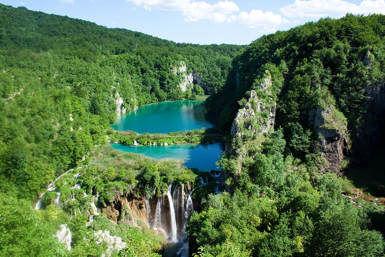
The lakes are renowned for their distinctive colors, ranging from turquoise to mint green, grey or blue.
Economy:
Croatia is classified as a high-income economy by the United Nations.
In 2017, economic output was dominated by the service sector which accounted for 70.1% of GDP, followed by the industrial sector with 26.2% and agriculture accounting for 3.7% of GDP. According to 2017 data, 1.9% of the workforce were employed in agriculture, 27.3% by industry and 70.8% in services. The industrial sector is dominated by shipbuilding, food processing, pharmaceuticals, information technology, biochemical and timber industry. Croatia’s largest trading partner was the rest of the European Union, with top three countries being Germany, Italy and Slovenia.