

Falkland Islands
The Falkland Islands have a land area of 4,700 square miles (12,000 km2) and a coastline estimated at 800 miles (1,300 km). The archipelago consists of two main islands, West Falkland and East Falkland, and 776 smaller islands. The islands are predominantly mountainous and hilly, with the major exception being the depressed plains of Lafonia (a peninsula forming the southern part of East Falkland). The Falklands consists of continental crust fragments resulting from the break-up of Gondwana and the opening of the South Atlantic that began 130 million years ago. The islands are located in the South Atlantic Ocean, on the Patagonian Shelf, about 300 miles (480 km) east of Patagonia in southern Argentina.
The archipelago’s two main islands are separated by the Falkland Sound, and its deep coastal indentations form natural harbors. East Falkland houses Stanley (the capital and largest settlement), the UK military base at RAF Mount Pleasant, and the archipelago’s highest point: Mount Usborne, at 2,313 feet (705 m). Outside of these significant settlements is the area colloquially known as “Camp”, which is derived from the Spanish term for countryside (Campo).
The climate of the islands is cold, windy and humid maritime. Variability of daily weather is typical throughout the archipelago. Rainfall is common over half of the year, averaging 610 millimeters (24 in) in Stanley, and sporadic light snowfall occurs nearly all year. The temperature has historically stayed between 21.1 and −11.1 °C (70.0 and 12.0 °F) in Stanley, with mean monthly temperatures varying from 9 °C (48 °F) early in the year to −1 °C (30 °F) in July. Strong westerly winds and cloudy skies are common. Although numerous storms are recorded each month, conditions are normally calm.
Economy:

The economy of the Falkland Islands is ranked the 222nd largest out of 229 in the world by GDP (PPP), but ranks 5th worldwide by GDP (PPP) per capita. The unemployment rate was 1% in 2016, and inflation was calculated at 1.4% in 2014. Based on 2010 data, the islands have a high Human Development Index of 0.874 and a moderate Gini coefficient for income inequality of 34.17. The local currency is the Falkland Islands pound, which is pegged to the British pound sterling.
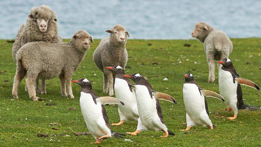
Economic development was advanced by ship resupplying and sheep farming for high-quality wool. The main sheep breeds in the Falkland Islands are Polwarth and Corriedale. During the 1980s, although ranch under-investment and the use of synthetic fibers damaged the sheep-farming sector, the government secured a major revenue stream by the establishment of an exclusive economic zone and the sale of fishing licences to “anybody wishing to fish within this zone”. Since the end of the Falklands War in 1982, the islands’ economic activity has increasingly focused on oil field exploration and tourism.
The port settlement of Stanley has regained the islands’ economic focus, with an increase in population as workers migrate from Camp. Fear of dependence on fishing licenses and threats from overfishing, illegal fishing and fish market price fluctuations have increased interest in oil drilling as an alternative source of revenue; exploration efforts have yet to find “exploitable reserves”. Development projects in education and sports have been funded by the Falklands government, without aid from the United Kingdom.
The primary sector of the economy accounts for most of the Falkland Islands’ gross domestic product, with the fishing industry alone contributing between 50% and 60% of annual GDP; agriculture also contributes significantly to GDP and employs about a tenth of the population. A little over a quarter of the workforce serves the Falkland Islands government, making it the archipelago’s largest employer. Tourism, part of the service economy, has been spurred by increased interest in Antarctic exploration and the creation of direct air links with the United Kingdom and South America. Tourists, mostly cruise ship passengers, are attracted by the archipelago’s wildlife and environment, as well as activities such as fishing and wreck diving; the majority find accommodation in Stanley. The islands’ major exports include wool, hides, venison, fish and squid; its main imports include fuel, building materials and clothing.
Transportation:
In 1982, the Falkland Islands had no roads outside Stanley, only tracks. By 2007, the Falkland Islands had a road network of 488 miles (786 km) with a further roads planned for construction link to all occupied mainland settlements by 2013. In 2012, the Falkland Islands Government classified the 536 miles (862 km) road network – East Falkland 304 miles (489 km) and West Falkland 232 miles (373 km) – into “A” roads, “B” roads and “C” roads for purposes of Highways Asset Management Plan. The “A” roads are the 75 miles (121 km) link between Stanley and New Haven (East Falkland) and the 48 miles (78 km) link between Port Howard and Fox Bay (West Falkland). All roads within Stanley are asphalted as are the ones at Mount Pleasant Airport (MPA). The road between Stanley and MPA is mostly gravel all-weather roads (as like the rest of the roads in the islands) with some short asphalted sections. The road between Stanley and MPA has a large trench on either side, which will ground any vehicle driving into it. These trenches were allegedly dug deeper than they needed to be as annual rainfall was taken as a number for the monthly rainfall.