
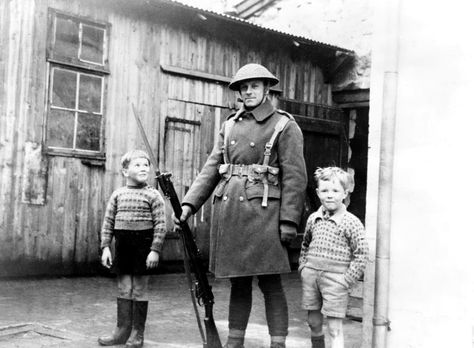
In the first year of World War II, on 12 April 1940, British troops occupied the Faroe Islands, shortly after the Operation Weserübung with the Nazi German invasion of Denmark on 9 April 1940. In 1942–1943 the British Royal Engineers, under the leadership of Lt. Col. William Law MC, built the only airport in the Faroe Islands, Vágar Airport. Control of the islands reverted to Denmark following the war, but Danish rule had been undermined, and Iceland’s independence served as a precedent for many Faroese.
The 1946 Faroese independence referendum resulted in 50.73% in favor of independence to 49.27% against. The Faroe Islands subsequently declared independence on 18 September 1946; however, this declaration was annulled by Denmark on 20 September on the grounds that a majority of the Faroese voters had not supported independence and King Christian X of Denmark dissolved the Faroese Løgting on 24 September. The dissolution of the Løgting was on 8 November followed by the Faroese parliamentary election of 1946 in which the parties in favor of full independence received a total of 5,396 votes while the parties against received a total of 7,488 votes. As a reaction to the growing self-government and independence movements, Denmark finally granted the Faroe Islands home-rule with a high degree of local autonomy on 30 March 1948.
In 1973 the Faroe Islands declined to join Denmark in entering the European Economic Community (later absorbed into the European Union). The islands experienced considerable economic difficulties following the collapse of the fishing industry in the early 1990s, but have since made efforts to diversify the economy. Since then, support for independence has grown and is the objective of the Republican Party.
Geography:
The Faroe Islands are an island group consisting of 18 major islands (and a total of 779 islands, islets, and skerries) about 655 kilometers (407 mi) off the coast of Northern Europe, between the Norwegian Sea and the North Atlantic Ocean, about halfway between Iceland and Norway, the closest neighbors being the Northern Isles and the Outer Hebrides of Scotland.
The islands cover an area of 1,399 square kilometers (540 sq. mi) and have small lakes and rivers, but no major ones. There are 1,117 kilometers (694 mi) of coastline. The only significant uninhabited island is Lítla Dímun.
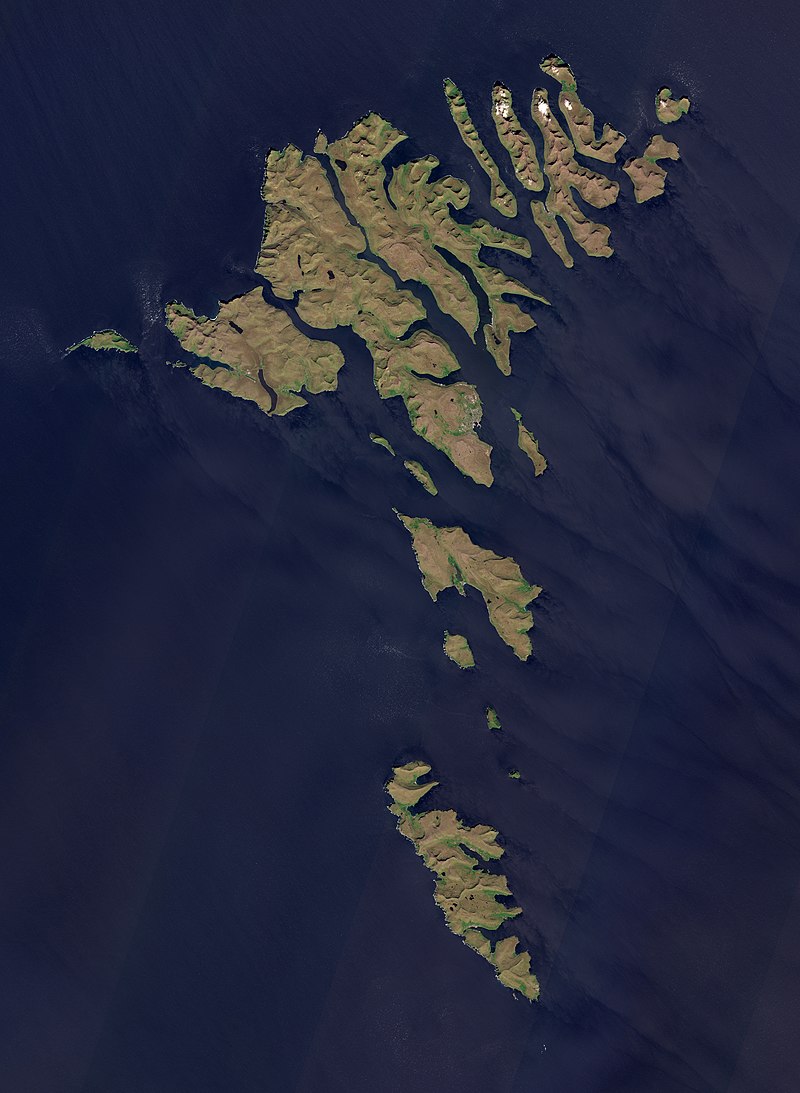
The islands are rugged and rocky with some low peaks; the coasts are mostly cliffs. The highest point is Slættaratindur in northern Eysturoy, 882 meters (2,894 ft) above sea level.
The Faroe Islands are made up of an approximately six-kilometers-thick succession of mostly basaltic lava that was part of the great North Atlantic Igneous Province during the Paleogene period. The lavas were erupted during the opening of the North Atlantic ocean, which began about 60 million years ago, and what is today the Faroe Islands was then attached to Greenland. The lavas are underlain by circa 30 km of unidentified ancient continental crust.
Economy:
Economic troubles caused by a collapse of the Faroese fishing industry in the early 1990s brought high unemployment rates of 10 to 15% by the mid-1990s. Unemployment decreased in the later 1990s, down to about 6% at the end of 1998. By June 2008 unemployment had declined to 1.1%, before rising to 3.4% in early 2009. In December 2014 the unemployment was 3.2%. Nevertheless, the almost total dependence on fishing and fish farming means that the economy remains vulnerable. One of the biggest private companies of the Faroe Islands is the salmon farming company Bakkafrost, which is the largest of the four salmon farming companies in the Faroe Islands and the eighth biggest in the world.