
The total area of Greenland is 2,166,086 km2 (836,330 sq mi) (including other offshore minor islands), of which the Greenland ice sheet covers 1,755,637 km2 (677,855 sq mi) (81%) and has a volume of approximately 2,850,000 km3 (680,000 cu mi). The highest point on Greenland is Gunnbjørn Fjeld at 3,700 m (12,139 ft) of the Watkins Range (East Greenland mountain range). The majority of Greenland, however, is less than 1,500 m (4,921 ft) in elevation.
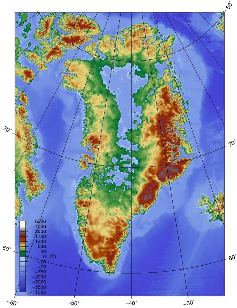
The weight of the ice sheet has depressed the central land area to form a basin lying more than 300 m (984 ft) below sea level, while elevations rise suddenly and steeply near the coast.
The ice flows generally to the coast from the center of the island. A survey led by French scientist Paul-Emile Victor in 1951 concluded that, under the ice sheet, Greenland is composed of three large islands. This is disputed, but if it is so, they would be separated by narrow straits, reaching the sea at Ilulissat Icefjord, at Greenland’s Grand Canyon and south of Nordostrundingen.
All towns and settlements of Greenland are situated along the ice-free coast, with the population being concentrated along the west coast. The northeastern part of Greenland is not part of any municipality, but it is the site of the world’s largest national park, Northeast Greenland National Park.
The extreme north of Greenland, Peary Land, is not covered by an ice sheet, because the air there is too dry to produce snow, which is essential in the production and maintenance of an ice sheet. If the Greenland ice sheet were to melt away completely, the world’s sea level would rise by more than 7 m (23 ft).
Economy:
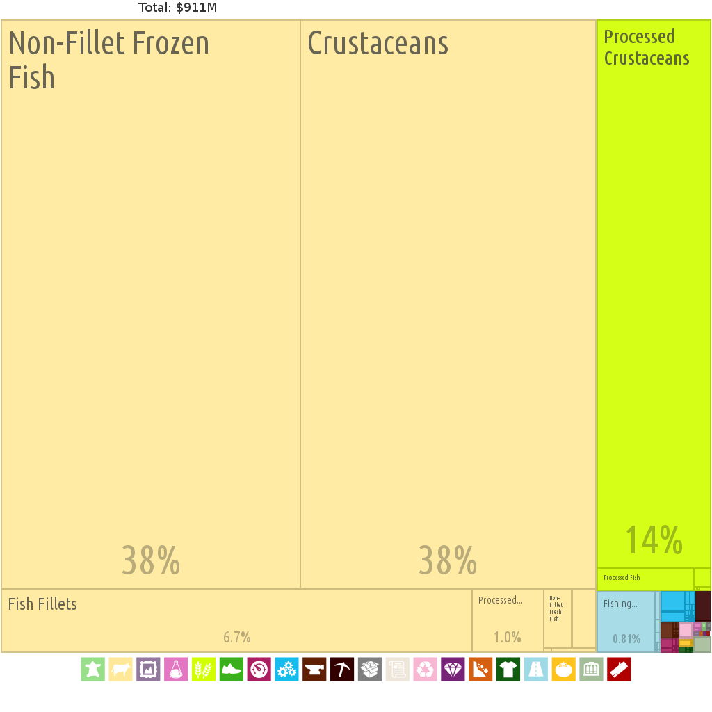
The Greenlandic economy is highly dependent on fishing. Fishing accounts for more than 90% of Greenland’s exports. The shrimp and fish industry is by far the largest income earner.
Greenland is abundant in minerals. Mining of ruby deposits began in 2007. Other mineral prospects are improving as prices are increasing. These include iron, uranium, aluminium, nickel, platinum, tungsten, titanium, and copper. Despite resumption of several hydrocarbon and mineral exploration activities, it will take several years before hydrocarbon production can materialize. The state oil company Nunaoil was created to help develop the hydrocarbon industry in Greenland. The state company Nunamineral has been launched on the Copenhagen Stock Exchange to raise more capital to increase the production of gold, started in 2007.
Electricity has traditionally been generated by oil or diesel power plants, even if there is a large surplus of potential hydropower. There is a program to build hydro power plants. The first, and still the largest, is Buksefjord hydroelectric power plant.
There are also plans to build a large aluminium smelter, using hydropower to create an exportable product. It is expected that much of the labor needed will be imported.
The European Union has urged Greenland to restrict People’s Republic of China development of rare-earth projects, as China accounts for 95% of the world’s current supply. In early 2013, the Greenland government said that it had no plans to impose such restrictions.