At the same time, the Chisholm Trail was opened and the Wild West-era commenced in Kansas. Wild Bill Hickok was a deputy marshal at Fort Riley and a marshal at Hays and Abilene. Dodge City was another wild cowboy town, and both Bat Masterson and Wyatt Earp worked as lawmen in the town. In one year alone, eight million head of cattle from Texas boarded trains in Dodge City bound for the East, earning Dodge the nickname “Queen of the Cowtowns.”

In response to demands of Methodists and other evangelical Protestants, in 1881 Kansas became the first U.S. state to adopt a constitutional amendment prohibiting all alcoholic beverages, which was only repealed in 1948.
Known as rural flight, the last few decades have been marked by a migratory pattern out of the countryside into cities. Out of all the cities in these Midwestern states, 89% have fewer than 3,000 people, and hundreds of those have fewer than 1,000. In Kansas alone, there are more than 6,000 ghost towns and dwindling communities, according to one Kansas historian, Daniel C. Fitzgerald. At the same time, some of the communities in Johnson County (metropolitan Kansas City) are among the fastest-growing in the country.

Geography:
Kansas is bordered by Nebraska on the north; Missouri on the east; Oklahoma on the south; and Colorado on the west. The state is divided into 105 counties with 628 cities, and is located equidistant from the Pacific and Atlantic oceans. The geographic center of the 48 contiguous states is in Smith County near Lebanon. Until 1989, the Meades Ranch Triangulation Station in Osborne County was the geodetic center of North America: the central reference point for all maps of North America. The geographic center of Kansas is in Barton County.
Kansas is underlain by a sequence of horizontal to gently westward dipping sedimentary rocks. A sequence of Mississippian, Pennsylvanian and Permian rocks outcrop in the eastern and southern part of the state. The state’s western half has exposures of Cretaceous through Tertiary sediments, the latter derived from the erosion of the uplifted Rocky Mountains to the west. These are underlain by older Paleozoic and Mesozoic sediments which correlate well with the outcrops to the east. The state’s northeastern corner was subjected to glaciation in the Pleistocene and is covered by glacial drift and loess.

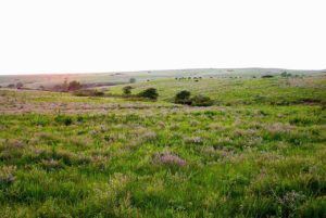
The western two-thirds of the state, lying in the great central plain of the United States, has a generally flat or undulating surface, while the eastern third has many hills and forests. The land gradually rises from east to west. The highest point, 4,039 feet is Mount Sunflower, 0.5 miles from the Colorado border. It is a common misconception that Kansas is the flattest state in the nation. In fact, Kansas has a maximum topographic relief of 3,360 feet making it the 23rd flattest U.S. state measured by maximum relief.
In south-central Kansas, the Wichita metropolitan area is home to over 600,000 people.
