
In 1855 the island was officially designated as part of New South Wales by the Constitution Act.
Over the next 30 years population remained small and the island was the subject of numerous scientific expeditions.
1890–1999:
In 1883 the company Burns Philp started a regular shipping service and the number of tourists gradually increased. By 1932, with the regular tourist run of SS Morinda, tourism became the second biggest source of external income after kentia palm sales to Europe. The service continues into the present day with the fortnightly Island Trader service from Port Macquarie.
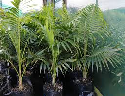
The palm trade began in the 1880s when the lowland kentia palm (Howea forsteriana) was first exported to Britain, Europe and America but the trade was only placed on a firm financial footing when the Lord Howe Island Kentia Palm Nursery was formed in 1906.
When Lord Howe Island Airport was completed in 1974, seaplanes were eventually replaced with QantasLink twin-engined turbo-prop Dash 8-200 aircraft.
21st Century:
In recent times tourism has increased and the government of New South Wales has been increasingly involved with issues of conservation.
One of the most contentious issues among islanders in the 21st century is what to do about the rodent situation. Rodents have only been on the island since the SS Makambo ran aground in 1918 and have wiped out several endemic bird species and were thought to have done the same to the Lord Howe Island stick insect. There is a plan to drop 42 tonnes of rat bait across the island but the community is heavily divided.
Geography:
Lord Howe Island is an irregularly crescent-shaped volcanic remnant in the southwest Pacific Ocean. Lying in the Tasman Sea between Australia and New Zealand the island is 370 miles east of mainland Port Macquarie, 436 miles northeast of Sydney, and about 480 miles from Norfolk Island to its northeast. The island is about 6.2 miles long and between 0.19 and 1.24 miles wide with an area of 5.62 square miles. Along the west coast there is a semi-enclosed sheltered coral reef lagoon with white sand, the most accessible of the island’s eleven beaches.
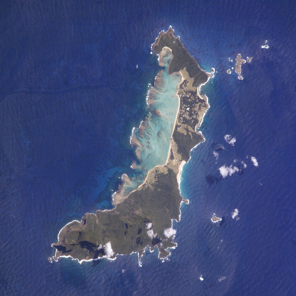
Both the north and south sections of the island are high ground of relatively untouched forest, in the south comprising two volcanic mountains, Mount Lidgbird 2,549 feet and Mount Gower which, rising to 2,871 feet, is the highest point on the island. The two mountains are separated by the saddle at the head of Erskine Valley. In the north, where most of the population live, high points are Malabar 686 feet and Mount Eliza 482 feet. Between these two uplands is an area of cleared lowland with some farming, the airstrip, and housing. The Lord Howe Island Group of islands comprises 28 islands, islets and rocks. Apart from Lord Howe Island itself the most notable of these is the pointed rocky islet Ball’s Pyramid, a 1,808 foot eroded volcano about 14 miles to the southeast, which is uninhabited but bird-colonized. It contains the only known wild population of the Lord Howe Island stick insect, formerly thought to be extinct.