
In 2010, a new constitution was adopted by referendum, establishing a Fourth Republic, which sustained the democratic, multi-party structure established in the previous constitution. Hery Rajaonarimampianina was declared the winner of the 2013 presidential election, which the international community deemed fair and transparent.
Geography:
At 592,800 square kilometers (228,900 sq mi), Madagascar is the world’s 47th largest country, the 2nd largest island country and the fourth-largest island. Neighboring islands include the French territory of Réunion and the country of Mauritius to the east, as well as the state of Comoros and the French territory of Mayotte to the north west. The nearest mainland state is Mozambique, located to the west.
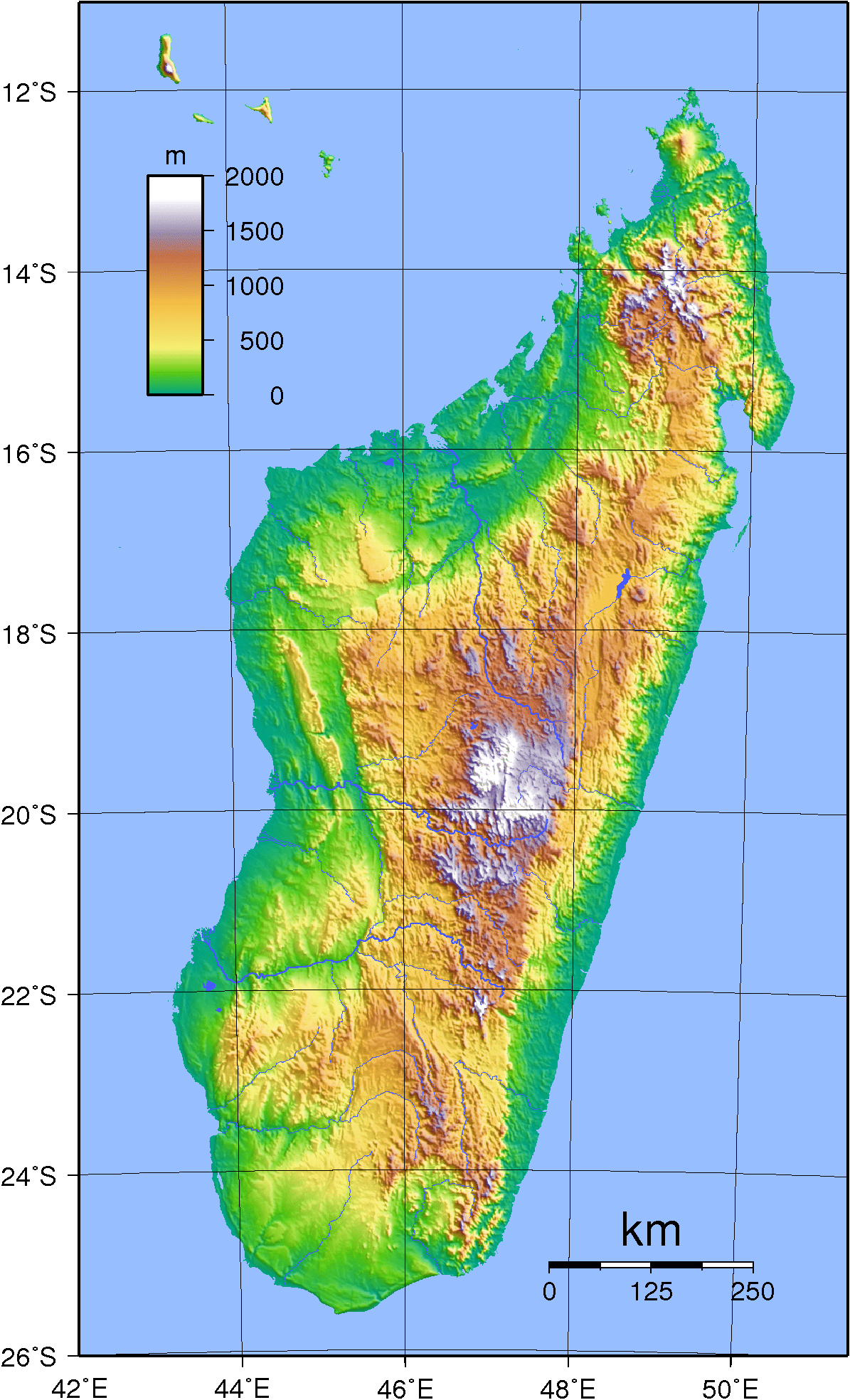
Along the length of the eastern coast runs a narrow and steep escarpment containing much of the island’s remaining tropical lowland forest.
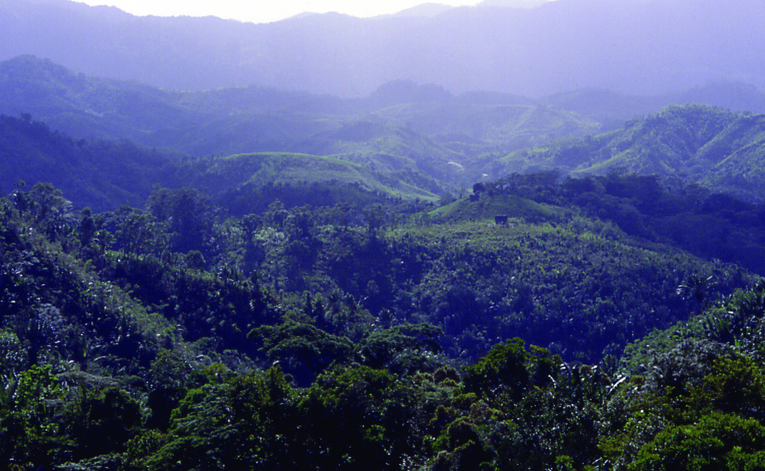
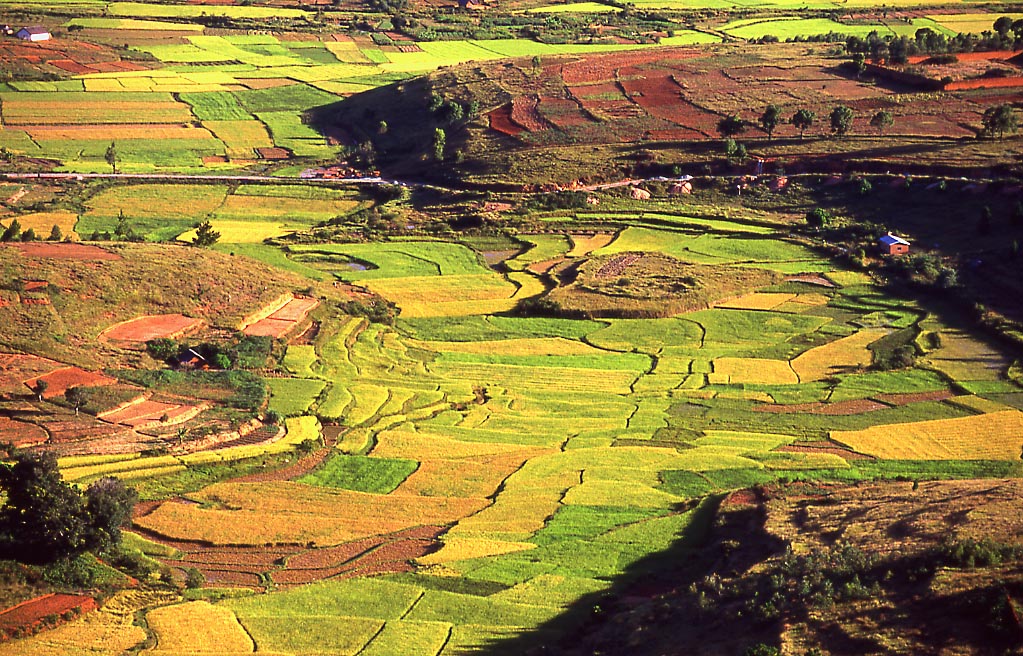
To the west of this ridge lies a plateau in the center of the island ranging in altitude from 750 to 1,500 m (2,460 to 4,920 ft) above sea level. These central highlands, traditionally the homeland of the Merina people and the location of their historic capital at Antananarivo, are the most densely populated part of the island and are characterized by terraced, rice-growing valleys lying between grassy hills and patches of the sub-humid forests that formerly covered the highland region.
To the west of the highlands, the increasingly arid terrain gradually slopes down to the Mozambique Channel and mangrove swamps along the coast.
Madagascar’s highest peaks rise from three prominent highland massifs: Maromokotro 2,876 m (9,436 ft) in the Tsaratanana Massif is the island’s highest point, followed by Boby Peak 2,658 m (8,720 ft) in the Andringitra Massif, and Tsiafajavona 2,643 m (8,671 ft) in the Ankaratra Massif. To the east, the Canal des Pangalanes is a chain of man-made and natural lakes connected by canals built by the French just inland from the east coast and running parallel to it for some 600 km (370 mi).
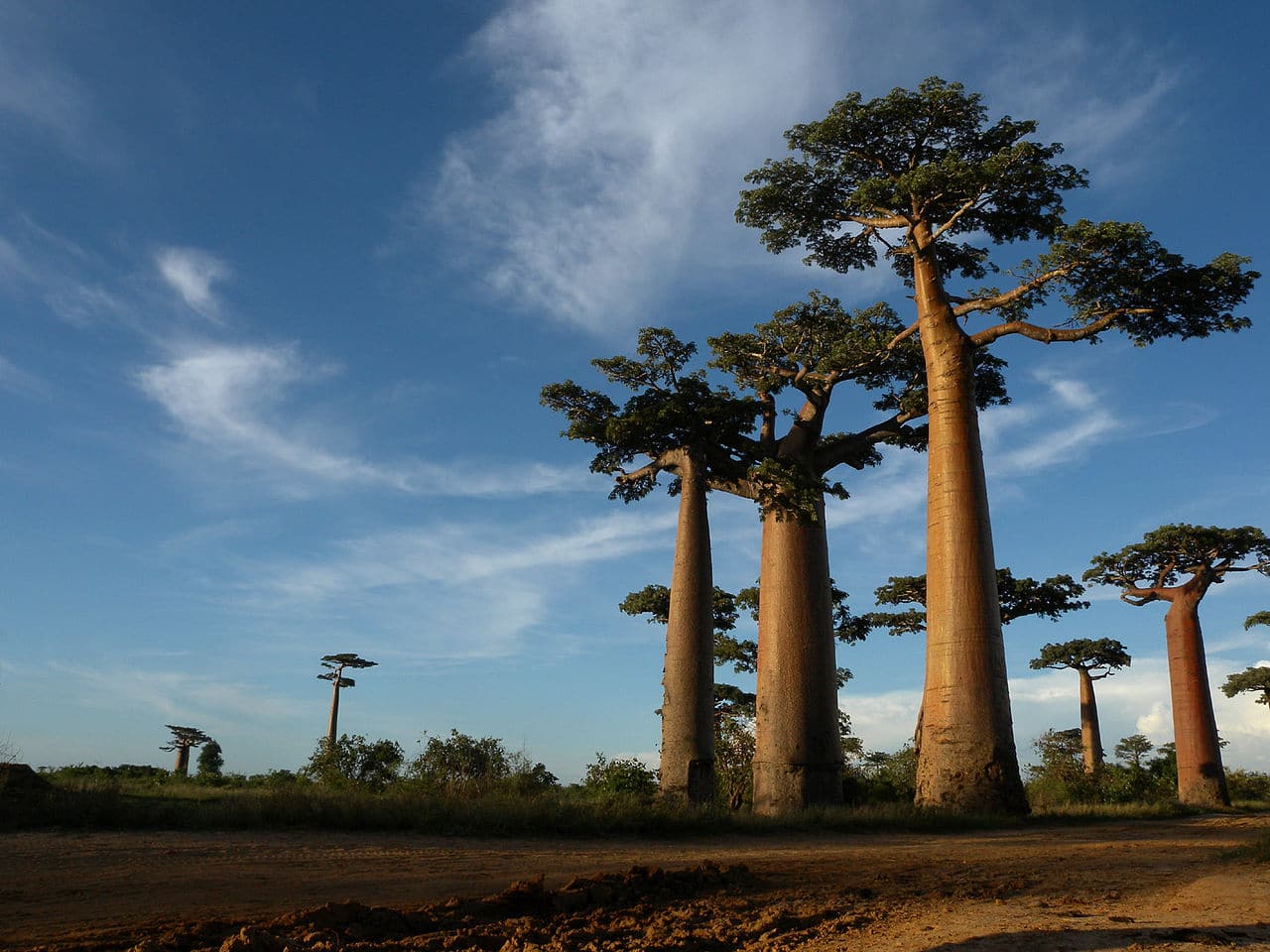
The western and southern sides, which lie in the rain shadow of the central highlands, are home to dry deciduous forests, spiny forests, and deserts and xeric shrublands.
Due to their lower population densities, Madagascar’s dry deciduous forests have been better preserved than the eastern rain forests or the original woodlands of the central plateau. The western coast features many protected harbors, but silting is a major problem caused by sediment from the high levels of inland erosion carried by rivers crossing the broad western plains.
Economy:
The agriculture sector constituted 29 percent of Malagasy GDP in 2011, while manufacturing formed 15 percent of GDP. Madagascar’s other sources of growth are tourism, agriculture and the extractive industries. Tourism focuses on the niche eco-tourism market, capitalizing on Madagascar’s unique biodiversity, unspoiled natural habitats, national parks and lemur species. An estimated 365,000 tourists visited Madagascar in 2008, but the sector declined during the political crisis with 180,000 tourists visiting in 2010. However, the sector has been growing steadily for a few years; In 2016, 293,000 tourists landed in the African island with an increase of 20% compared to 2015; For 2017 the country has the goal of reaching 366,000 visitors, while for 2018 government estimates are expected to reach 500,000 annual tourists.