
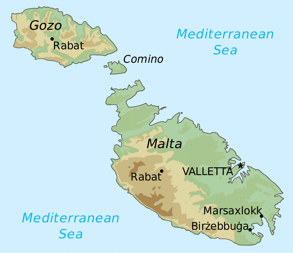
Numerous bays along the indented coastline of the islands provide good harbors. The landscape consists of low hills with terraced fields. The highest point in Malta is Ta’ Dmejrek, at 253 m (830 ft), near Dingli. Although there are some small rivers at times of high rainfall, there are no permanent rivers or lakes on Malta. However, some watercourses have fresh water running all year round at Baħrija near Ras ir-Raħeb, at l-Imtaħleb and San Martin, and at Lunzjata Valley in Gozo.
Economy:
Malta is classified as an advanced economy together with 32 other countries according to the International Monetary Fund (IMF). Until 1800, Malta depended on cotton, tobacco and its shipyards for exports. Once under British control, they came to depend on Malta Dockyard for support of the Royal Navy, especially during the Crimean War of 1854. The military base benefited craftsmen and all those who served the military.
In 1869, the opening of the Suez Canal gave Malta’s economy a great boost, as there was a massive increase in the shipping which entered the port. Ships stopping at Malta’s docks for refueling helped the Entrepôt trade, which brought additional benefits to the island. However, towards the end of the 19th century, the economy began declining, and by the 1940s Malta’s economy was in serious crisis. One factor was the longer range of newer merchant ships that required fewer refueling stops.
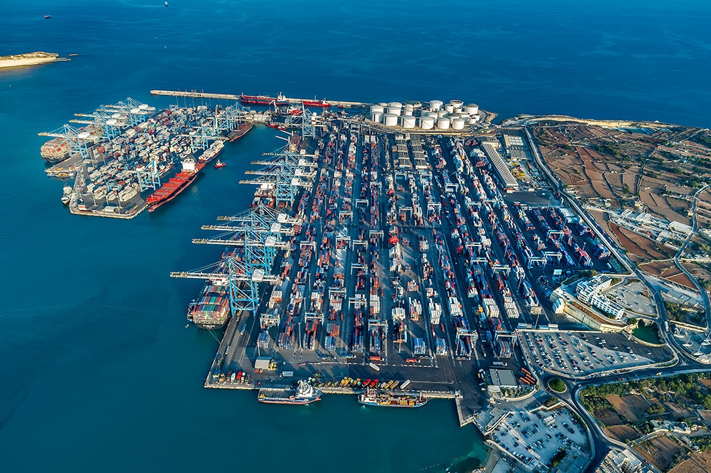
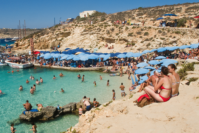
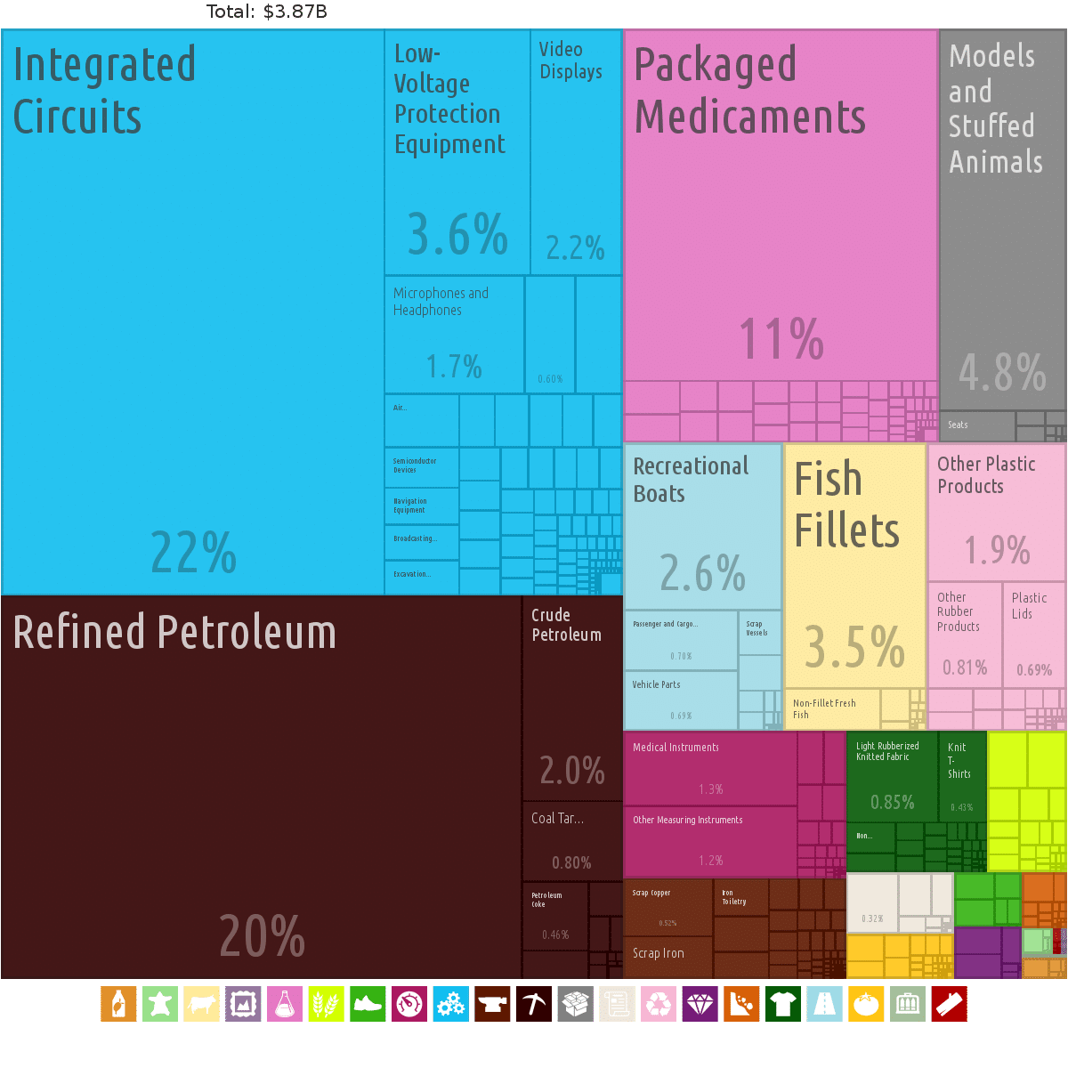
Currently, Malta’s major resources are limestone, a favorable geographic location and a productive labor force. Malta produces only about 20 percent of its food needs, has limited fresh water supplies because of the drought in the summer, and has no domestic energy sources, aside from the potential for solar energy from its plentiful sunlight. The economy is dependent on foreign trade (serving as a freight trans-shipment point), manufacturing (especially electronics and textiles), and tourism.
Film production has contributed to the Maltese economy. The film Sons of the Sea was the first shot in Malta, in 1925; by 2016, over 100 feature films had been entirely or partially filmed in the country since. Malta has served as a “double” for a wide variety of locations and historic periods including Ancient Greece, Ancient and modern Rome, Iraq, the Middle East and many more. The Maltese government introduced financial incentives for filmmakers in 2005. The current financial incentives to foreign productions as of 2015 stand at 25 per cent with an additional 2 per cent if Malta stands in as Malta; meaning a production can get up to 27 per cent back on their eligible spending incurred in Malta.
In preparation for Malta’s membership in the European Union, which it joined on 1 May 2004, it privatized some state-controlled firms and liberalized markets. For example, the government announced on 8 January 2007 that it was selling its 40 per cent stake in MaltaPost, to complete a privatization process which had been ongoing for the previous five years. From 2000 to 2010, Malta privatized telecommunications, postal services, shipyards and Malta International Airport.
Transportation:
Malta has 2,254 kilometers (1,401 miles) of road, 1,972 km (1,225 mi) (87.5 per cent) of which are paved and 282 km (175 mi) were unpaved (as of December 2003). The main roads of Malta from the southernmost point to the northernmost point are these: Triq Birżebbuġa in Birżebbuġa, Għar Dalam Road and Tal-Barrani Road in Żejtun, Santa Luċija Avenue in Paola, Aldo Moro Street (Trunk Road), 13 December Street and Ħamrun-Marsa Bypass in Marsa, Regional Road in Santa Venera/Msida/Gżira/San Ġwann, St Andrew’s Road in Swieqi/Pembroke, Malta, Coast Road in Baħar iċ-Ċagħaq, Salina Road, Kennedy Drive, St. Paul’s Bypass and Xemxija Hill in San Pawl il-Baħar, Mistra Hill, Wettinger Street (Mellieħa Bypass) and Marfa Road in Mellieħa.