
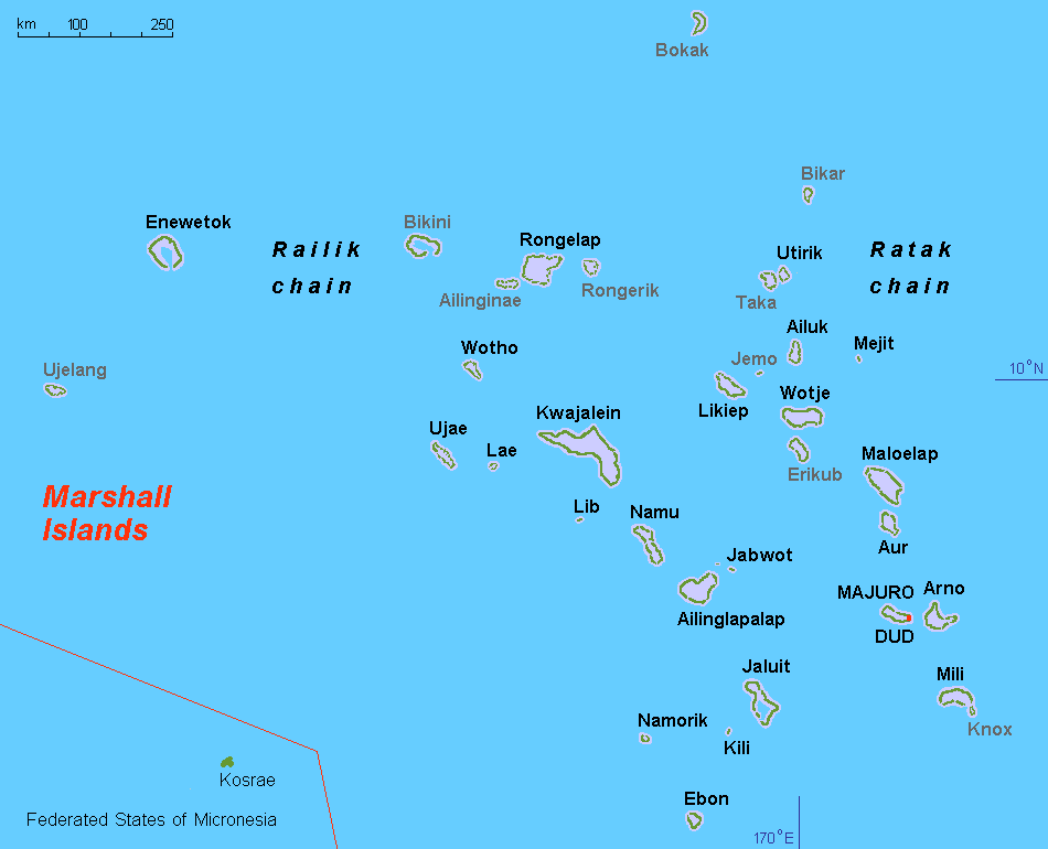
The atolls and islands form two groups: the Ratak (sunrise) and the Ralik (sunset). The two island chains lie approximately parallel to one another, running northwest to southeast, comprising about 750,000 square miles (1,900,000 km2) of ocean but only about 70 square miles (180 km2) of land mass. Each includes 15 to 18 islands and atolls. The country consists of a total of 29 atolls and five individual islands situated in about 180,000 square miles (470,000 km2) of the Pacific. The largest atoll with a land area of 6 square miles (16 km2) is Kwajalein. It surrounds a 655-square-mile (1,700 km2) lagoon.
Twenty-four of the atolls and islands are inhabited. The remaining atolls are uninhabited due to poor living conditions, lack of rain, or nuclear contamination.
Economy:
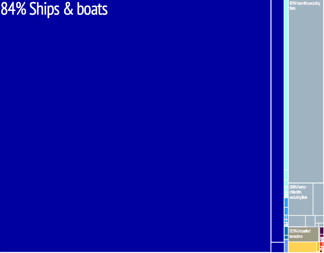
The islands have few natural resources, and their imports far exceed exports. According to the CIA, the value of exports in 2013 was approximately $53.7 million while estimated imports were $133.7 million. Agricultural products include coconuts, tomatoes, melons, taro, breadfruit, fruits, pigs and chickens. Industry is made of the production of copra and craft items, tuna processing and tourism.
In 2018, the Republic of Marshall Islands passed the Sovereign Currency Act, which made it the first country to issue their own cryptocurrency and certify it as legal tender; the currency is called the “sovereign”.
Transportation:
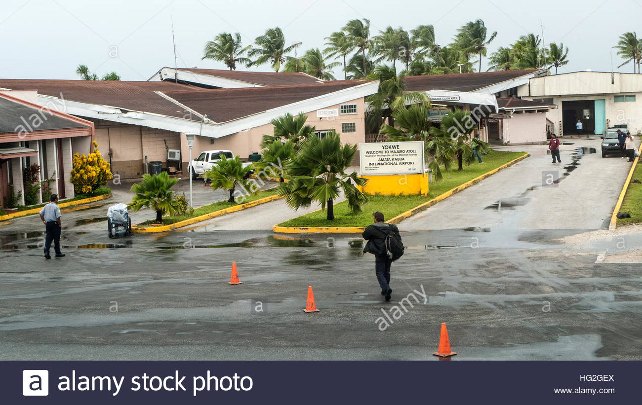
The Marshall Islands are served by the Marshall Islands International Airport in Majuro, the Bucholz Army Airfield in Kwajalein, and other small airports and airstrips.
Airlines include United Airlines, Nauru Airlines, Air Marshall Islands, and Asia Pacific Airlines.
Flag of the Marshall Islands:
The flag of the Marshall Islands was adopted upon the start of self-government, May 1, 1979. The flag was designed by Emlain Kabua, who served as the first First Lady of the republic.
Rules and specifications regarding the flag are set forth in the Official Flag of the Marshall Islands Act 1979 (Public Law 1979-1).
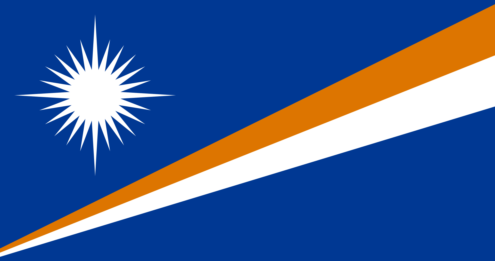
The Marshall Islands were part of the Trust Territory of the Pacific Islands administered by the United States, from which the Marshall Islands, Palau, and the Federated States of Micronesia split. In common with other island nations in the region, this flag features the symbolic representation of the islands’ place within the ocean. The rising diagonal band represents the equator, the star above representing this Northern Hemisphere archipelago. The white and orange portions of the band represent, respectively, the Ratak Chain (“sunrise”) and the Ralik Chain (“sunset”), as well as symbolizing peace and courage. The sun’s 24 points represent the number of electoral districts, while the four elongated points represent the principal cultural centers of Majuro, Jaluit, Wotje and Ebeye. The flag is also the national flag with the most points on a star, at 24.