
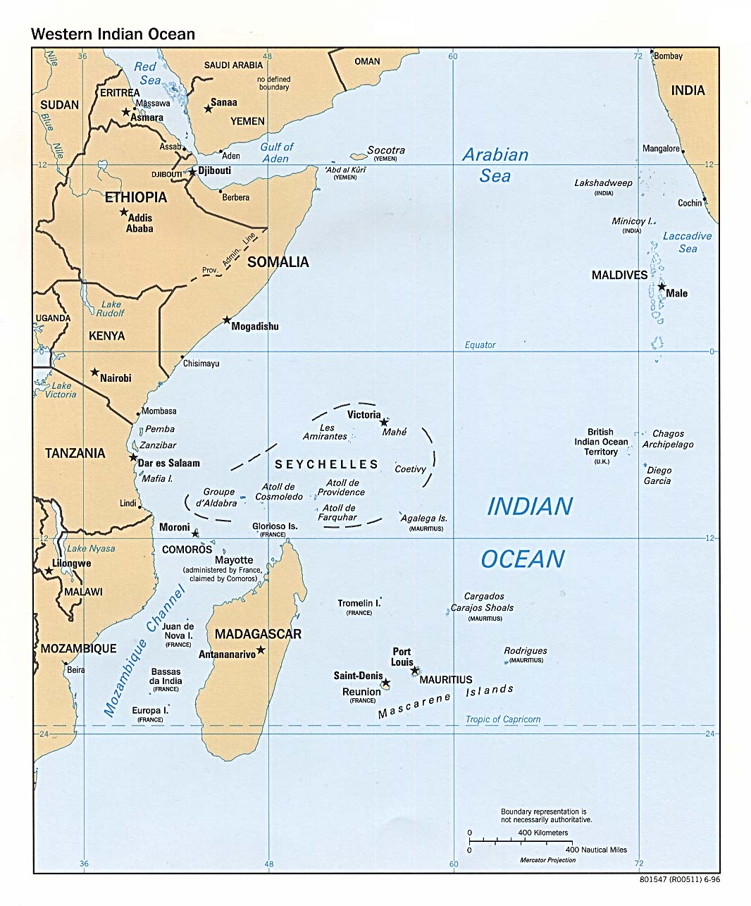
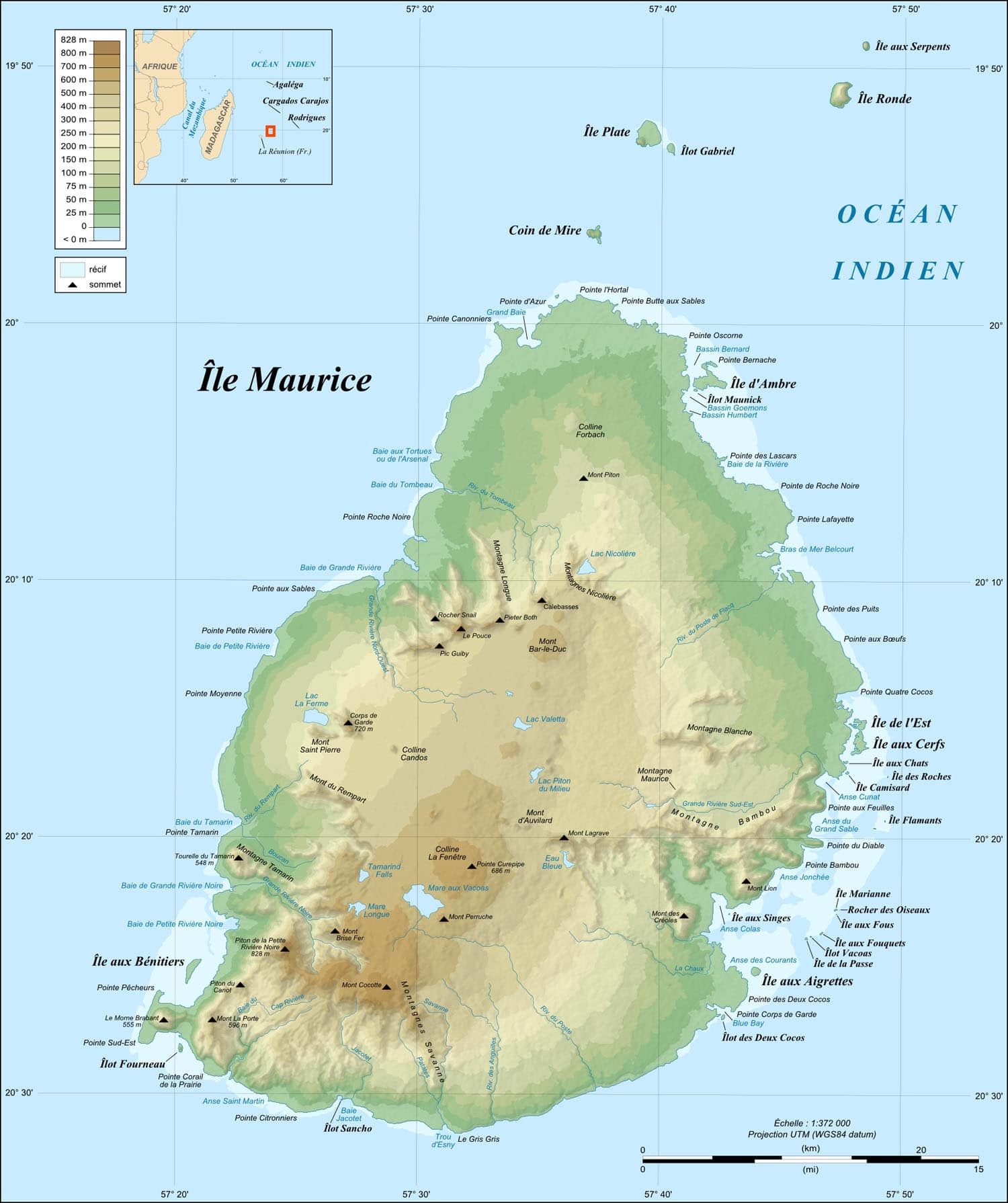
Mauritius is 2,000 km (1,200 mi) off the southeast coast of Africa. It is 65 km (40 mi) long and 45 km (30 mi) wide. Its land area is 1,864.8 km2 (720.0 sq mi). The island is surrounded by more than 150 km (100 mi) of white sandy beaches, and the lagoons are protected from the open sea by the world’s third-largest coral reef, which surrounds the island. Just off the Mauritian coast lie some 49 uninhabited islands and islets, several of which have been declared natural reserves for endangered species.
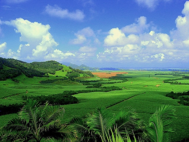
The Mauritius Island (Mauritian Creole: Isle Moris; French: Île Maurice, pronounced [il mɔʁis]) is relatively young geologically, having been created by volcanic activity some 8 million years ago. Together with Saint Brandon, Réunion, and Rodrigues, the island is part of the Mascarene Islands. These islands emerged as a result of gigantic underwater volcanic eruptions that happened thousands of kilometers to the east of the continental block made up of Africa and Madagascar. They are no longer volcanically active and the hotspot now rests under Réunion Island. Mauritius is encircled by a broken ring of mountain ranges, varying in height from 300–800 m (1,000–2,600 ft) above sea level. The land rises from coastal plains to a central plateau where it reaches a height of 670 m (2,200 ft); the highest peak is in the south-west, Piton de la Petite Rivière Noire at 828 meters (2,717 ft). Streams and rivers speckle the island, many formed in the cracks created by lava flows.
The autonomous island of Rodrigues is located 560 km (350 mi) to the east of Mauritius, with an area 108 km2 (42 sq mi).
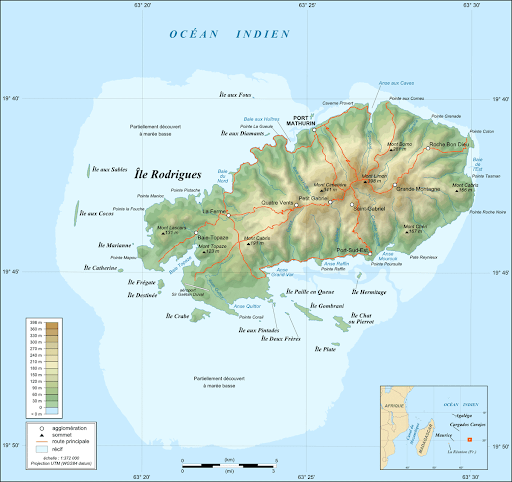
Rodrigues is a volcanic island rising from a ridge along the edge of the Mascarene Plateau. The island is hilly with a central spine culminating in the highest peak, Mountain Limon at 398 m (1,306 ft). The island also has a coral reef and extensive limestone deposits. According to Statistics Mauritius, at 1 July 2019, the population of the island was estimated at 43,371.[96]
Economy:
Since independence from Britain in 1968, Mauritius has developed from a low-income, agriculture-based economy to a high-income diversified economy, based on tourism, textiles, sugar, and financial services. The economic history of Mauritius since independence has been called “the Mauritian Miracle” and the “success of Africa”.
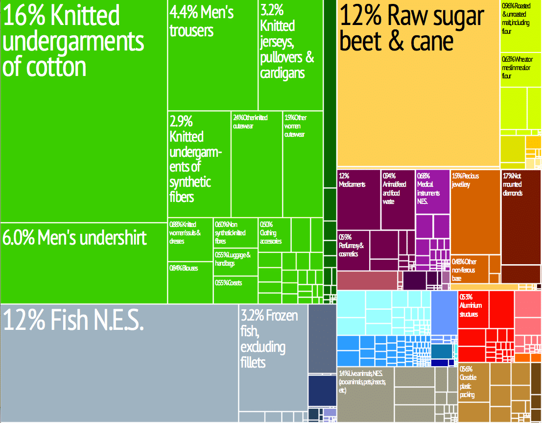
In recent years, information and communication technology, seafood, hospitality and property development, healthcare, renewable energy, and education and training have emerged as important sectors, attracting substantial investment from both local and foreign investors.
Mauritius has one of the largest exclusive economic zones in the world, and in 2012 the government announced its intention to develop the marine economy.
Transportation:
There is currently a railway project under construction in Mauritius, former privately owned industrial railways having been abandoned. The harbor of Port Louis handles international trade as well as a cruise terminal. The sole international airport for civil aviation is Sir Seewoosagur Ramgoolam International Airport, which also serves as the home operating base for the national airline Air Mauritius; the airport authority inaugurated a new passenger terminal in September 2013.