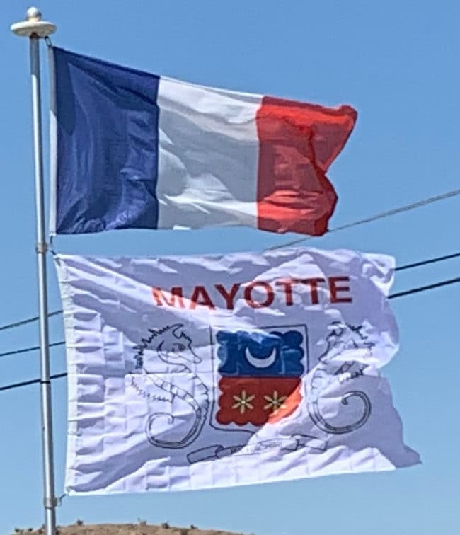
Mayotte was the only island in the archipelago that voted in referenda in 1974 and 1976 to retain its link with France and forgo independence (with 63.8% and 99.4% of votes respectively). The United Nations’ constant policy regarding decolonisation has been that independence must be effected in the framework of the colonial borders and for that reason it has not recognized the validity of that referendum; over twenty UN resolutions have condemned France’s annexation of Mayotte, while the independent Comoros have never ceased to claim the island. A draft 1976 United Nations Security Council resolution recognizing Comorian sovereignty over Mayotte, supported by 11 of the 15 members of the Council, was vetoed by France. It was the last time, as of 2011, that France cast a lone veto in the Council. The United Nations General Assembly adopted a series of resolutions on the issues, under the title “Question of the Comorian Island of Mayotte” up to 1995. Since 1995, the subject of Mayotte has not been discussed by the General Assembly, and all the following referenda over Mayotte independence have shown a strong will of Mayotte people to remain French.
Mayotte became an overseas department of France in March 2011 in consequence of a 29 March 2009 referendum. The outcome was a 95.5 per cent vote in favour of changing the island’s status from a French “overseas community” to become France’s 101st département. Its non-official traditional Islamic law, applied in some aspects of the day-to-day life, will be gradually abolished and replaced by the uniform French civil code. Additionally, French social welfare and taxes apply in Mayotte, though some of each will be brought in gradually. Comoros continues to claim the island, while criticising the French military base there.
Geography:
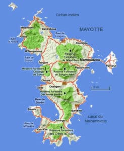
The term Mayotte (or Maore) may refer to all of the department’s islands, of which the largest is known as Maore (French: Grande-Terre) and includes Maore’s surrounding islands, most notably Pamanzi (French: Petite-Terre), or only to the largest island. The name is believed to come from Mawuti, contraction of the Arabic جزيرة الموت Jazīrat al-Mawt – meaning “island of death” (maybe due to the dangerous reefs circling the island) and corrupted to Mayotta in Portuguese, later turned into French. However, the local name is Mahore, and the Arabic etymology is doubtful.

The main island, Grande-Terre (or Maore), geologically the oldest of the Comoro Islands, is 39 kilometres (24 mi) long and 22 kilometres (14 mi) wide, and its highest point is Mount Benara, at 660 metres (2,165 ft) above sea level. Because of the volcanic rock, the soil is relatively rich in some areas. A coral reef encircling much of the island ensures protection for ships and a habitat for fish. Dzaoudzi was the capital of Mayotte (and earlier the capital of all the colonial Comoros) until 1977, when the capital was relocated to Mamoudzou on the main island of Grande-Terre. It is situated on Petite-Terre (or Pamanzi), which at 10 square kilometres (4 sq mi) is the largest of several islets adjacent to Maore. The area of the lagoon behind the reef is approximately 1,500 square kilometres (580 sq mi), reaching a maximum depth of about 80m. It is described as “the largest barrier-reef-lagoon complex within the southwestern Indian Ocean”.
Economy:
Living standards are lower than in metropolitan France. Close to a third of the population lives in a housing which is not connected to public water network. Additionally, 10% of the housing has no electricity.
