
The participation of Aung San Suu Kyi’s NLD party in the 2012 by-elections, facilitated by the government’s abolition of the laws that previously barred the NLD. In the April 2012 by-elections, the NLD won 43 of the 45 available seats; previously an illegal organization, the NLD had not won a single seat under the new constitution. The 2012 by-elections were also the first time that international representatives were allowed to monitor the voting process in Myanmar.
2015 General Elections:
General elections were held on 8 November 2015. These were the first openly contested elections held in Myanmar since 1990. The results gave the NLD an absolute majority of seats in both chambers of the national parliament, enough to ensure that its candidate would become president, while NLD leader Aung San Suu Kyi is constitutionally barred from the presidency. The new parliament convened on 1 February 2016.
2020 Elections and 2021 Military Coup d’etat:
The NLD won the 2020 Myanmar general election on 8 November in a landslide, again winning supermajorities in both houses. The army alleged fraud and threatened to “take action”.
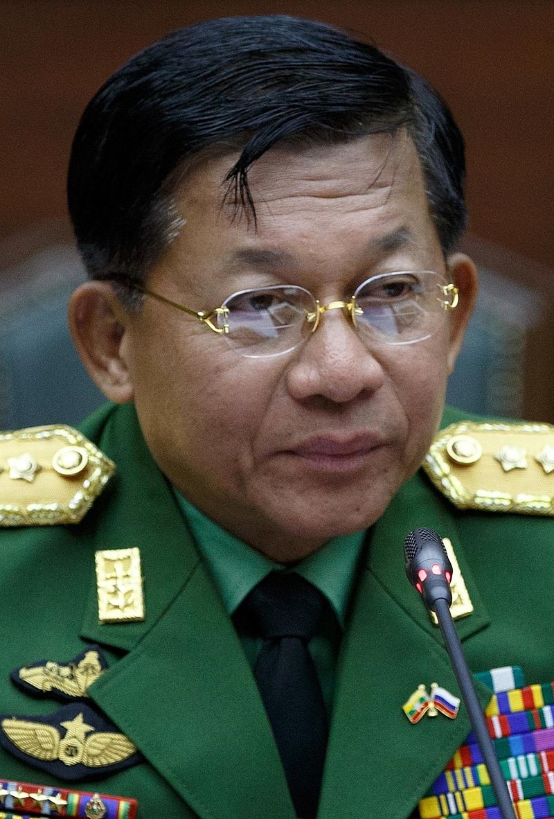
In the early morning of 1 February 2021, the day parliament was set to convene, the Tatmadaw, Myanmar’s military, detained State Counsellor Aung San Suu Kyi and other members of the ruling party. The military handed power to military chief Min Aung Hlaing and declared a state of emergency for one year, after which they will have another election.
Geography:
Myanmar has a total area of 678,500 square kilometers (262,000 sq mi). Myanmar is bordered in the northwest by the Chittagong Division of Bangladesh and the Mizoram, Manipur, Nagaland and Arunachal Pradesh states of India. Its north and northeast border is with the Tibet Autonomous Region and Yunnan for a Sino-Myanmar border total of 2,185 km (1,358 mi). It is bounded by Laos and Thailand to the southeast. Myanmar has 1,930 km (1,200 mi) of contiguous coastline along the Bay of Bengal and Andaman Sea to the southwest and the south, which forms one quarter of its total perimeter.
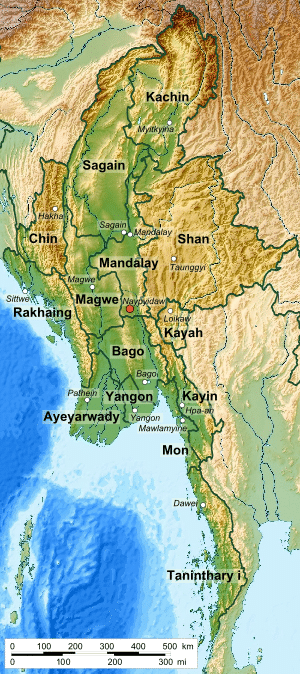
In the north, the Hengduan Mountains form the border with China. Hkakabo Razi, located in Kachin State, at an elevation of 5,881 meters (19,295 ft), is the highest point in Myanmar. Many mountain ranges, such as the Rakhine Yoma, the Bago Yoma, the Shan Hills and the Tenasserim Hills exist within Myanmar, all of which run north-to-south from the Himalayas. The mountain chains divide Myanmar’s three river systems, which are the Irrawaddy, Salween (Thanlwin), and the Sittaung rivers. The Irrawaddy River, Myanmar’s longest river at nearly 2,170 kilometers (1,348 mi), flows into the Gulf of Martaban. Fertile plains exist in the valleys between the mountain chains. The majority of Myanmar’s population lives in the Irrawaddy valley, which is situated between the Rakhine Yoma and the Shan Plateau.
Economy:
Myanmar’s economy is one of the fastest growing economies in the world. Foreigners are able to legally lease but not own property. In December 2014, Myanmar set up its first stock exchange, the Yangon Stock Exchange.