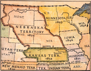
In the 1860s, after the U.S. government forced many of the Native American tribes to cede their lands and settle on reservations, it opened large tracts of land to agricultural development by Europeans and Americans. Under the Homestead Act, thousands of settlers migrated into Nebraska to claim free land granted by the federal government. Because so few trees grew on the prairies, many of the first farming settlers built their homes of sod, as had Native Americans such as the Omaha.
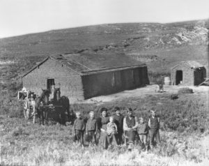
The first wave of settlement gave the territory a sufficient population to apply for statehood. Nebraska became the 37th state on March 1, 1867, and the capital was moved from Omaha to the center at Lancaster, later renamed Lincoln after the recently assassinated President of the United States, Abraham Lincoln. The battle of Massacre Canyon on August 5, 1873, was the last major battle between the Pawnee and the Sioux.
During the 1870s to the 1880s, Nebraska experienced a large growth in population. Several factors contributed to attracting new residents. The first was that the vast prairie land was perfect for cattle grazing. This helped settlers learn the unfamiliar geography of the area. The second factor was the invention of several farming technologies. Agricultural inventions such as barbed wire, wind mills, and the steel plow, combined with good weather, enabled settlers to use of Nebraska as prime farming land. By the 1880s, Nebraska’s population had soared to more than 450,000 people.
Geography:
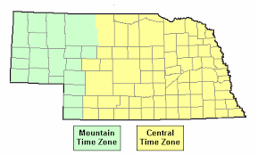
Nebraska is split between two time zones, with the state’s eastern half observing Central Time and the western half observing Mountain Time. Three rivers cross the state from west to east. The Platte River, formed by the confluence of the North Platte and the South Platte, runs through the state’s central portion, the Niobrara River flows through the northern part, and the Republican River runs across the southern part.
Nebraska is composed of two major land regions: the Dissected Till Plains and the Great Plains. The easternmost portion of the state was scoured by Ice Age glaciers; the Dissected Till Plains were left after the glaciers retreated. The Dissected Till Plains is a region of gently rolling hills; Omaha and Lincoln are in this region. The Great Plains occupy most of western Nebraska, with the region consisting of several smaller, diverse land regions, including the Sandhills, the Pine Ridge, the Rainwater Basin, the High Plains and the Wildcat Hills. Panorama Point, at 5,424 feet is Nebraska’s highest point; though despite its name and elevation, it is a relatively low rise near the Colorado and Wyoming borders.
Economy:
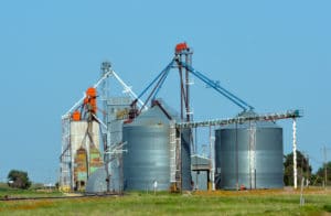
Nebraska has a large agriculture sector, and is a major producer of beef, pork, corn, soybeans, and sorghum. Other important economic sectors include freight transport, manufacturing, telecommunications, information technology, and insurance.
As of April 2015, the state’s unemployment rate was 2.5%, the lowest in the nation.
