
Introduction:
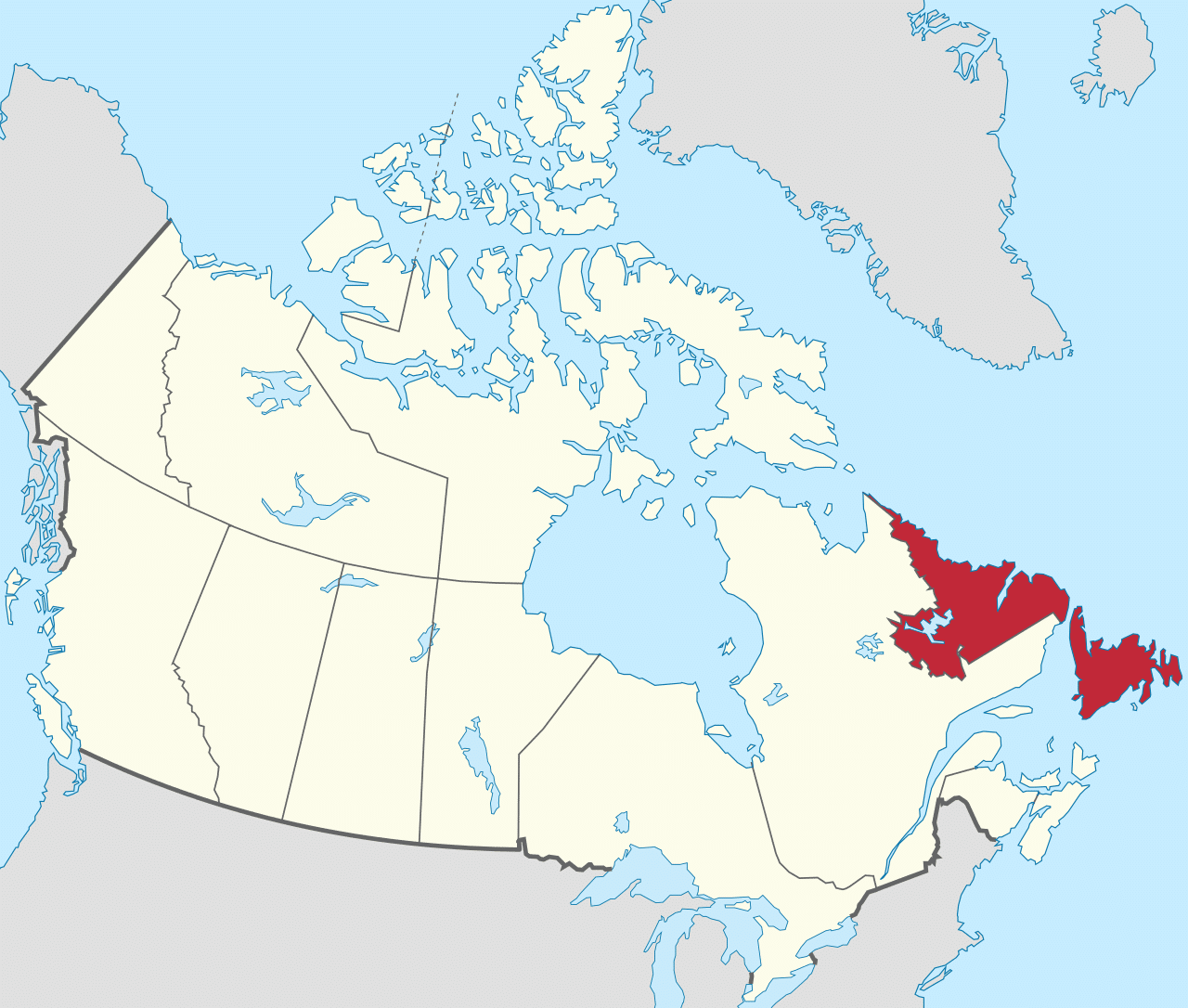
Newfoundland and Labrador is the easternmost province of Canada. Situated in the country’s Atlantic region, it is composed of the insular region of Newfoundland and the continental region of Labrador to the northwest, with a combined area of 156,500 square miles. In 2018, the province’s population was estimated at 525,073. About 92% of the province’s population lives on the island of Newfoundland (and its neighbouring smaller islands), of whom more than half live on the Avalon Peninsula.
The province is Canada’s most linguistically homogeneous, with 97.0% of residents reporting English (Newfoundland English) as their mother tongue in the 2016 census. Historically, Newfoundland was also home to unique varieties of French and Irish, as well as the extinct Beothuk language. In Labrador, the indigenous languages Innu-aimun and Inuktitut are also spoken.
Newfoundland and Labrador’s capital and largest city, St. John’s, is Canada’s 20th-largest census metropolitan area and is home to almost 40 per cent of the province’s population. St. John’s is the seat of government, home to the House of Assembly of Newfoundland and Labrador and to the highest court in the jurisdiction, the Newfoundland and Labrador Court of Appeal.
A former colony and then dominion of the United Kingdom, Newfoundland gave up its independence in 1933, following significant economic distress caused by the Great Depression and the aftermath of Newfoundland’s participation in World War I. It became the tenth province to enter the Canadian Confederation on 31 March 1949, as “Newfoundland”. On 6 December 2001, an amendment was made to the Constitution of Canada to change the province’s name to Newfoundland and Labrador.
Etymology:
The name “New founde lande” was uttered by King Henry VII in reference to the land explored by the Cabots. In Portuguese it is Terra Nova, which literally means “new land” which is also the French name for the Province’s island region (Terre-Neuve). The name “Terra Nova” is in wide use on the island (e.g. Terra Nova National Park). The influence of early Portuguese exploration is also reflected in the name of Labrador, which derives from the surname of the Portuguese navigator João Fernandes Lavrador.
Labrador’s name in the Inuttitut language (spoken in Nunatsiavut) is Nunatsuak, meaning “the big land” (a common English nickname for Labrador). Newfoundland’s Inuttitut name is Ikkarumikluak meaning “place of many shoals”.
Geography:
Newfoundland and Labrador is the most easterly province in Canada, and is at the north-eastern corner of North America. The Strait of Belle Isle separates the province into two geographical parts: Labrador, which is a large area of mainland Canada, and Newfoundland, an island in the Atlantic Ocean. The province also includes over 7,000 tiny islands.
Newfoundland is roughly triangular. Each side is about 250 miles long, and its area is 42,030 square miles. Newfoundland and its neighboring small islands (excluding French possessions) have an area of 43,010 square miles.
Labrador is roughly triangular. The western part of its border with Quebec is the drainage divide of the Labrador Peninsula. Lands drained by rivers that flow into the Atlantic Ocean are part of Labrador, and the rest belongs to Quebec. Most of Labrador’s southern boundary with Quebec follows the 52nd parallel of latitude. Labrador’s extreme northern tip, at 60°22′N, shares a short border with Nunavut. Labrador’s area (including associated small islands) is 113,640 square miles. Together, Newfoundland and Labrador make up 4.06% of Canada’s area, with a total area of 156,650 square miles.