
The lowest point is the Niger River, with an elevation of 200 meters (656 ft). The highest point is Mont Idoukal-n-Taghès in the Aïr Mountains at 2,022 m (6,634 ft).
Economy:
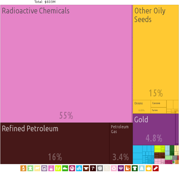
The economy of Niger centers on subsistence crops, livestock, and some of the world’s largest uranium deposits. Drought cycles, desertification, a 2.9% population growth rate, and the drop in world demand for uranium have undercut the economy.
Niger shares a common currency, the CFA franc, and a common central bank, the Central Bank of West African States (BCEAO), with seven other members of the West African Monetary Union. Niger is also a member of the Organization for the Harmonization of Business Law in Africa (OHADA).
In December 2000, Niger qualified for enhanced debt relief under the International Monetary Fund program for Heavily Indebted Poor Countries (HIPC) and concluded an agreement with the Fund for Poverty Reduction and Growth Facility (PRGF). Debt relief provided under the enhanced HIPC initiative significantly reduces Niger’s annual debt service obligations, freeing funds for expenditures on basic health care, primary education, HIV/AIDS prevention, rural infrastructure, and other programs geared at poverty reduction.
In December 2005, it was announced that Niger had received 100% multilateral debt relief from the IMF, which translates into the forgiveness of approximately US$86 million in debts to the IMF, excluding the remaining assistance under HIPC. Nearly half of the government’s budget is derived from foreign donor resources. Future growth may be sustained by exploitation of oil, gold, coal, and other mineral resources. Uranium prices have recovered somewhat in the last few years.
Transportation:
Niger’s transport system was little developed during the colonial period (1899–1960), relying upon animal transport, human transport, and limited river transport in the far south west and south east. No railways were constructed in the colonial period, and roads outside the capital remained unpaved. The Niger River is unsuitable for large-scale river transport, as it lacks depth for most of the year and is broken by rapids at many spots. Camel caravan transport was historically important in the Sahara desert and Sahel regions which cover most of the north.
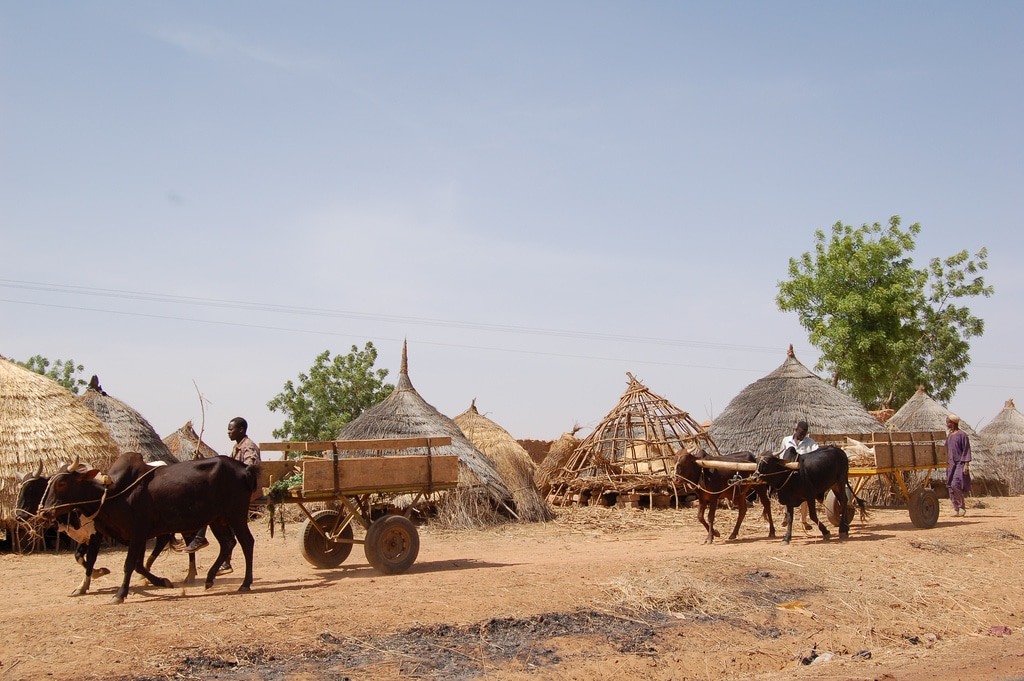
While few Nigeriens own vehicles, the majority of travel relies on motorized transportation in the form of motor bikes, buses and shared taxis. Animal powered locomotion is also common.
The road system has been greatly improved since colonial times although it is far from comprehensively paved, especially in the desert north. In 2012, there is 19,675 kilometres (12,225 mi) of road network throughout Niger, of which only 4,225 kilometres (2,625 mi) are paved.
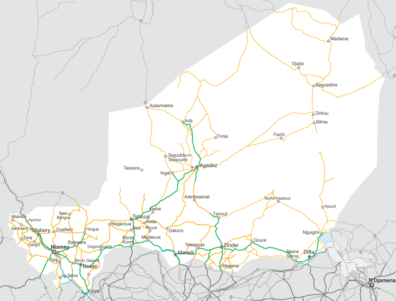
The Niger River is navigable 300 km from Niamey to Gaya on the Benin frontier from mid-December to March. Thereafter a series of falls and rapids render the Niger unnavigable in all seasons. In the navigable stretches, shallows prevent all but the small draft African canoes from operating in many areas. As there is only one major bridge over the Niger (The Kennedy Bridge in Niamey: the Niger River bridge at Gaya crosses into Benin), car ferries are of crucial importance, especially the crossing at Bac Farie, 40 km north of Niamey on the RN4, and the car ferry at Ayorou.