Oregon lies in two time zones. Most of Malheur County is in the Mountain Time Zone, while the rest of the state lies in the Pacific Time Zone.
Geology:
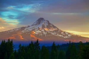
Western Oregon’s mountainous regions, home to three of the most prominent mountain peaks of the United States including Mount Hood, were formed by the volcanic activity of the Juan de Fuca Plate, a tectonic plate that poses a continued threat of volcanic activity and earthquakes in the region.

The most recent major activity was the 1700 Cascadia earthquake. Washington’s Mount St. Helens erupted in 1980, an event visible from northern Oregon and affecting some areas there.
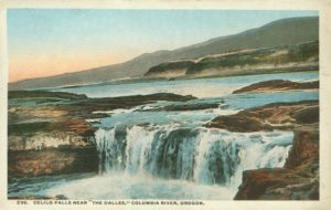
The Columbia River, which forms much of Oregon’s northern border, also played a major role in the region’s geological evolution, as well as its economic and cultural development. The Columbia is one of North America’s largest rivers, and one of two rivers to cut through the Cascades (the Klamath River in southern Oregon is the other). About 15,000 years ago, the Columbia repeatedly flooded much of Oregon during the Missoula Floods; the modern fertility of the Willamette Valley is largely a result of those floods. Plentiful salmon made parts of the river, such as Celilo Falls, hubs of economic activity for thousands of years.

Today, Oregon’s landscape varies from rain forest in the Coast Range to barren desert in the southeast, which still meets the technical definition of a frontier. Central Oregon’s geographical features range from high desert and volcanic rock formations resulting from lava beds. The Oregon Badlands Wilderness is in this region of the state.
History:
Humans have inhabited the area that is now Oregon for at least 15,000 years. In recorded history, mentions of the land date to as early as the 16th century. During the 18th and 19th centuries, European powers – and later the United States – quarreled over possession of the region until 1846, when the U.S. and Great Britain finalized division of the region. Oregon became a state on February 14, 1859, and as of 2015 is home to over 4 million residents.
Earliest Inhabitants:
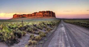
While there is considerable evidence that Paleo-Indians inhabited the region, the oldest evidence of habitation in Oregon was found at Fort Rock Cave and the Paisley Caves in Lake County. Archaeologist Luther Cressman dated material from Fort Rock to 13,200 years ago, and there is evidence supporting inhabitants in the region at least 15,000 years ago. By 8000 BC there were settlements throughout the state, with populations concentrated along the lower Columbia River, in the western valleys, and around coastal estuaries.

By the 16th century, Oregon was home to many Native American groups, including the Chinook, Coquille (Ko-Kwell), Bannock, Chasta, Kalapuya, Klamath, Klickitat, Molalla, Nez Perce, Takelma, Killamuk, Neah-kah-nie, Umatilla, and Umpqua.
European and Pioneer Settlement:
The first Europeans to visit Oregon were Spanish explorers led by Juan Rodríguez Cabrillo, who sighted southern Oregon off the Pacific coast in 1543. Francis Drake made his way to Nehalem Bay in 1579 and spent five weeks in the middle of summer repairing his ship. He claimed the land between 38–48 degrees north latitude as a Symbolic Sovereign Act for England. Exploration was retaken routinely in 1774, starting with the expedition of the frigate Santiago by Juan José Pérez Hernández and the coast of Oregon became a valuable trading route to Asia. In 1778, British captain James Cook also explored the coast.
