
Orkney Islands
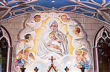
Orkney was the site of a Royal Navy base at Scapa Flow, which played a major role in World War I and II. After the Armistice in 1918, the German High Seas Fleet was transferred in its entirety to Scapa Flow to await a decision on its future. The German sailors opened the seacocks and scuttled all the ships. Most ships were salvaged, but the remaining wrecks are now a favored haunt of recreational divers. One month into World War II, a German U-boat sank the Royal Navy battleship HMS Royal Oak in Scapa Flow. As a result, barriers were built to close most of the access channels; these had the additional advantage of creating causeways enabling travelers to go from island to island by road instead of being obliged to rely on ferries. The causeways were constructed by Italian prisoners of war, who also constructed the ornate Italian Chapel.
The navy base became run down after the war, eventually closing in 1957. The problem of a declining population was significant in the post-war years, though in the last decades of the 20th century there was a recovery and life in Orkney focused on growing prosperity and the emergence of a relatively classless society. Orkney was rated as the best place to live in Scotland in both 2013 and 2014, and in 2019 the best place to live in the UK, according to the Halifax Quality of Life survey.
Geography:

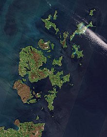
Orkney is separated from the Shetland Islands, a group farther out, by a body of water called the Fair Isle Channel.
The islands are mainly low-lying except for some sharply rising sandstone hills on Mainland, Rousay and Hoy (where the tallest point in Orkney, Ward Hill, can be found) and rugged cliffs on some western coasts. Nearly all of the islands have lochs, but the watercourses are merely streams draining the high land. The coastlines are indented, and the islands themselves are divided from each other by straits generally called “sounds” or “firths”.
The tidal currents, or “roosts” as some of them are called locally, off many of the isles are swift, with frequent whirlpools. The islands are notable for the absence of trees, which is partly accounted for by the strong winds.
Economy:
The soil of Orkney is generally very fertile and most of the land is taken up by farms, agriculture being by far the most important sector of the economy and providing employment for a quarter of the workforce according to a 2008 report. More than 90% of agricultural land is used for grazing for sheep and cattle, with cereal production utilizing about 4% (4,200 hectares (10,000 acres)) and woodland occupying only 134 hectares (330 acres).