Introduction:
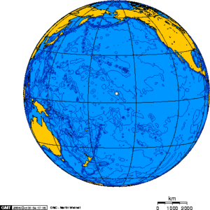
Palmyra Atoll is one of the Northern Line Islands (southeast of Kingman Reef and north of Kiribati Line Islands), located almost due south of the Hawaiian Islands, roughly one-third of the way between Hawaii and American Samoa. The nearest continent is almost 3,400 miles to the northeast. The atoll is 4.6 square miles and it is located in the equatorial Northern Pacific Ocean. Its 9 mi of coastline has one anchorage known as West Lagoon.

It is an unoccupied equatorial Northern Pacific atoll administered as an unorganized incorporated territory, the only of its kind, by the United States federal government. The territory hosts a variable temporary population of 4–25 “non-occupants”, namely staff and scientists employed by various departments of the U.S. Government and by The Nature Conservancy, as well as a rotating mix of Palmyra Atoll Research Consortium scholars pursuing research.
Geography:
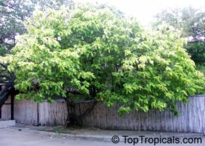
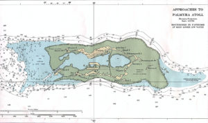
The atoll consists of an extensive reef, two shallow lagoons, and some 50 sand and reef-rock islets and bars covered with vegetation—mostly coconut palms, Scaevola, and tall Pisonia trees.

The islets of the atoll are mostly connected. Sand Island and the two Home Islets in the west and Barren Island in the east are not. The largest island is Cooper Island in the north, followed by Kaula Island in the south.
Palmyra Atoll is in the Samoa Time Zone (UTC−11:00), the same time zone as American Samoa, Midway Atoll, Kingman Reef and Jarvis Island.
History:
First Discovery:
Palmyra was first sighted in 1798 by captain Edmund Fanning of Stonington, Connecticut, master of the American sealing ship Betsy, on a voyage to Asia, according to his published memoir 35 years later. Fanning wrote that he had awakened three times during the night before. After the third time, he took it as a premonition, and he ordered Betsy to heave to for the rest of the night. The next morning, Betsy resumed sailing, but only about a nautical mile further on, and he believed that he sighted the reef later known as Palmyra Island. Had the ship continued on her course at night, the ship might have been wrecked.

Captain Fanning’s claim to have discovered Palmyra itself has been challenged, on the view that he had only reached Kingman Reef 34 miles away and could not possibly have seen Palmyra from that distance.
On November 7, 1802, the USS Palmyra under Captain Cornelius Sowle was shipwrecked on the reef, which was given the name of this vessel. The remote atoll, lacking a navigable boat passage through the reef from the sea, had never been inhabited. No marae, basalt artifacts or evidence of Polynesian, Micronesian or other pre-European native settlements before 1802 have been found on Palmyra.
Captain Sawle wrote:
“There are no inhabitants on the island, nor was any fresh water found; but cocoanuts of a very large size, are in great abundance; and fish of various kinds and in large shoals surround the land.”
Esperanza Treasure:
During the 19th and 20th centuries, stories circulated in the Pacific of a large treasure of gold, silver and precious stones, sometimes described as Inca treasures, that had been looted in the Viceroyalty of Peru. A crew loaded it in secret onto the ship Esperanza in Callao harbor, Peru, and embarked into the Pacific Ocean on January 1, 1816 bound for the Spanish West Indies.
