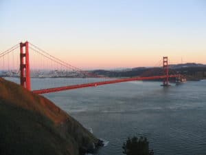
State Route 1 also enters San Francisco from the north via the Golden Gate Bridge and bisects the city as the 19th Avenue arterial thoroughfare, joining with Interstate 280 at the city’s southern border. Interstate 280 continues south from San Francisco, and also turns to the east along the southern edge of the city, terminating just south of the Bay Bridge in the South of Market neighborhood.

After the 1989 Loma Prieta earthquake, city leaders demolished the Embarcadero Freeway and a portion of the Central Freeway, converting them into street-level boulevards.
State Route 35 enters the city from the south as Skyline Boulevard and terminates at its intersection with Highway 1. State Route 82 enters San Francisco from the south as Mission Street, and terminates shortly thereafter at its junction with 280.
The Western Terminus of the historic transcontinental Lincoln Highway, the first road across America, is in San Francisco’s Lincoln Park.
Public Transportation:
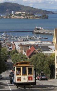
32% of San Francisco residents use public transportation for their daily commute to work, ranking it first on the West Coast and third overall in the United States. The San Francisco Municipal Railway, known as Muni, is the primary public transit system of San Francisco. Muni is the seventh-largest transit system in the United States, with 210,848,310 rides in 2006. The system operates a combined light rail and subway system, the Muni Metro, as well as large bus and trolley coach networks. Additionally, it runs a historic streetcar line, which runs on Market Street from Castro Street to Fisherman’s Wharf. It also operates the famous cable cars, which have been designated as a National Historic Landmark and are a major tourist attraction.

Bay Area Rapid Transit, a regional Rapid Transit system, connects San Francisco with the East Bay through the underwater Transbay Tube. The line runs under Market Street to Civic Center where it turns south to the Mission District, the southern part of the city, and through northern San Mateo County, to the San Francisco International Airport, and Millbrae.
Another commuter rail system, Caltrain, runs from San Francisco along the San Francisco Peninsula to San Jose. Historically, trains operated by Southern Pacific Lines ran from San Francisco to Los Angeles, via Palo Alto and San Jose.
Amtrak California Thruway Motorcoach runs a shuttle bus from three locations in San Francisco to its station across the bay in Emeryville. Additionally, BART offers connections to San Francisco from Amtrak’s stations in Emeryville, Oakland and Richmond, and Caltrain offers connections in San Jose and Santa Clara. Thruway service also runs south to San Luis Obispo with connection to the Pacific Surfliner.
San Francisco Bay Ferry operates from the Ferry Building and Pier 39 to points in Oakland, Alameda, Bay Farm Island, South San Francisco, and north to Vallejo in Solano County. The Golden Gate Ferry is the other ferry operator with service between San Francisco and Marin County. Soltrans runs supplemental bus service between the Ferry Building and Vallejo.
