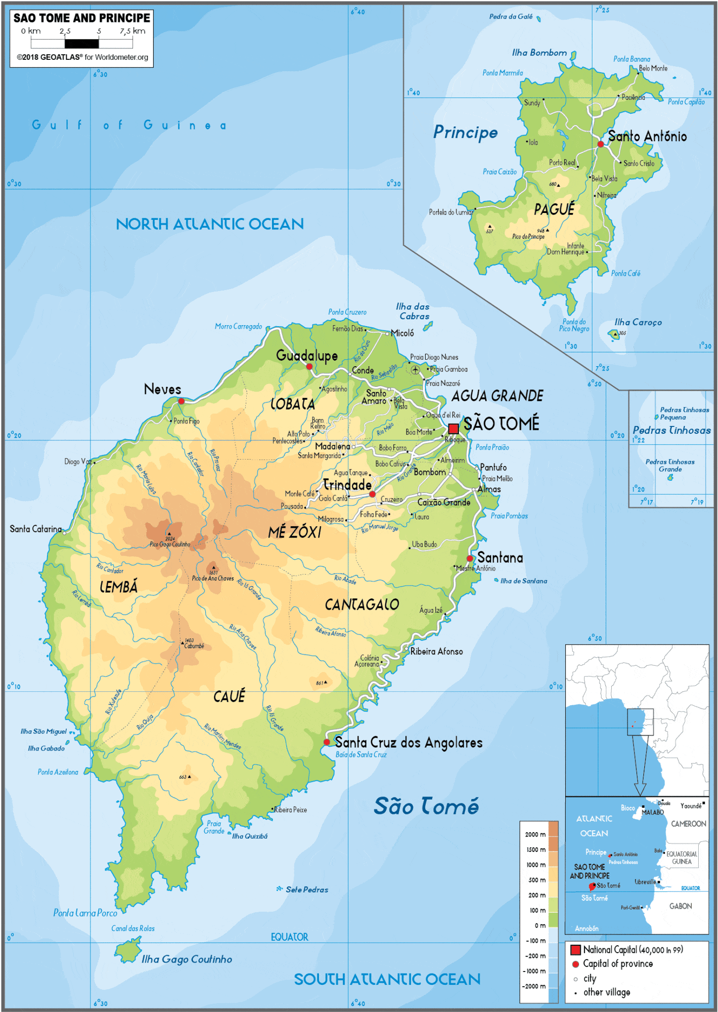
São Tomé is 50 km (30 mi) long and 30 km (20 mi) wide and the more mountainous of the two islands. Its peaks reach 2,024 m (6,640 ft) – Pico de São Tomé. Príncipe is about 30 km (20 mi) long and 6 km (4 mi) wide. Its peaks reach 948 m (3,110 ft) – Pico de Príncipe. Swift streams radiating down the mountains through lush forest and cropland to the sea cross both islands. The Equator lies immediately south of São Tomé Island, passing through the islet Ilhéu das Rolas.
Economy:
Since the 19th century, the economy of São Tomé and Príncipe has been based on plantation agriculture. At the time of independence, Portuguese-owned plantations occupied 90% of the cultivated area. After independence, control of these plantations passed to various state-owned agricultural enterprises. The main crop on São Tomé is cocoa, representing about 95% of agricultural exports. Other export crops include copra, palm kernels, and coffee.
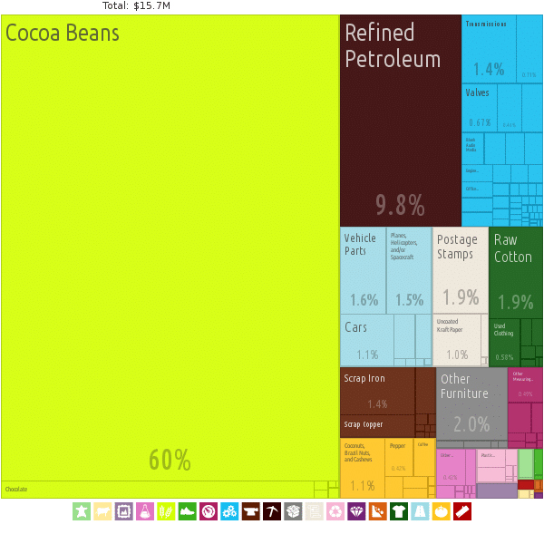
Domestic food-crop production is inadequate to meet local consumption, so the country imports most of its food. As of 1997, an estimated 90% of the country’s food needs were met through imports. Efforts have been made by the government in recent years to expand food production, and several projects have been undertaken, largely financed by foreign donors.
Other than agriculture, the main economic activities are fishing and a small industrial sector engaged in processing local agricultural products and producing a few basic consumer goods. The scenic islands have potential for tourism, and the government is attempting to improve its rudimentary tourist industry infrastructure. The government sector accounts for about 11% of employment.
Recent oil exploration holds promise for new revenue if the cost of offshore drilling is economically viable.
Transportation:
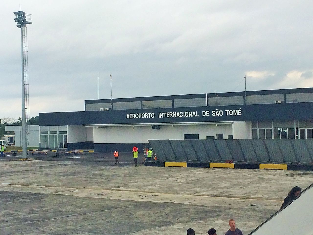
The main ports in the country are in the city of São Tomé and Neves, both on the island of São Tomé, which were modernized in 2014. Close to the city of São Tomé, the international airport was expanded and modernized.
The telephone system and the road network are good by African standards. The use of the cell phone is widely used and has been improved in recent years. The Internet service is available and has been widely installed in urban areas.
Flag of São Tomé and Príncipe:
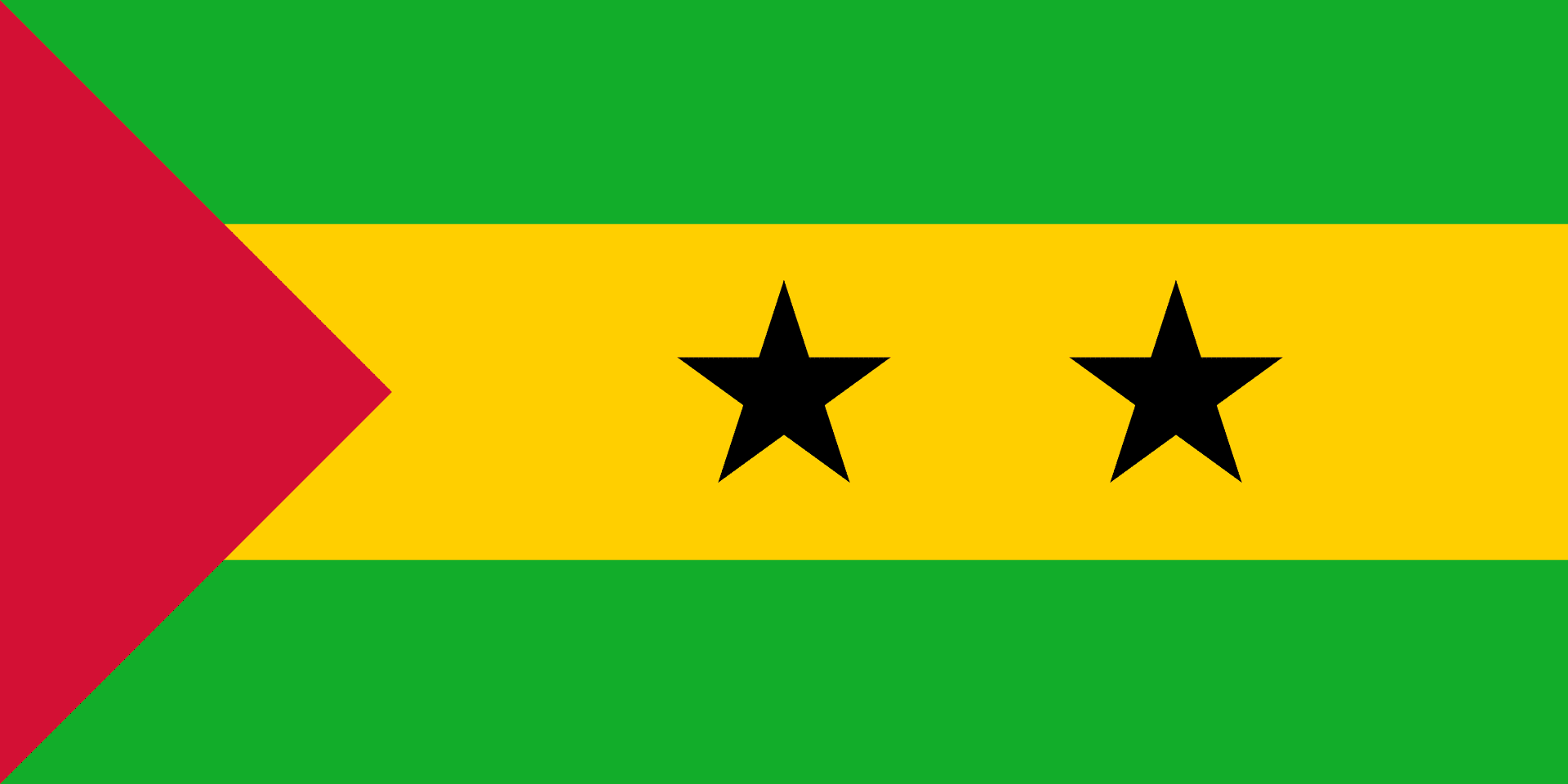
The flag of São Tomé and Príncipe consists of a red triangle situated at the hoist, with three horizontal green, yellow and green bands charged with two five-pointed black stars at the center. Adopted in 1975 to replace the flag of Portugal from the colonial period, it has been the flag of the Democratic Republic of São Tomé and Príncipe since the country gained independence in that same year. The design of the present flag was inspired by and is almost identical to the flag of the Movement for the Liberation of São Tomé and Príncipe.