Eastern South Dakota generally features higher precipitation and lower topography than the western part of the state. Smaller geographic regions of this area include the Coteau des Prairies, the Dissected Till Plains, and the James River Valley.
The Great Plains cover most of the western two-thirds of South Dakota. West of the Missouri River the landscape becomes more arid and rugged, consisting of rolling hills, plains, ravines, and steep flat-topped hills called buttes. In the south, east of the Black Hills, lie the South Dakota Badlands.
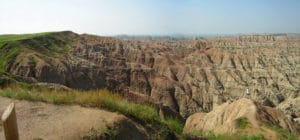
Erosion from the Black Hills, marine skeletons which fell to the bottom of a large shallow sea that once covered the area, and volcanic material all contribute to the geology of this area.
The Black Hills are in the southwestern part of South Dakota and extend into Wyoming.
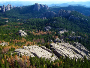
This range of low mountains covers 6,000 sq miles with peaks that rise from 2,000 to 4,000 feet above their bases. The Black Hills are the location of Black Elk Peak, 7,242 feet above sea level, the highest point in South Dakota and also the highest point in the United States east of the Rocky Mountains. Two billion-year-old Precambrian formations, the oldest rocks in the state, form the central core of the Black Hills. Formations from the Paleozoic Era form the outer ring of the Black Hills; these were created between roughly 540 and 250 million years ago. This area features rocks such as limestone, which were deposited here when the area formed the shoreline of an ancient inland sea.
History:
Humans have lived in what is today South Dakota for several thousand years. The first inhabitants were Paleo-Indian hunter-gatherers, who disappeared from the area around 5000 BCE. Between 500 CE and 800 CE, a semi-nomadic people known as the Mound Builders lived in central and eastern South Dakota. In the 14th century, the Crow Creek Massacre occurred, in which several hundred men, women, and children were killed near the Missouri River.
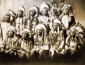
By 1500, the Arikara (or Ree) had settled in much of the Missouri River valley. European contact with the area began in 1743, when the La Vérendrye brothers explored the region. The La Vérendrye group buried a plate near the site of modern-day Pierre, claiming the region for France as part of greater Louisiana. In 1762 the entire region became part of the Spanish Louisiana until 1802. By the early 19th century, the Sioux had largely replaced the Arikara as the dominant group in the area.
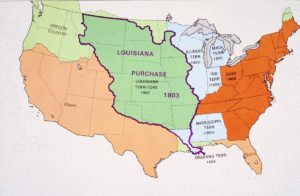
In 1803, the United States purchased the Louisiana Territory, an area that included most of South Dakota, from Napoleon Bonaparte, and President Thomas Jefferson organized a group commonly referred to as the “Lewis and Clark Expedition” to explore the region.
In 1817, an American fur trading post was set up at present-day Fort Pierre, beginning continuous American settlement of the area. In 1855, the U.S. Army bought Fort Pierre but abandoned it in 1857 in favor of Fort Randall to the south. Settlement by Americans and Europeans was by this time increasing rapidly, and in 1858 the Yankton Sioux signed the 1858 Treaty, ceding most of present-day eastern South Dakota to the United States.
