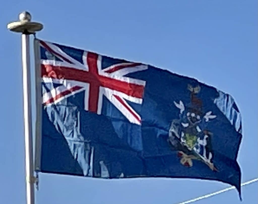
In 1985, South Georgia and the South Sandwich Islands ceased to be administered as a Falkland Islands Dependency and became a separate territory. The King Edward Point base, which had become a small military garrison after the Falklands War, returned to civilian use in 2001 and is now operated by the British Antarctic Survey.
South Sandwich Islands:
Captain James Cook discovered the southern eight islands of the Sandwich Islands Group in 1775, although he lumped the southernmost three together, and their status as separate islands was not established until 1820 by Fabian Gottlieb von Bellingshausen. The northern three islands were discovered by Bellingshausen in 1819. The islands were tentatively named “Sandwich Land” by Cook, although he also commented that they might be a group of islands rather than a single body of land. The name was chosen in honor of John Montagu, 4th Earl of Sandwich, First Lord of the Admiralty. The word “South” was later added to distinguish them from the “Sandwich Islands”, now known as the Hawaiian Islands.
Argentina claimed the South Sandwich Islands in 1938, and challenged British sovereignty in the Islands on several occasions. From 25 January 1955 to mid-1956, Argentina maintained the summer station Teniente Esquivel at Ferguson Bay on the southeastern coast of Thule Island. Argentina maintained a naval base (Corbeta Uruguay) from 1976 to 1982, in the lee (southern east coast) of the same island. Although the British discovered the presence of the Argentine base in 1976, protested and tried to resolve the issue by diplomatic means, no effort was made to remove them by force until after the Falklands War. The base was removed on 20 June 1982.
Geography:
South Georgia and the South Sandwich Islands are a collection of islands in the South Atlantic Ocean. Most of the islands, rising steeply from the sea, are rugged and mountainous. At higher elevations, the islands are permanently covered with ice and snow.
South Georgia Group:
The South Georgia Group lies about 1,390 kilometers (860 mi; 750 nmi) east-southeast of the Falkland Islands, at 54°–55°S, 36°–38°W. It comprises South Georgia Island itself, by far the largest island in the territory, and the islands that immediately surround it and some remote and isolated islets to the west and east-southeast. It has a total land area of 3,756 square kilometers (1,450 sq mi), including satellite islands, but excluding the South Sandwich Islands which form a separate island group.
Islands within the South Georgia Group:
South Georgia Island lies at 54°15′S 36°45′WCoordinates: 54°15′S 36°45′W and has an area of 3,528 square kilometers (1,362 sq mi). It is mountainous and largely barren. Eleven peaks rise to over 2,000 meters (6,600 ft) high, their slopes furrowed with deep gorges filled with glaciers; the largest is Fortuna Glacier. The highest peak is Mount Paget in the Allardyce Range at 2,934 meters (9,626 ft).
Geologically, the island consists of gneiss and argillaceous schists with occasional tuffs and other sedimentary layers from which fossils have been recovered. The island is a fragment of some greater land-mass now vanished and was probably a former extension of the Andean system.


