
Sri Lanka
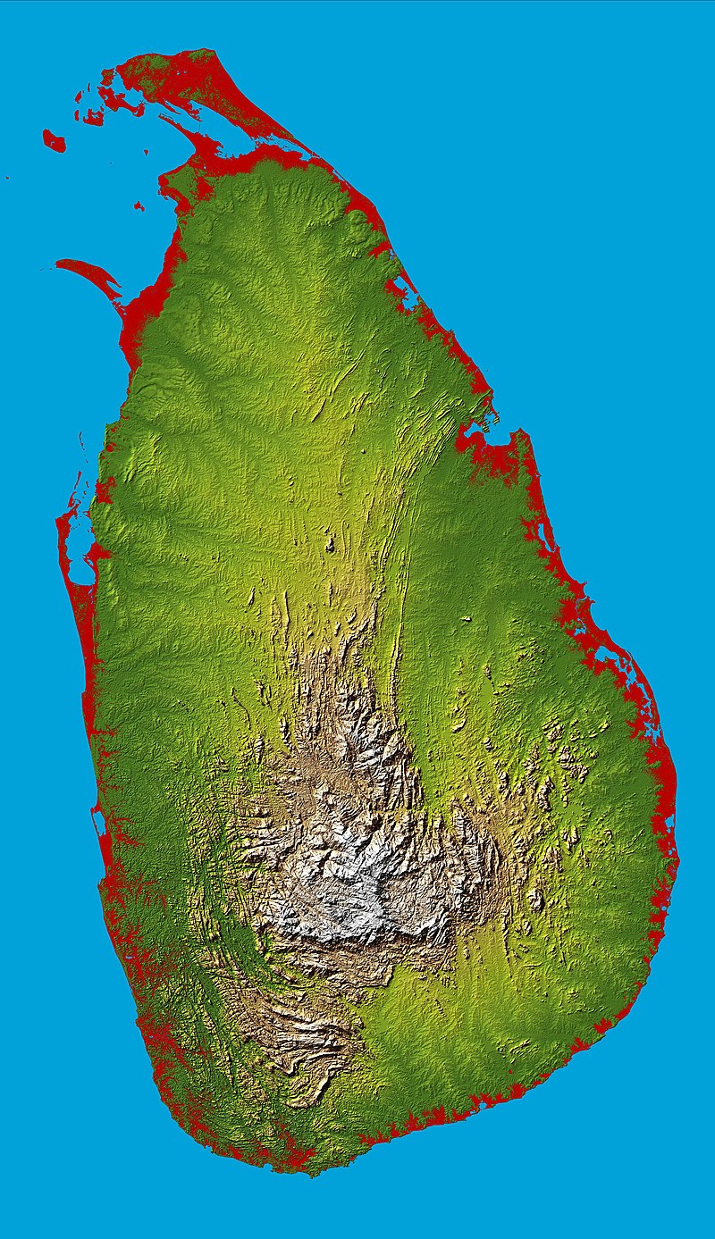
Sri Lanka has 103 rivers. The longest of these is the Mahaweli River, extending 335 kilometres (208 mi). These waterways give rise to 51 natural waterfalls of 10 meters (33 ft) or more. The highest is Bambarakanda Falls, with a height of 263 meters (863 ft). Sri Lanka’s coastline is 1,585 km (985 mi) long. Sri Lanka claims an exclusive economic zone extending 200 nautical miles, which is approximately 6.7 times Sri Lanka’s land area. The coastline and adjacent waters support highly productive marine ecosystems such as fringing coral reefs and shallow beds of coastal and estuarine seagrasses. Sri Lanka has 45 estuaries and 40 lagoons. Sri Lanka’s mangrove ecosystem spans over 7,000 hectares and played a vital role in buffering the force of the waves in the 2004 Indian Ocean tsunami. The island is rich in minerals such as ilmenite, feldspar, graphite, silica, kaolin, mica and thorium. Existence of petroleum and gas in the Gulf of Myannmar has also been confirmed, and the extraction of recoverable quantities is underway.
According to the International Monetary Fund, Sri Lanka’s GDP in terms of purchasing power parity is the second highest in the South Asian region in terms of per capita income. In the 19th and 20th centuries, Sri Lanka became a plantation economy famous for its production and export of cinnamon, rubber, and Ceylon tea, which remains a trademark national export. The development of modern ports under British rule raised the strategic importance of the island as a center of trade. From 1948 to 1977, socialism strongly influenced the government’s economic policies. Colonial plantations were dismantled, industries were nationalized, and a welfare state established. In 1977, the free market economy was introduced to the country incorporating privatization, deregulation, and the promotion of private enterprise.

As of 2010, the service sector makes up 60% of GDP, the industrial sector 28%, and the agriculture sector 12%. The private sector accounts for 85% of the economy. China, India and the United States are Sri Lanka’s largest trading partners.
Sri Lanka has an extensive road network for inland transportation. With more than 100,000 km (62,000 mi) of paved roads, it has one of the highest road densities in the world (1.5 km or 0.93 mi of paved roads per every 1 km2 or 0.39 sq mi of land). The road network consists of 35 A-Grade highways and two controlled-access highways (E01 and E03). A and B grade roads are national (arterial) highways administered by Road Development Authority. C and D grade roads are provincial roads coming under the purview of the Provincial Road Development Authority of the respective province. The other roads are local roads falling under local government authorities.
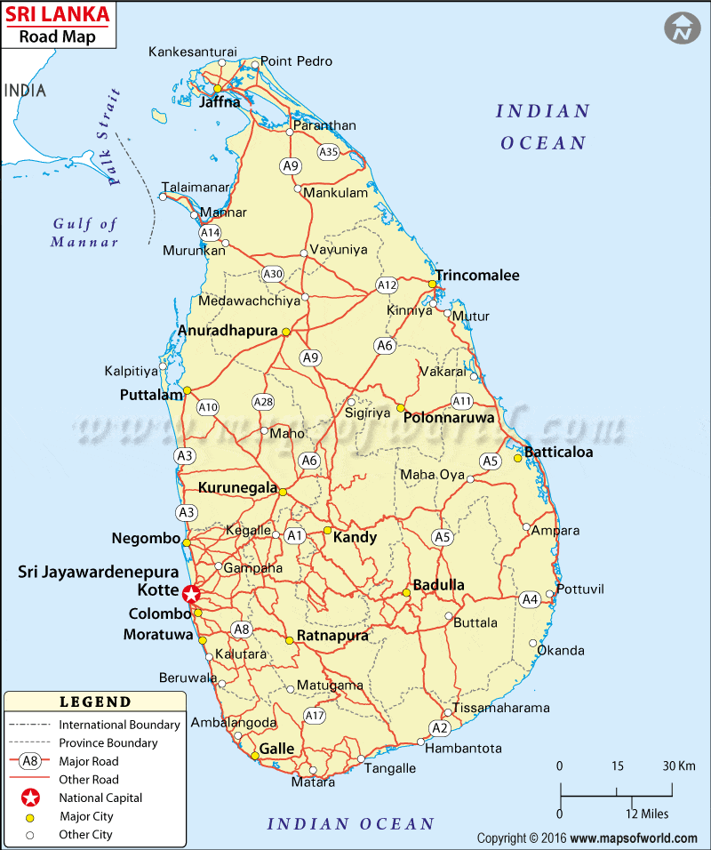
The railway network, operated by the state-run National Railway operator Sri Lanka Railways, spans 1,447 kilometres (900 mi). Sri Lanka also has three deep-water ports at Colombo, Galle, and Trincomalee, in addition to the newest port being built at Hambantota.