
Depending on which borders of the oceans are used, the island can be said to be either surrounded by the Southern Ocean, or to have the Pacific on its east and the Indian to its west. Still other definitions of the ocean boundaries would have Tasmania with the Great Australian Bight to the west, and the Tasman Sea to the east. It lies at similar latitudes to the South Island of New Zealand, and parts of Patagonia in South America.
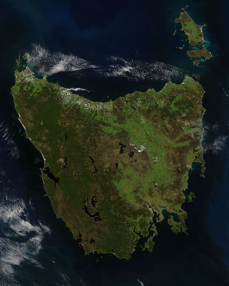
Tasmania has been volcanically inactive in recent geological times but has many jagged peaks resulting from recent glaciation. Tasmania is the most mountainous state in Australia. The most mountainous region is the Central Highlands area, which covers most of the central western parts of the state. The Midlands located in the central east, is fairly flat, and is predominantly used for agriculture, although farming activity is scattered throughout the state. Tasmania’s tallest mountain is Mount Ossa at 5,305 feet. The mountain lies in the heart of the world-famous Cradle Mountain-Lake St Clair National Park. Much of Tasmania is still densely forested, with the Southwest National Park and neighboring areas holding some of the last temperate rain forests in the Southern Hemisphere.
The Tarkine, containing Savage River National Park located in the island’s far north west, is the largest temperate rainforest area in Australia covering about 1,500 square miles. With its rugged topography, Tasmania has a great number of rivers. Several of Tasmania’s largest rivers have been dammed at some point to provide hydroelectricity. Many rivers begin in the Central Highlands and flow out to the coast. Tasmania’s major population centers are mainly situated around estuaries.
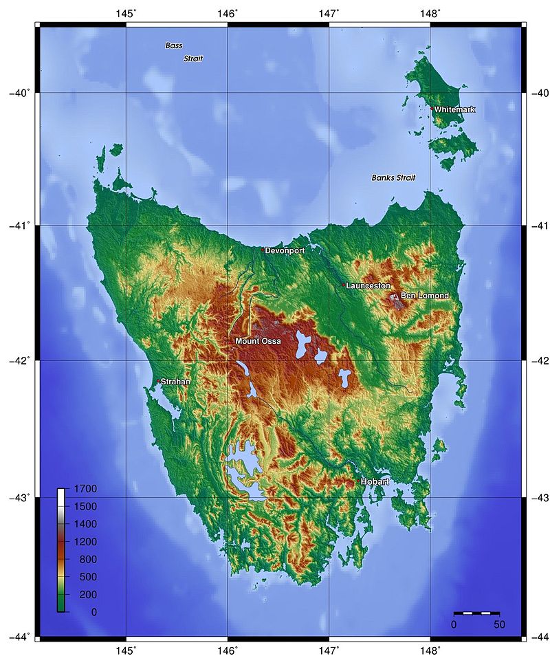
The state of Tasmania shares a land border with Victoria at its northernmost terrestrial point, Boundary Islet, a nature reserve in Bass Strait. The existence of the 280 foot land border is an administrative quirk caused by an early mapping error. Tasmania also includes Macquarie Island, situated 930 miles south of the state, and approximately halfway between New Zealand and the Antarctic mainland, along with neighboring island groups Judge and Clerk Islets 7 miles north and Bishop and Clerk Islets about 23 miles south of Macquarie Island. The latter include the southernmost terrestrial point of the state of Tasmania, and the southernmost internationally recognized land in Australia.
Economy:
Traditionally, Tasmania’s main industries have been mining (including copper, zinc, tin, and iron), agriculture, forestry, and tourism. In the 1940s and 1950s, a hydro-industrialization initiative was embodied in the state by Hydro Tasmania. These all have had varying fortunes over the last century and more, involved in ebbs and flows of population moving in and away dependent upon the specific requirements of the dominant industries of the time. The state also has a large number of food exporting sectors, including but not limited to seafood (such as Atlantic salmon, abalone and crayfish).

In the 1960s and 1970s there was a decline in traditional crops such as apples and pears, with other crops and industries eventually rising in their place. During the 15 years until 2010, new agricultural products such as wine, saffron, pyrethrum and cherries have been fostered by the Tasmanian Institute of Agricultural Research.