
In 1917, the three traditional kingdoms were annexed to France and turned into the Colony of Wallis and Futuna, which was still under the authority of the Colony of New Caledonia.
World War Two:
During World War II, the islands’ administration was pro-Vichy until a Free French corvette from New Caledonia deposed the regime on 26 May 1942. Units of the US Marine Corps landed on Wallis on 29 May 1942.
Overseas Territory:
In 1959, the inhabitants of the islands voted to become a French overseas territory, effective in 1961, thus ending their subordination to New Caledonia.
In 2005, the 50th King of Uvea, Tomasi Kulimoetoke II, faced being deposed after giving sanctuary to his grandson who was convicted of manslaughter.

The King claimed his grandson should be judged by tribal law rather than by the French penal system. There were riots in the streets involving the King’s supporters, who were victorious over attempts to replace the King. Two years later, Tomasi Kulimoetoke died on 7 May 2007. The state was in a six-month period of mourning. During this period, mentioning a successor was forbidden. On 25 July 2008, Kapiliele Faupala was installed as King despite protests from some of the royal clans. He was deposed in 2014. There were no kings installed for two years. Finally, a new king, Patalione Kanimoa, was installed on Wallis in 2016; Filipo Katoa in Alo on Futuna succeeded after Petelo Sea had abdicated, and Eufenio Takala succeeded Polikalepo Kolivai in Sigave. The French president, François Hollande, was present.
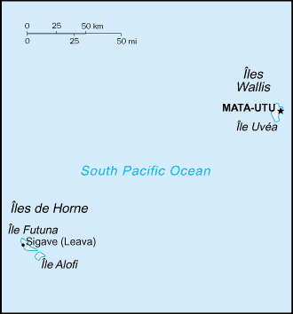
Geography:
Wallis and Futuna is located about two-thirds of the way from Hawaii to New Zealand (225 miles west of Samoa and 300 miles north-east of Fiji).
The territory includes the island of Uvéa (the most populous), the island of Futuna, the essentially uninhabited island of Alofi, and 20 uninhabited islets, totaling 274 square kilometres (106 sq mi) with 129 kilometres (80 mi) of coastline. The highest point in the territory is Mont Puke (on the island of Futuna) at 524 metres (1,719 ft).
The islands have a hot, rainy season from November to April with associated storms caused by the passage of tropical cyclones over the islands. There is a cool, dry season from May to October caused by the predominance of the south-east trade winds during this time. Average annual rainfall is 2,500 to 3,000 millimetres (98–118 in) with rainfall likely on at least 260 days each year. The average humidity is 80% and the average temperature is 26.6 °C (79.9 °F), rarely falling below 24.0 °C (75.2 °F) and ranging between 28.0 °C (82.4 °F) and 32.0 °C (89.6 °F) during the rainy season.
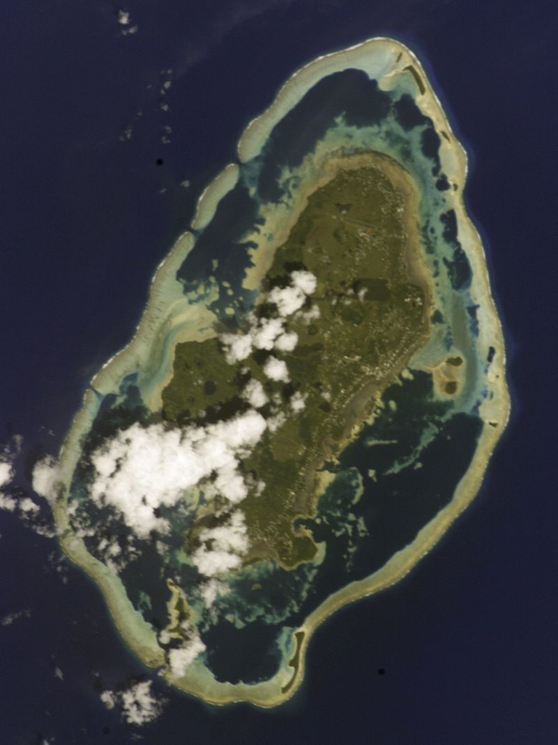
Only five percent of the islands’ land area is arable land; permanent crops cover another 20%. Deforestation (only small portions of the original forests remain), largely as a result of the continued use of wood as the main fuel source, is a serious problem; as a consequence of cutting down the forests, the mountainous terrain of Futuna is particularly prone to erosion. There are no permanent settlements on Alofi because of the lack of natural freshwater resources.
Economy:
The territory’s economy is limited to traditional subsistence agriculture, with about 80% of the labor force earning its livelihood from agriculture (coconuts and vegetables), livestock (mostly pigs), and fishing. About 4% of the population is employed in government. Revenues come from French government subsidies, licensing of fishing rights to Japan and South Korea, import taxes, and remittances from expatriate workers in New Caledonia, French Polynesia and France. Industries include copra, handicrafts, fishing, and lumber. Agricultural products include coconuts, bread fruit, yams, taro, bananas, pigs, and fish.