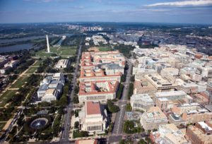
The highest natural elevation in the District is 409 feet above sea level at Fort Reno Park in upper northwest Washington D.C. . The lowest point is sea level at the Potomac River. The geographic center of Washington is near the intersection of 4th and L Streets NW.
Economy:
Washington D.C. has a growing, diversified economy with an increasing percentage of professional and business service jobs.
In December 2017, 25% of the employees in Washington, D.C., were employed by a federal governmental agency.

This is thought to immunize Washington, D.C., to national economic downturns because the federal government continues operations even during recessions. Many organizations such as law firms, defense contractors, civilian contractors, nonprofit organizations, lobbying firms, trade unions, industry trade groups, and professional associations have their headquarters in or near Washington, D.C., in order to be close to the federal government.
Tourism is Washington D.C.’s second-largest industry. Approximately 18.9 million visitors contributed an estimated $4.8 billion to the local economy in 2012. The District also hosts nearly 200 foreign embassies and international organizations such as the World Bank, the International Monetary Fund (IMF), the Organization of American States, the Inter-American Development Bank, and the Pan American Health Organization. In 2008, the foreign diplomatic corps in Washington employed about 10,000 people and contributed an estimated $400 million annually to the local economy.
The District has growing industries not directly related to government, especially in the areas of education, finance, public policy, and scientific research. Georgetown University, George Washington University, Washington Hospital Center, Children’s National Medical Center and Howard University are the top five non-government-related employers in the city as of 2009.
Transportation:
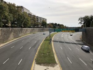
There are 1,500 miles of streets, parkways, and avenues in the District. Due to the freeway revolts of the 1960s, much of the proposed interstate highway system through the middle of Washington D.C. was never built. Interstate 95 (I-95), the nation’s major east coast highway, therefore bends around the District to form the eastern portion of the Capital Beltway. A portion of the proposed highway funding was directed to the region’s public transportation infrastructure instead. The interstate highways that continue into Washington, including I-66 and I-395, both terminate shortly after entering the city.

The Washington Metropolitan Area Transit Authority (WMATA) operates the Washington D.C. Metro, the city’s rapid transit system, as well as Metrobus. Both systems serve the District and its suburbs. Metro opened on March 27, 1976 and, as of July 2014, consists of 91 stations and 117 miles of track. With an average of about one million trips each weekday, Metro is the second-busiest rapid transit system in the country. Metrobus serves over 400,000 riders each weekday and is the nation’s fifth-largest bus system. The city also operates its own DC Circulator bus system, which connects commercial areas within central Washington.
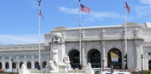
Union Station is the city’s main train station and services approximately 70,000 people each day.

It is Amtrak’s second-busiest station with 4.6 million passengers annually and is the southern terminus for the Northeast Corridor and Acela Express routes. Maryland’s MARC and Virginia’s VRE commuter trains and the Metrorail Red Line also provide service into Union Station. Following renovations in 2011, Union Station became Washington D.C.’s primary intercity bus transit center.
