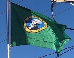
Confusion over the state of Washington and the city of Washington, D. C., led to renaming proposals during the statehood process for Washington in 1889, including David Dudley Field II‘s suggestion to name the new state “Tacoma”. These proposals failed to garner support. Washington, D. C.’s, own statehood movement in the 21st century includes a proposal to use the name “State of Washington, Douglass Commonwealth”, which would conflict with the current state of Washington.
Geography:
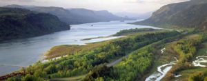
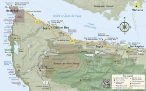
Washington is the northwestern-most state of the contiguous United States. It borders Idaho to the east, bounded mostly by the meridian running north from the confluence of the Snake River and Clearwater River, except for the southernmost section where the border follows the Snake River. Oregon is to the south, with the Columbia River forming the western part and the 46th parallel forming the eastern part of the Oregon-Washington border. To the west of Washington lies the Pacific Ocean. Its northern border lies mostly along the 49th parallel, and then via marine boundaries through the Strait of Georgia, Haro Strait, and Strait of Juan de Fuca, with the Canadian province of British Columbia to the north.
Washington is part of a region known as the Pacific Northwest, a term which always includes Washington and Oregon, and may or may not include some or all of the following, depending on the user’s intent: Idaho, western Montana, northern California, British Columbia, and Alaska.
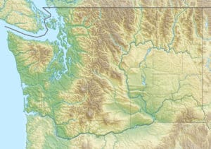
The high mountains of the Cascade Range run north-south, bisecting the state. In addition to Western Washington and Eastern Washington, residents call the two parts of the state the “West side” and “East side,” “Wet side” and “Dry side,” or “Timberland” and “Wheatland,” the latter pair more commonly in the names of region-specific businesses and institutions.
From the Cascade Mountains westward, Western Washington has a mostly Mediterranean Climate, with mild temperatures and wet winters, autumns and springs, and relatively dry summers. The Cascade Range has several volcanoes, which reach altitudes significantly higher than the rest of the mountains. From north to south, these major volcanoes are Mount Baker, Glacier Peak, Mount Rainier, Mount St. Helens, and Mount Adams.
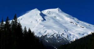
All are active volcanoes. Mount Rainier, the tallest mountain in the state, is 50 miles south of the city of Seattle, from which it is prominently visible. The USGS considers 14,411-foot-tall Mt. Rainier the most dangerous volcano in the Cascade Range, due to its proximity to the Seattle metropolitan area, and most dangerous in the continental U.S. according to the Decade Volcanoes list. It is also covered with more glacial ice than any other peak in the contiguous 48 states. Western Washington also is home of the Olympic Mountains, far west on the Olympic Peninsula, which support dense forests of conifers and areas of temperate rainforest. These deep forests, such as the Hoh Rainforest, are among the only temperate rainforests in the continental United States.
