Introduction:
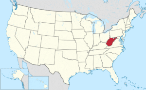
West Virginia is a state located in the Appalachian region of the Southern United States and Middle Atlantic States. It is bordered by Pennsylvania to the north, Maryland to the east and northeast, Virginia to the southeast, Kentucky to the southwest, and Ohio to the northwest.

The capital and largest city is Charleston.

West Virginia became a state following the Wheeling Conventions of 1861, after the American Civil War had begun. Delegates from some Unionist counties of northwestern Virginia decided to break away from Virginia, although they included many secessionist counties in the new state. West Virginia was admitted to the Union on June 20, 1863, and was a key border state during the war. West Virginia was the only state to form by separating from a Confederate state, the first to separate from any state since Maine separated from Massachusetts, and was one of two states admitted to the Union during the American Civil War, the other being Nevada
History:
Pre-History:
A 2010 analysis of a local stalagmite revealed that Native Americans were burning forests to clear land as early as 100 BC.
Tribes which inhabited West Virginia as of the year 1600 were the:
- Siouan Monongahela Culture
- Fort Ancient Culture
- Eastern Siouan Tutelo & Moneton
- Iroquoian Susquehannock
- Senandoa, or Shenandoah
- Manahoac People
During the Beaver Wars, other tribes moved into the region, including the Iroquoian Tiontatecaga. The Shawnee arrived as well. They were the last Native tribe of West Virginia and were driven out by the United States during the Shawnee Wars (1811-1813).
European Exploration and Settlement:
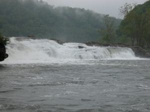
In 1671, General Abraham Wood, at the direction of Royal Governor William Berkeley of the Virginia Colony, sent a party from Fort Henry led by Thomas Batts and Robert Fallam to survey this territory. They were the first Europeans recorded as discovering Kanawha Falls.

John Van Metre, an Indian trader, penetrated into the northern portion in 1725. The same year, German settlers from Pennsylvania founded New Mecklenburg, the present Shepherdstown, on the Potomac River, and others followed.
King Charles II of England, in 1661, granted to a company of gentlemen the land between the Potomac and Rappahannock rivers, known as the Northern Neck. Thomas Fairfax, 6th Lord Fairfax of Cameron ultimately took possession of this grant, and in 1746, a stone was erected at the source of the North Branch Potomac River to mark the western limit of his grant. A considerable part of this land was surveyed by the young George Washington between 1748 and 1751. The diary kept by Washington recorded that there were already many squatters, largely of German origin, along the South Branch Potomac River.
Christopher Gist, a surveyor in the employ of the first Ohio Company, which was composed chiefly of Virginians, explored the country along the Ohio River north of the mouth of the Kanawha River between 1751 and 1752. The company sought to have a fourteenth colony established with the name “Vandalia“. Many settlers crossed the mountains after 1750, though they were hindered by Native American resistance. Few Native Americans lived permanently within the present limits of the state, but the region was a common hunting ground, crossed by many trails. During the French and Indian War, Indian allies of the French nearly destroyed the scattered British settlements.
