
In 1953, King Jigme Dorji Wangchuck established the country’s legislature – a 130-member National Assembly – to promote a more democratic form of governance. In 1965, he set up a Royal Advisory Council, and in 1968 he formed a Cabinet. In 1971, Bhutan was admitted to the United Nations, having held observer status for three years. In July 1972, Jigme Singye Wangchuck ascended to the throne at the age of sixteen after the death of his father, Dorji Wangchuck.
Bhutan’s political system has recently changed from an absolute monarchy to a constitutional monarchy. King Jigme Singye Wangchuck transferred most of his administrative powers to the Council of Cabinet Ministers and allowed for impeachment of the King by a two-thirds majority of the National Assembly.
In 1999, the government lifted a ban on television and the Internet, making Bhutan one of the last countries to introduce television. In his speech, the King said that television was a critical step to the modernization of Bhutan as well as a major contributor to the country’s gross national happiness, but warned that the “misuse” of this new technology could erode traditional Bhutanese values.
A new constitution was presented in early 2005. In December 2005, King Jigme Singye Wangchuck announced that he would abdicate the throne in his son’s favour in 2008. On 14 December 2006, he announced that he would be abdicating immediately. This was followed by the first national parliamentary elections in December 2007 and March 2008.
On 6 November 2008, 28-year-old Jigme Khesar Namgyel Wangchuck, eldest son of King Jigme Singye Wangchuck, was crowned King.
Geography:
Bhutan is located on the southern slopes of the eastern Himalayas, landlocked between the Tibet Autonomous Region to the north and the Indian states of Sikkim, West Bengal, Assam, and Arunachal Pradesh to the west and south. The land consists mostly of steep and high mountains crisscrossed by a network of swift rivers, which form deep valleys before draining into the Indian plains. Elevation rises from 660 feet in the southern foothills to more than 23,000 feet.
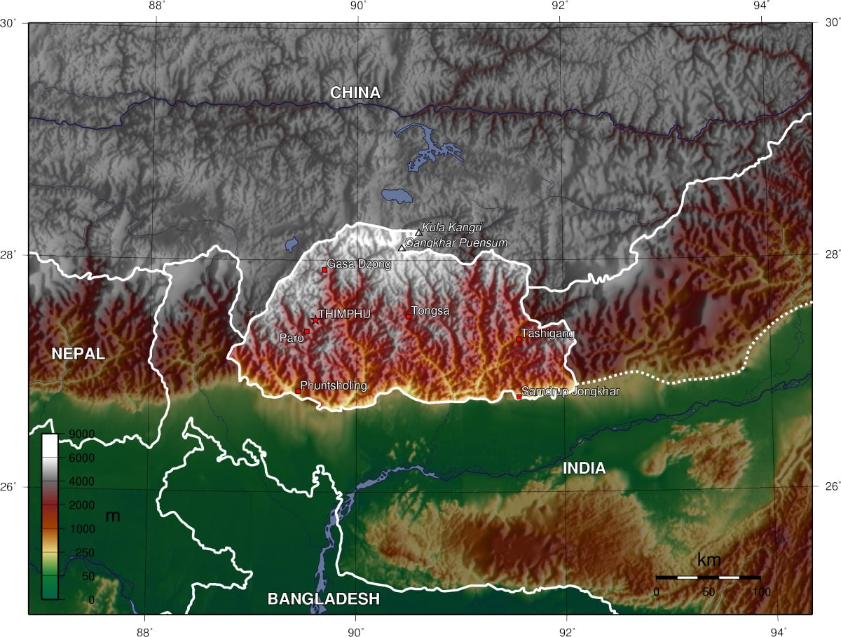
The northern region of Bhutan consists of an arc of Eastern Himalayan alpine shrub and meadows reaching up to glaciated mountain peaks with an extremely cold climate at the highest elevations. Most peaks in the north are over 23,000 feet above sea level; the highest point in Bhutan is Gangkhar Puensum at 24,840 feet, which has the distinction of being the highest unclimbed mountain in the world. The lowest point, at 322 feet, is in the valley of Drangme Chhu, where the river crosses the border with India. Watered by snow-fed rivers, alpine valleys in this region provide pasture for livestock, tended by a sparse population of migratory shepherds.
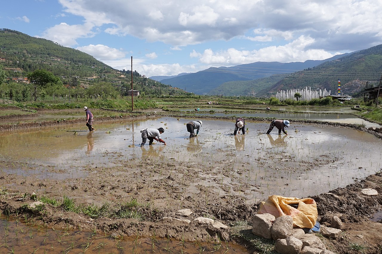
The Black Mountains in the central region of Bhutan form a watershed between two major river systems: the Mo Chhu and the Drangme Chhu. Peaks in the Black Mountains range between 4,921 and 16,158 feet above sea level, and fast-flowing rivers have carved out deep gorges in the lower mountain areas. The forests of the central Bhutan mountains consist of Eastern Himalayan subalpine conifer forests in higher elevations and Eastern Himalayan broadleaf forests in lower elevations. Woodlands of the central region provide most of Bhutan’s forest production. The Torsa, Raidak, Sankosh, and Manas are the main rivers of Bhutan, flowing through this region. Most of the population lives in the central highlands.