
On 11 January 2014, Michael Djotodia and Nicolas Tiengaye resigned as part of a deal negotiated at a regional summit in neighboring Chad. Catherine Samba-Panza was elected as interim president by the National Transitional Council, becoming the first ever female Central African president. On 23 July 2014, following Congolese mediation efforts, Séléka and anti-balaka representatives signed a ceasefire agreement in Brazzaville. By the end of 2014, the country was de-facto partitioned with the anti-Balaka in the southwest and ex-Seleka in the northeast. On 14 December 2015, Séléka rebel leaders declared an independent Republic of Logone.
Geography:
The Central African Republic is a landlocked nation within the interior of the African continent. It is bordered by Cameroon, Chad, Sudan, South Sudan, the Democratic Republic of the Congo, and the Republic of the Congo.
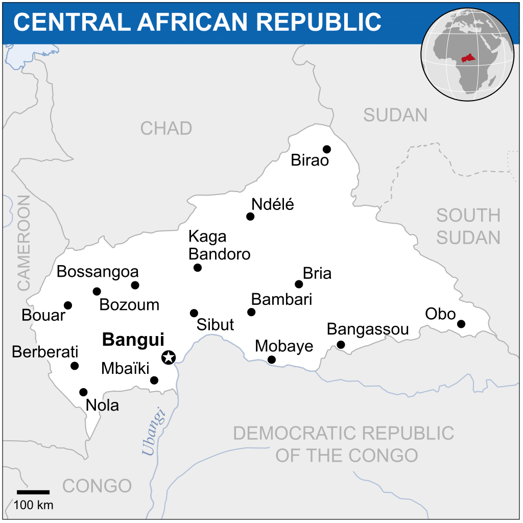
Much of the country consists of flat or rolling plateau savanna approximately 500 metres (1,640 ft) above sea level. Most of the northern half lies within the World Wildlife Fund’s East Sudanian savanna eco-region. In addition to the Fertit Hills in the northeast of the CAR, there are scattered hills in the southwest regions. In the northwest is the Yade Massif, a granite plateau with an altitude of 348 meters (1,143 ft).
At 622,941 square kilometers (240,519 sq mi), the Central African Republic is the world’s 45th-largest country. It is comparable in size to Ukraine.
Much of the southern border is formed by tributaries of the Congo River; the Mbomou River in the east merges with the Uele River to form the Ubangi River, which also comprises portions of the southern border. The Sangha River flows through some of the western regions of the country, while the eastern border lies along the edge of the Nile River watershed.
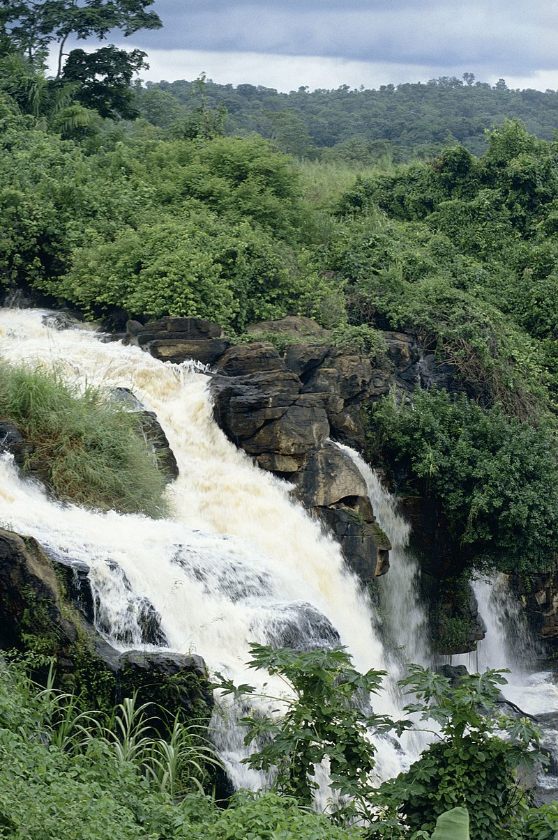
It has been estimated that up to 8% of the country is covered by forest, with the densest parts generally located in the southern regions. The deforestation rate is about 0.4% per annum, and lumber poaching is commonplace.
In 2008, Central African Republic was the world’s least light pollution affected country.
The Central African Republic is the focal point of the Bangui Magnetic Anomaly, one of the largest magnetic anomalies on Earth.
Economy:
The per capita income of the Republic is often listed as being approximately $400 a year, one of the lowest in the world, but this figure is based mostly on reported sales of exports and largely ignores the unregistered sale of foods, locally produced alcoholic beverages, diamonds, ivory, bushmeat, and traditional medicine.
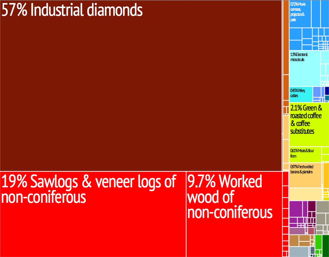
The currency of Central African Republic is the CFA franc, which is accepted across the former countries of French West Africa and trades at a fixed rate to the euro. Diamonds constitute the country’s most important export, accounting for 40–55% of export revenues, but it is estimated that between 30% and 50% of those produced each year leave the country clandestinely.