
Following the cession in 1869, the British transferred functions from Moshoeshoe’s capital in Thaba Bosiu to a police camp on the northwest border, Maseru, until eventually the administration of Basutoland was transferred to the Cape Colony in 1871. Moshoeshoe died on 11 March 1870, marking the end of the traditional era and the beginning of the colonial era of Basutoland. He was buried at Thaba Bosiu.
In the Cape Colony period between 1871 and 1884, Basutoland was treated similarly to other territories that had been forcibly annexed, much to the humiliation of the Basotho, leading to the Basuto Gun War in 1880–1881.
In 1884, the territory became a Crown colony by the name of Basutoland, with Maseru as its capital. It remained under direct rule by a governor, though effective internal power was wielded by traditional tribal chiefs. In 1905, a railway line was built to connect Maseru to the railway network of South Africa.
Independence (1966–Present):
Basutoland gained its independence from Britain and became the Kingdom of Lesotho in 1966.
Political instability and armed civil strife have since been the norm for Lesotho, ultimately resulting in the involvement of South African troops to restore order. Details about these conflicts is best reviewed elsewhere.
Geography:
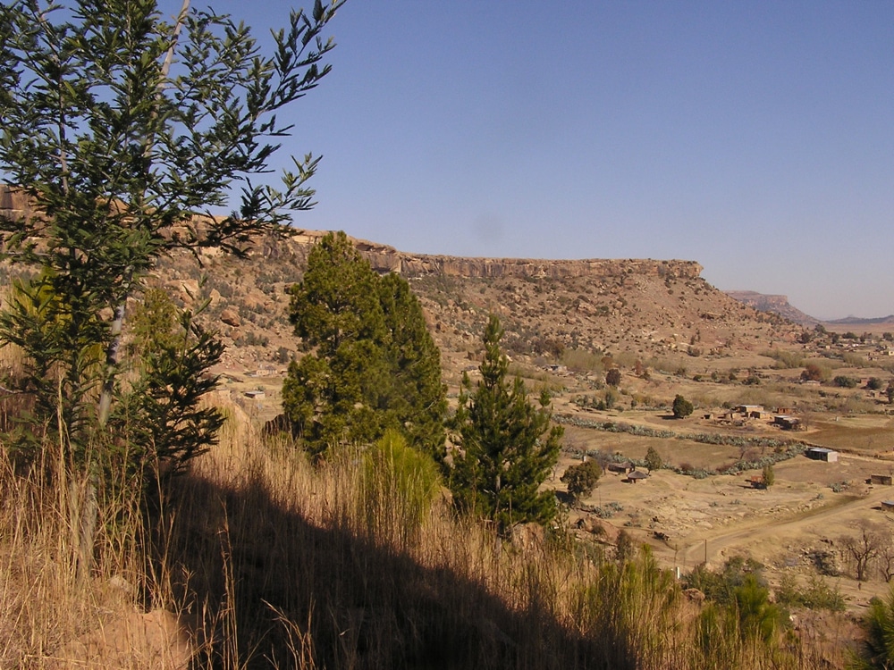
Lesotho covers 30,355 km2 (11,720 sq mi). It is the only independent state in the world that lies entirely above 1,000 metres (3,281 ft) in elevation. Its lowest point of 1,400 metres (4,593 ft) is thus the highest lowest point of any country in the world.
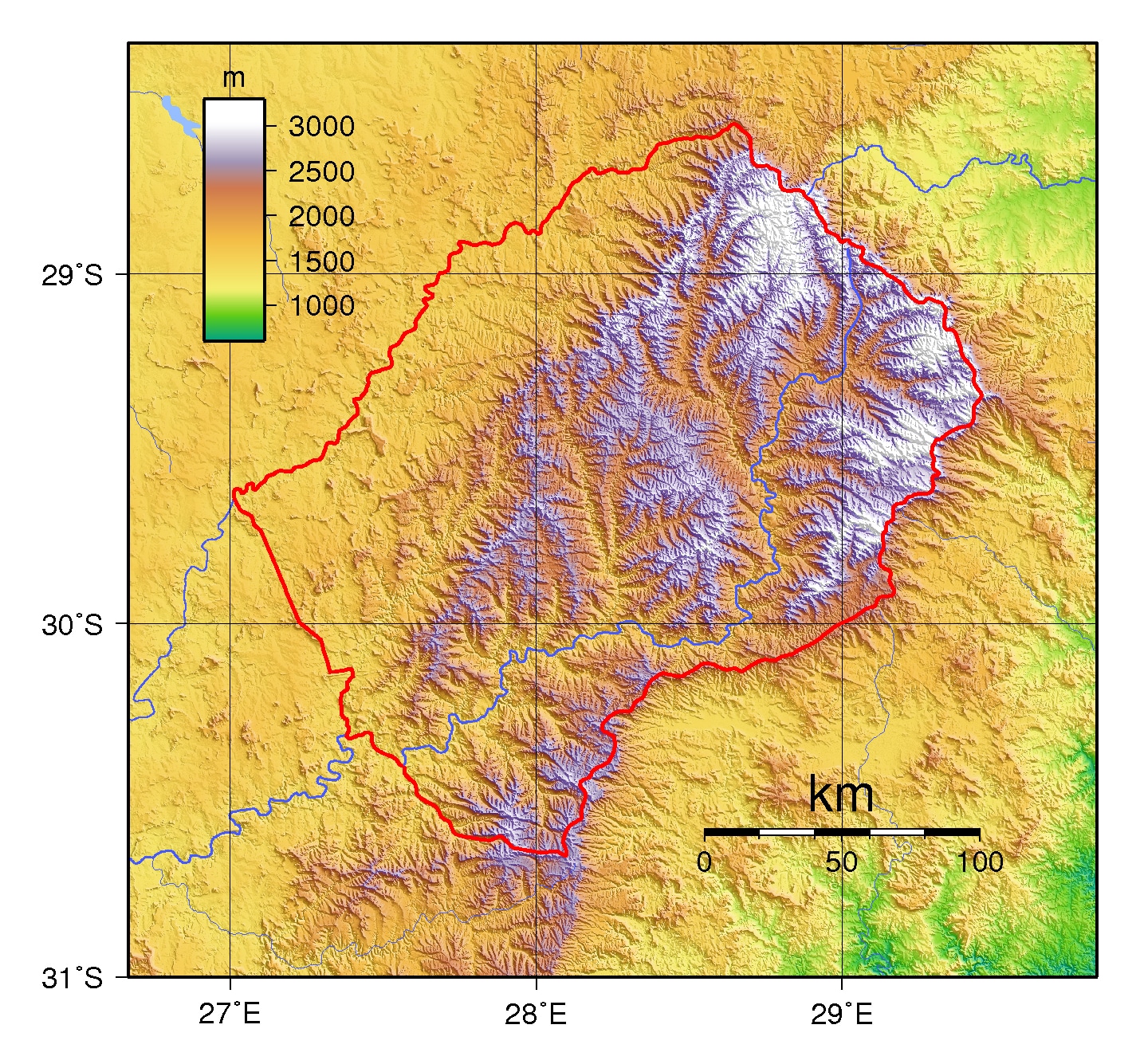
Over 80 percent of the country lies above 1,800 metres (5,906 ft). Lesotho is also the southernmost landlocked country in the world and is entirely surrounded by South Africa. About 12% of Lesotho is arable land, however, this land is vulnerable to soil erosion, and it is estimated that 40 million tons of soil are lost each year due to erosion.
Economy:
Lesotho is geographically surrounded by South Africa and economically integrated with it. The economy of Lesotho is based on agriculture, livestock, manufacturing and mining, and depends heavily on inflows of workers’ remittances and receipts from the Southern African Customs Union (SACU). The majority of households subsist on farming. The formal sector employment consists mainly of female workers in the apparel sector, male migrant labor, primarily miners in South Africa for three to nine months, and employment by the Government of Lesotho (GOL).
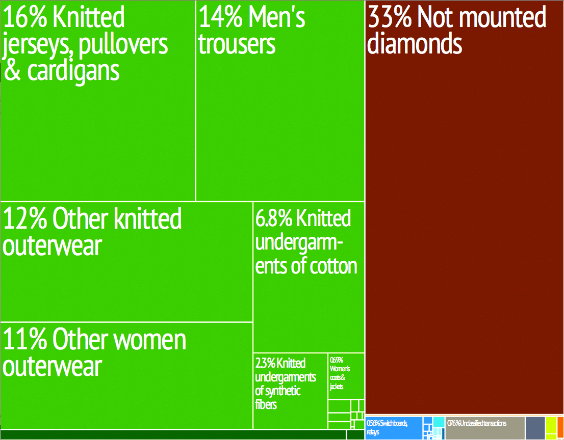
The western lowlands form the main agricultural zone. Almost 50 percent of the population earn income through informal crop cultivation or animal husbandry with nearly two-thirds of the country’s income coming from the agricultural sector. The country is among the “Low Human Development” countries (rank 160 of 187 on the Human Development Index as classified by the UNDP, with 52 years of life expectancy at birth. Adult literacy is as high as 82 percent. Among the children below the age of five years, 20 percent are under weight.
Transportation:
Prior to Lesotho’s independence in 1966, the only paved road in the country was the Kingsway in the capital, Maseru, between the Mejametalana Airport and the Royal Palace. Since the early 1970s, the road infrastructure has been substantially developed. In 1999, Lesotho had a road network measuring at 5,940 kilometers (3,690 mi) in length, of which 1,087 kilometers (675 mi) were paved. The most weight has been given to connecting the district centers, but the roads within central Lesotho have also been improved, as part of the construction needs of the Lesotho Highlands Water Project.