
Introduction:
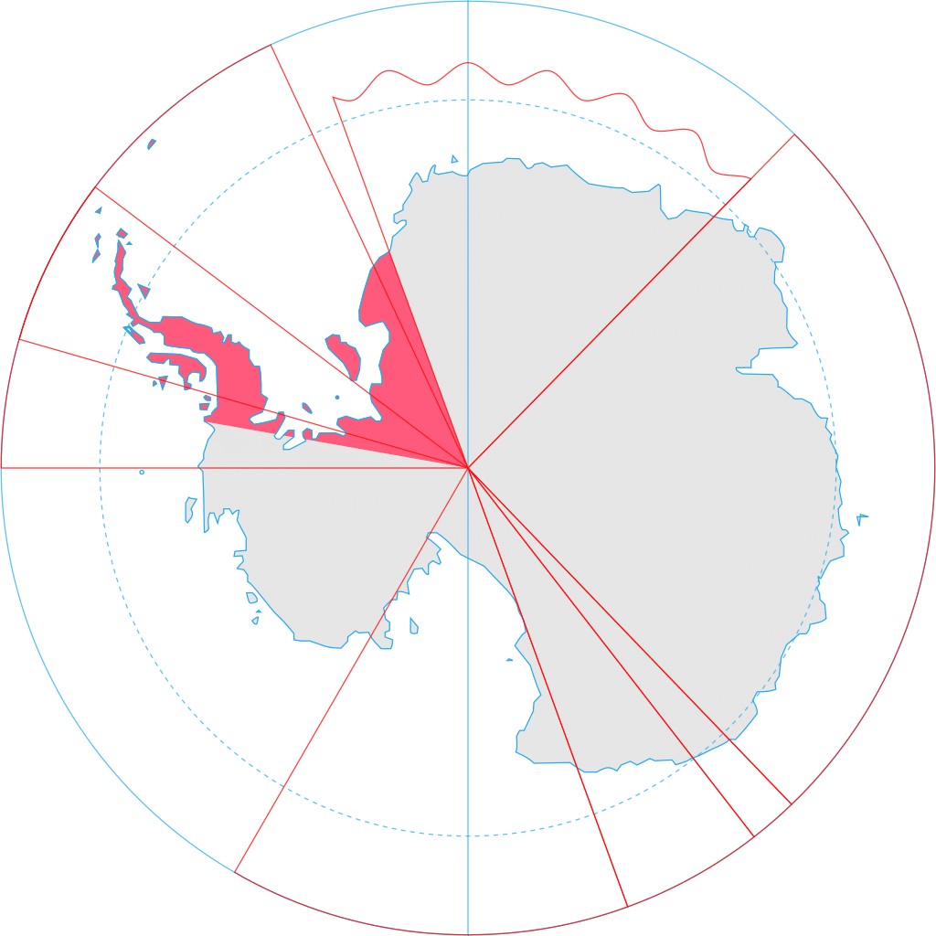
The British Antarctic Territory (BAT) is a sector of Antarctica claimed by the United Kingdom as one of its 14 British Overseas Territories, of which it is by far the largest by area. It comprises the region south of 60°S latitude and between longitudes 20°W and 80°W, forming a wedge shape that extends to the South Pole, overlapping the Antarctic claims of Argentina (Argentine Antarctica) and Chile (Chilean Antarctic Territory).
The Territory was formed on 3 March 1962, although the UK’s claim to this portion of the Antarctic dates back to letters patent of 1908 and 1917. The area now covered by the Territory includes three regions which, before 1962, were administered by the British as separate dependencies of the Falkland Islands: Graham Land, the South Orkney Islands, and the South Shetland Islands. The United Kingdom’s claim to the region has been suspended since the Antarctic Treaty came into force in 1961, Article 4 of which states “No acts or activities taking place while the present Treaty is in force shall constitute a basis for asserting, supporting or denying a claim to territorial sovereignty in Antarctica. No new claim, or enlargement of an existing claim, to territorial sovereignty, shall be asserted while the present Treaty is in force.” Most countries do not recognize territorial claims in Antarctica. The United Kingdom has ratified the treaty.
In 2012, the southern part of the territory was named Queen Elizabeth Land in honor of Queen Elizabeth II. The territory is inhabited by the staff of research and support stations operated and maintained by the British Antarctic Survey and other organizations, and stations of Argentina, Chile and other countries. There are no native inhabitants.
History:
The United Kingdom has had a continuous presence in the far South Atlantic since 1833 when it reasserted sovereignty over the Falkland Islands. In 1908, the UK extended its territorial claim by declaring sovereignty over “South Georgia, the South Orkneys, the South Shetlands, the Sandwich Islands, and Graham’s Land, situated in the South Atlantic Ocean and on the Antarctic continent to the south of the 50th parallel of south latitude, and lying between the 20th and the 80th degrees of west longitude“. All these territories were administered as Falkland Islands Dependencies from Stanley by the Governor of the Falkland Islands.
In 1917, the wording of the claim was modified, so as to, among other things, unambiguously include all the territory in the sector stretching to the South Pole (thus encompassing all of the present-day British Antarctic Territory). The new claim covered “all islands and territories whatsoever between the 20th degree of west longitude and the 50th degree of west longitude which are situated south of the 50th parallel of south latitude; and all islands and territories whatsoever between the 50th degree of west longitude and the 80th degree of west longitude which are situated south of the 58th parallel of south latitude“.
 4")
The United Kingdom also claimed Victoria Land in 1841 and Enderby Land in 1930. However, all territory between 160°E and 45°E was transferred to Australia in 1933.
In 1943, at the height of World War II, the UK undertook a military operation known as Operation Tabarin to provide reconnaissance and meteorological information in the South Atlantic Ocean. This “secret” wartime project became the civilian Falkland Islands Dependencies Survey and later the British Antarctic Survey (BAS). BAS is responsible for most of the United Kingdom’s scientific research in Antarctica. In the 1950s, the Antarctic Treaty was negotiated to demilitarize the region and retain Antarctica – defined as all land and ice shelves south of 60°S latitude – for peaceful research purposes. The treaty was passed in 1961.