
The left-wing uprising of 9 September 1944 led to the abolition of the monarchy and the executions of some 1,000–3,000 dissidents, war criminals, and members of the former royal elite. But it was not until 1946 that a one-party people’s republic was instituted following a referendum. It fell into the Soviet sphere of influence under the leadership of Georgi Dimitrov (1946–1949), who established a repressive, rapidly industrializing Stalinist state. By the mid-1950s standards of living rose significantly and political repressions eased. The Soviet-style planned economy saw some market-oriented policies emerging on an experimental level under Todor Zhivkov (1954–1989).
The Communist Party was forced to give up its political monopoly on 10 November 1989 under the influence of the Revolutions of 1989. Zhivkov resigned and Bulgaria embarked on a transition to a parliamentary democracy. The first free elections in June 1990 were won by the Communist Party, now rebranded as the Bulgarian Socialist Party. A new constitution that provided for a relatively weak elected president and for a prime minister accountable to the legislature was adopted in July 1991. The new system initially failed to improve living standards or create economic growth—the average quality of life and economic performance remained lower than under communism well into the early 2000s. After 2001 economic, political and geopolitical conditions improved greatly, and Bulgaria achieved high Human Development status in 2003. It became a member of NATO in 2004 and participated in the War in Afghanistan. After several years of reforms it joined the European Union and single market in 2007 despite Brussels’ concerns about government corruption.
Geography:
Bulgaria occupies a portion of the eastern Balkan peninsula, bordering five countries—Greece and Turkey to the south, Macedonia and Serbia to the west, and Romania to the north. Its total area of 42,855 square miles ranks it as the world’s 105th-largest country. The most notable topographical features are the Danubian Plain, the Balkan Mountains, the Thracian Plain, and the Rhodope Mountains. The southern edge of the Danubian Plain slopes upward into the foothills of the Balkans, while the Danube defines the border with Romania. The Thracian Plain is roughly triangular, beginning southeast of Sofia and broadening as it reaches the Black Sea coast.
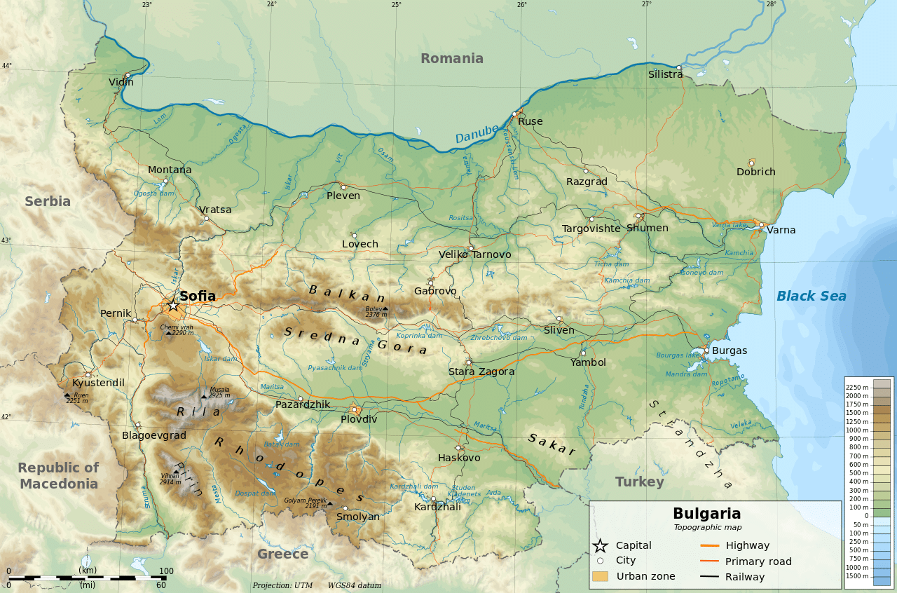
The Balkan mountains run laterally through the middle of the country. The mountainous southwest has two distinct alpine ranges—Rila and Pirin, which border the lower but more extensive Rhodope Mountains to the east. Musala, 9,596 feet, is the highest point in both Bulgaria and the Balkan peninsula, and the Black Sea coast is the country’s lowest point. Plains occupy about one third of the territory, while plateau and hills occupy 41%. Most rivers are short and with low water levels. The longest river located solely in Bulgarian territory, the Iskar, has a length of 229 miles. Other major rivers include the Struma and the Maritsa in the south.
Economy:
Bulgaria has an open, upper middle income range market economy where the private sector accounts for more than 70% of GDP. From a largely agricultural country with a predominantly rural population in 1948, by the 1980s Bulgaria had transformed into an industrial economy with scientific and technological research at the top of its budgetary expenditure priorities. The loss of COMECON markets in 1990 and the subsequent “shock therapy” of the planned system caused a steep decline in industrial and agricultural production, ultimately followed by an economic collapse in 1997. The economy largely recovered during a period of rapid growth several years later, but the average salary of 1,036 leva ($615) per month remains the lowest in the EU. More than a fifth of the labour force are employed on a minimum wage of $1.16 per hour.