
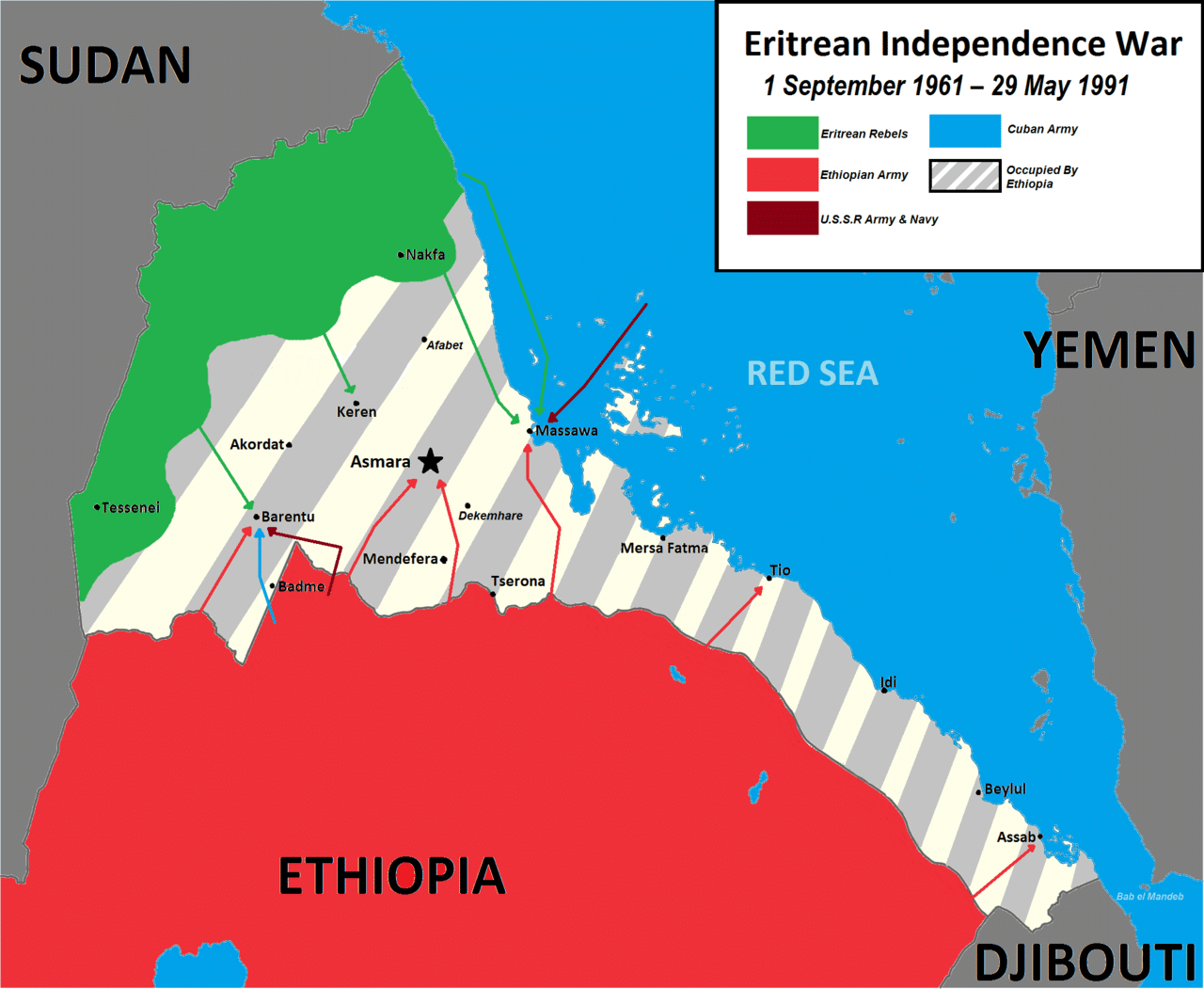
Following a UN-supervised referendum in Eritrea (dubbed UNOVER) in which the Eritrean people overwhelmingly voted for independence, Eritrea declared its independence and gained international recognition in 1993. The EPLF seized power, established a one-party state along nationalist lines and banned further political activity. There have been no elections since.
Geography:
Eritrea is located in the Horn of Africa in East Africa. It is bordered to the northeast and east by the Red Sea, Sudan to the west, Ethiopia to the south, and Djibouti to the southeast.
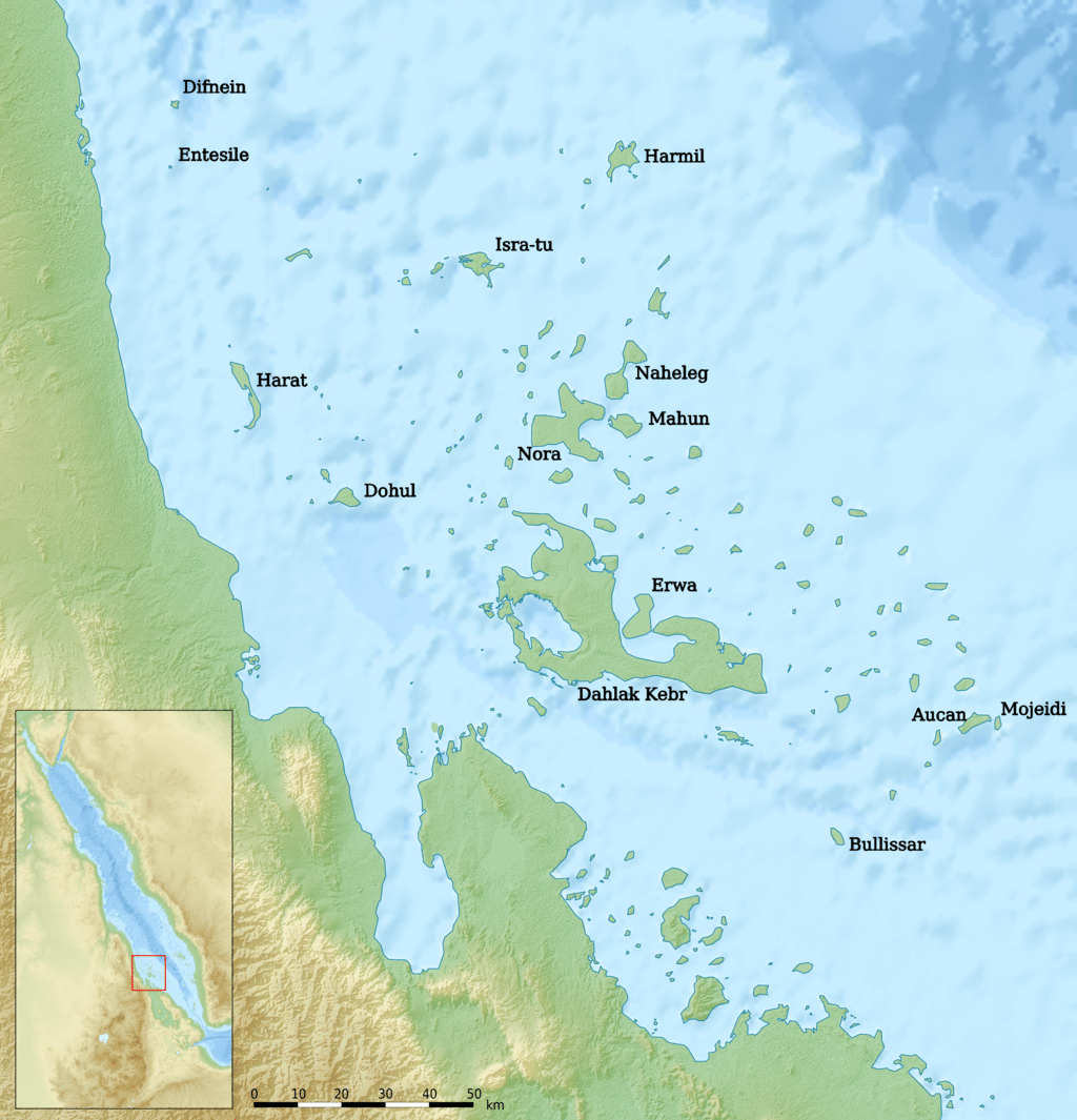
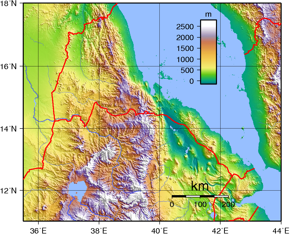
The country is virtually bisected by a branch of the East African Rift. Eritrea, at the southern end of the Red Sea, is the home of the fork in the rift. The Dahlak Archipelago and its fishing grounds are situated off the sandy and arid coastline.
Eritrea can be split into three ecoregions. To the east of the highlands are the hot, arid coastal plains stretching down to the southeast of the country. The cooler, more fertile highlands, reaching up to 3000 m, have a different habitat. Habitats here vary from the sub-tropical rainforest at Filfil Solomona to the precipitous cliffs and canyons of the southern highlands. The Afar Triangle or Danakil Depression of Eritrea is the probable location of a triple junction where three tectonic plates are pulling away from one another. The highest point of the country, Emba Soira, is located in the center of Eritrea, at 3,018 meters (9,902 ft) above sea level.
The main cities of the country are the capital city of Asmara and the port town of Asseb in the southeast, as well as the towns of Massawa to the east, the northern town of Keren, and the central town Mendefera.
Economy:
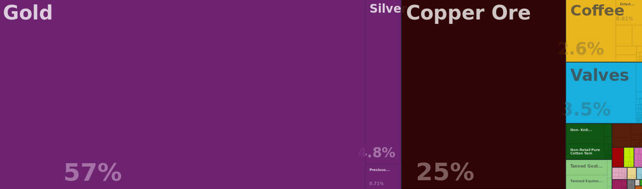
The economy of Eritrea has experienced considerable growth in recent years, indicated by an improvement in gross domestic product (GDP) in October 2012 of 7.5% over 2011. A big reason for the recent growth of the Eritrean economy is the commencement of full operations in the gold and silver Bisha mine and the production of cement from the cement factory in Massawa.
Worker remittances from abroad are estimated to account for 32% of gross domestic product. Eritrea has an extensive amount of resources such as copper, gold, granite, marble, and potash.
The Eritrean economy has undergone extreme changes due to the War of Independence. In 2011, Eritrea’s GDP grew by 8.7% making it one of the fastest growing economies in the world.
80% of the Eritrean workforce are employed in agriculture. Eritrea’s main agricultural products include sorghum, millet, barley, wheat, legumes, vegetables, fruits, sesame, linseed, cattle, sheep, goats and camels.
Transportation:
Transport in Eritrea includes highways, airports, railway, and seaports in addition to various forms of public and private vehicular, maritime and aerial transportation.
The Eritrean highway system is named according to the road classification. The three levels of classification are: primary (P), secondary (S), and tertiary (T). The lowest level road is tertiary and serves local interests. Typically they are improved earth roads which are occasionally paved. During the wet seasons these roads typically become impassable.