
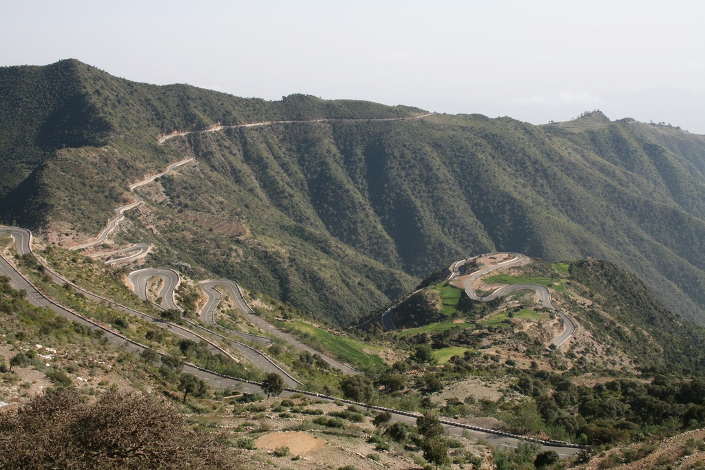
The next higher level road is a secondary road and typically is a single-layered asphalt road that connects district capitals together and those to the regional capitals. Roads that are considered primary roads are those that are fully asphalted (throughout their entire length) and in general they carry traffic between all the major cities and towns in Eritrea. 874km of the 4,010 km of roadways are paved.
As of 1999, there is a total of 317 kilometres of 950 mm (3 ft 1 3⁄8 in) (narrow gauge) rail line in Eritrea. The Eritrean Railway was built between 1887 and 1932. Badly damaged during WWII and in later fighting, it was closed section by section, with the final closure coming in 1978. After independence, a rebuilding effort commenced, and the first rebuilt section was reopened in 2003. As of 2009, the section from Massawa to Asmara was fully rebuilt and available for service.
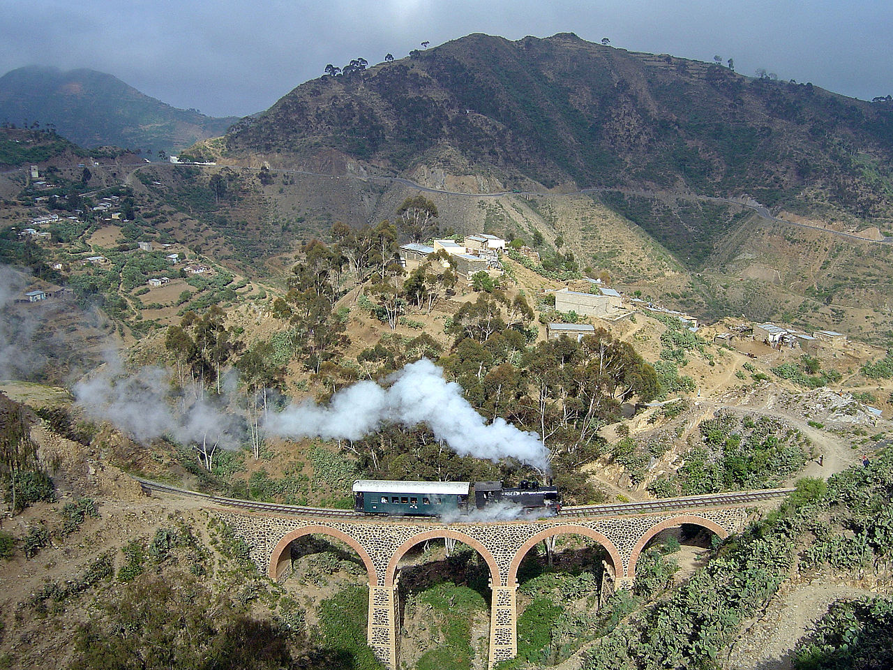
Rehabilitation of the remainder and of the rolling stock has occurred in recent years. Current service is very limited due to the extreme age of most of the railway equipment and its limited availability. Further rebuilding is planned. The railway linking Agordat and Asmara with the port of Massawa; had been inoperative since 1978 except for about a 5 kilometre stretch that was reopened in Massawa in 1994. A railway formerly ran from Massawa to Bishia via Asmara, and is under re-construction.
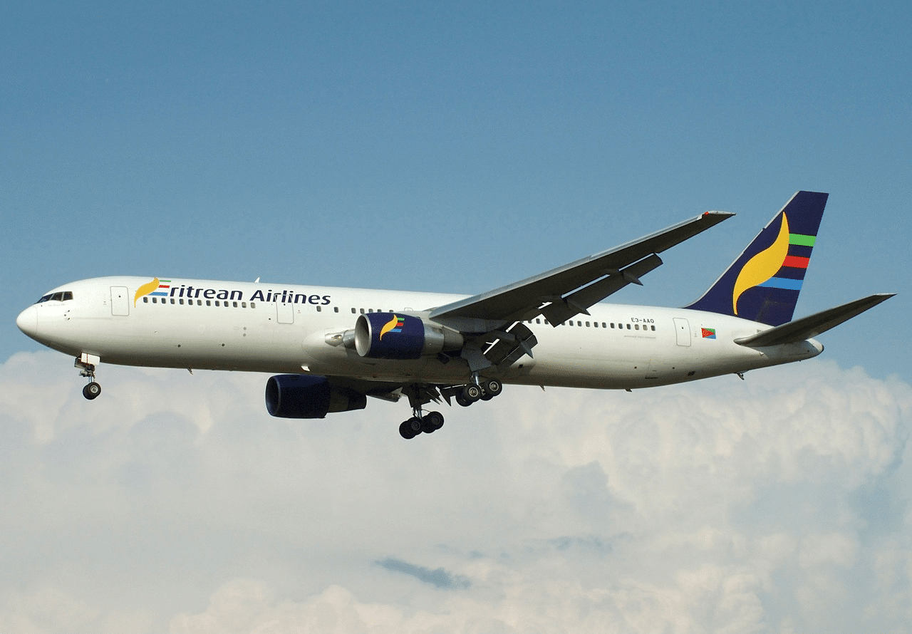
There are three international airports, one in the capital, Asmara International Airport, and the two others in the coastal cities, Massawa (Massawa International Airport) and Assab (Assab International Airport). The airport in Asmara received all international flights into the country as of March 2007, as well as being the main airport for domestic flights. The national carrier, Eritrean, erratically operates a limited network of flights.
Flag of Eritrea:
The national flag of Eritrea, ሃገራዊት ባንዴራ ኤርትራ as adopted on December 5, 1995, bears a resemblance to the official flag of the Eritrean People’s Liberation Front.
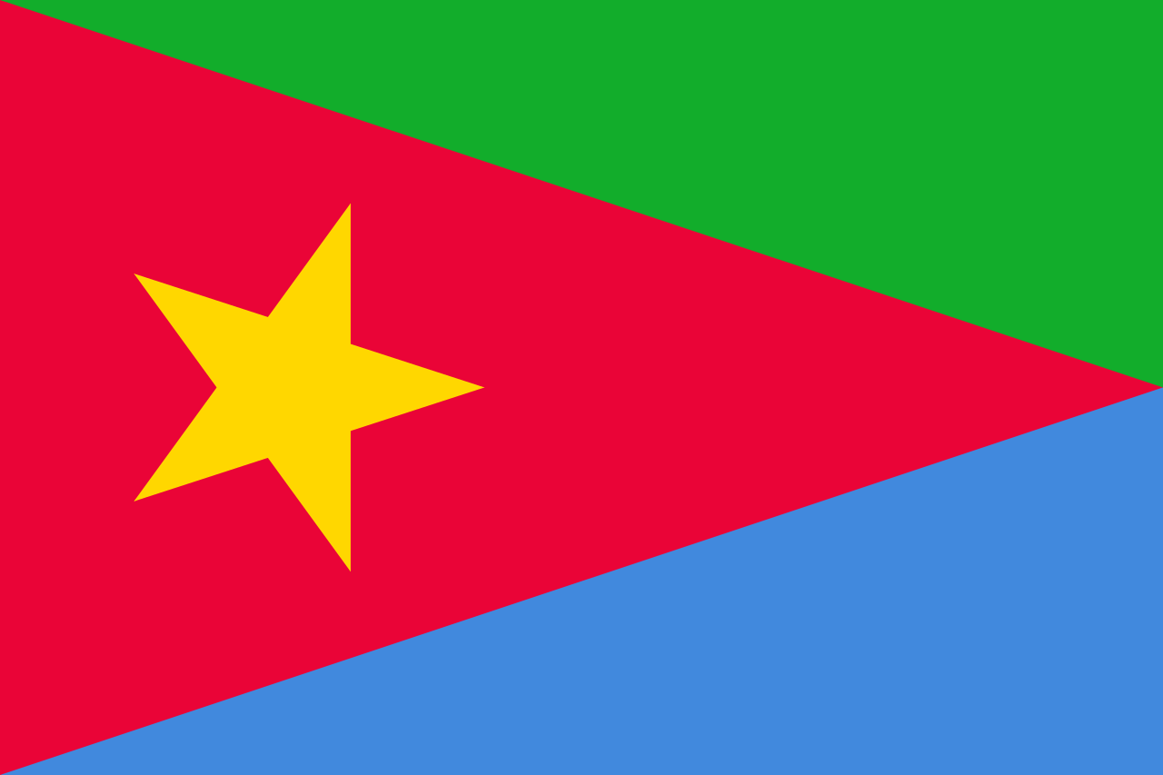
The wreath with the upright olive-branch symbol derived from the 1952 flag, which had a light blue background to honor the United Nations.
The green color in the flag stands for the agriculture and livestock of the country, the blue represents for the sea, and the red for the blood lost in the fight for freedom.
Eritrea and Ethiopia were both occupied by the Italians between 1935-1941. Before the Second World War, Eritrea was more developed and prosperous than Ethiopia. After Italy’s defeat in the war, Ethiopia reverted to its pre-Italian feudal monarchy while Eritrea was given over to modern British rule under a mandate by the United Nations in 1949. The advent of Arab nationalism in the 1940s saw the Muslim part of Eritrea demand independence from British rule. Meanwhile, Ethiopia tried to claim the Eritrean state as its own by calling it a “lost province”. Several officers proposed that Eritrea be separated into two parts: the Christian area to be merged to Ethiopia; the Muslim area to Sudan. After international debate and the intervention of the Allied Powers, the United States passed a resolution with the agreement of Britain formulating the creation of an autonomous Eritrea in federation with Ethiopia in 1950.