In 2013, negotiations for a 21-year extension to the lease broke down, with the tenant offering £440,000 and the owner requesting £6,000,000 plus improvements to infrastructure.
Geography and geology[edit]

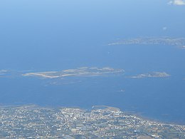
Herm is only 1+1⁄2 miles long (north-south) and less than half a mile wide (east-west). In the northern part of the island are two hills, Le Petit Monceau and Le Grand Monceau. To the north of these is a common, leading to Mouisonniere Beach on the northern coast, with Oyster Point in the northwestern corner and La Pointe du Gentilhomme or Alderney Point at the northeastern corner. To the east of the common is Shell Beach and to the west is The Bear’s Beach, leading down to the harbor. Half of the coastline of the northern part of the island is surrounded by sandy beaches; the southern half is rocky. Much of Herm’s bedrock is granite. In 2008, Adrian Heyworth, who was at the time the island’s tenant, said that two or three meters of sand were being lost annually at Alderney Point.
The isle of Jethou is around three-quarters of a mile to the southwest beyond Point Sauzebourge. It is possible that in AD 709 a storm washed away the strip of land that connected Jethou to Herm. About 215 m (705 ft) off the northern coast of Jethou is the islet of Crevichon, which measures about 212 by 168 m (696 by 551 ft), with an area of less than three hectares. To the west, between Herm and Guernsey, lies the channel Little Roussel (Petit Ruau); between Herm and Sark, to the east, lies the Big Roussel (Grand Ruau). Bréhon Tower, a Victorian-era fortification, is in the Little Roussel between Herm and Saint Peter Port. The tower was created between 1854 and 1856 by Thomas Charles de Putron (1806–1869) using granite from Herm.
Economy:
Tourism is Herm’s main source of income. During a busy summer season, up to 100,000 tourists visit the island, arriving by one of the Travel Trident catamaran ferries operated by the Trident Charter Company.


