
Iceland is closer to continental Europe than to mainland North America, although it is closest to Greenland (290 km, 180 mi), an island of North America. Iceland is generally included in Europe for geographical, historical, political, cultural, linguistic and practical reasons. Geologically, the island includes parts of both continental plates. The closest bodies of land in Europe are the Faroe Islands (420 km, 260 mi); Jan Mayen Island (570 km, 350 mi); Shetland and the Outer Hebrides, both about 740 km (460 mi); and the Scottish mainland and Orkney, both about 750 km (470 mi). The nearest part of Continental Europe is mainland Norway, about 970 km (600 mi) away, while mainland North America is 2,070 km (1,290 mi) away, at the northern tip of Labrador.
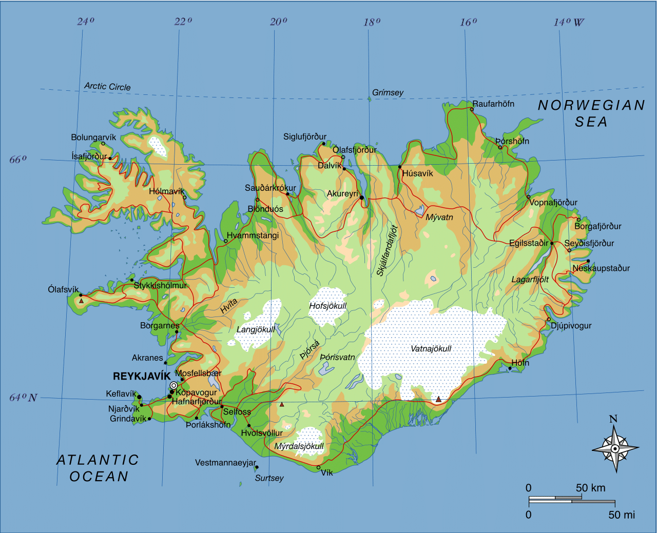
Iceland is the world’s 18th largest island, and Europe’s second-largest island after Great Britain. The main island is 101,826 km2 (39,315 sq mi), but the entire country is 103,000 km2 (40,000 sq mi) in size, of which 62.7% is tundra. About 30 minor islands are in Iceland, including the lightly populated Grímsey and the Vestmannaeyjar archipelago. Lakes and glaciers cover 14.3% of its surface; only 23% is vegetated. The largest lakes are Þórisvatn reservoir: 83–88 km2 (32–34 sq mi) and Þingvallavatn: 82 km2 (32 sq mi); other important lakes include Lagarfljót and Mývatn. Jökulsárlón is the deepest lake, at 248 m (814 ft).
Geologically, Iceland is part of the Mid-Atlantic Ridge, a ridge along which the oceanic crust spreads and forms new oceanic crust. This part of the mid-ocean ridge is located above a mantle plume, causing Iceland to be subaerial (above the surface of the sea). The ridge marks the boundary between the Eurasian and North American Plates, and Iceland was created by rifting and accretion through volcanism along the ridge.
Many fjords punctuate Iceland’s 4,970-km-long (3,088-mi) coastline, which is also where most settlements are situated. The island’s interior, the Highlands of Iceland, is a cold and uninhabitable combination of sand, mountains, and lava fields. The major towns are the capital city of Reykjavík, along with its outlying towns of Kópavogur, Hafnarfjörður, and Garðabær, nearby Reykjanesbær where the international airport is located, and the town of Akureyri in northern Iceland. The island of Grímsey on the Arctic Circle contains the northernmost habitation of Iceland, whereas Kolbeinsey contains the northernmost point of Iceland. Iceland has three national parks: Vatnajökull National Park, Snæfellsjökull National Park, and Þingvellir National Park. The country is considered a “strong performer” in environmental protection, having been ranked 13th in Yale University’s Environmental Performance Index of 2012.
Economy:
In 2007, Iceland was the seventh most productive country in the world per capita (US$54,858), and the fifth most productive by GDP at purchasing power parity ($40,112). About 85 percent of total primary energy supply in Iceland is derived from domestically produced renewable energy sources. Use of abundant hydroelectric and geothermal power has made Iceland the world’s largest electricity producer per capita. As a result of its commitment to renewable energy, the 2016 Global Green Economy Index ranked Iceland among the top 10 greenest economies in the world. Historically, Iceland’s economy depended heavily on fishing, which still provides 40% of export earnings and employs 7% of the work force. The economy is vulnerable to declining fish stocks and drops in world prices for its main material exports: fish and fish products, aluminium, and ferrosilicon. Whaling in Iceland has been historically significant. Iceland still relies heavily on fishing, but its importance is diminishing from an export share of 90% in the 1960s to 40% in 2006.