
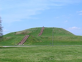
They built an urban complex of more than 100 platform and burial mounds, a 50-acre (20 ha) plaza larger than 35 football fields, and a woodhenge of sacred cedar, all in a planned design expressing the culture’s cosmology. Monks Mound, the center of the site, is the largest Pre-Columbian structure north of the Valley of Mexico.

The civilization vanished in the 15th century for unknown reasons, but historians and archeologists have speculated that the people depleted the area of resources. The next major power in the region was the Illinois Confederation or Illini, a political alliance. As the Illini declined during the Beaver Wars era, members of the Algonquian-speaking Potawatomi, Miami, Sauk, and other tribes including the Fox (Mesquakie), Ioway, Kickapoo, Mascouten, Piankashaw, Shawnee, Wea, and Winnebago (Ho-Chunk) came into the area from the east and north around the Great Lakes.
European Exploration and Settlement:
French explorers Jacques Marquette and Louis Jolliet explored the Illinois River in 1673. Marquette soon after founded a mission at the Grand Village of the Illinois in Illinois Country. In 1680, French explorers under René-Robert Cavelier, Sieur de La Salle and Henri de Tonti constructed a fort at the site of present-day Peoria, and in 1682, a fort atop Starved Rock in today’s Starved Rock State Park.

French Empire Canadiens came south to settle particularly along the Mississippi River, and Illinois was part of first New France, and then of La Louisiane until 1763, when it passed to the British with their defeat of France in the Seven Years’ War. The small French settlements continued, although many French migrated west to Ste. Genevieve and St. Louis, Missouri, to evade British rule.
A few British soldiers were posted in Illinois, but few British or American settlers moved there, as the Crown made it part of the territory reserved for Indians west of the Appalachians, and then part of the British Province of Quebec. In 1778, George Rogers Clark claimed Illinois County for Virginia. In a compromise, Virginia ceded the area to the new United States in 1783 and it became part of the Northwest Territory, to be administered by the federal government and later organized as states. Connecticut ceded northern Illinois in 1786 which was formerly claimed as the Connecticut Western Reserve.

19th Century:
The Illinois-Wabash Company was an early claimant to much of Illinois. The Illinois Territory was created on February 3, 1809, with its capital at Kaskaskia, an early French settlement.

During the discussions leading up to Illinois’s admission to the Union, the proposed northern boundary of the state was moved twice. The original provisions of the Northwest Ordinance had specified a boundary that would have been tangent to the southern tip of Lake Michigan. Such a boundary would have left Illinois with no shoreline on Lake Michigan at all. The original bill for Illinois statehood, submitted to Congress on January 23, 1818, stipulated a northern border at the same latitude as Indiana’s, which is defined as 10 miles north of the southernmost extremity of Lake Michigan. But the Illinois delegate, Nathaniel Pope, wanted more. Pope lobbied to have the boundary moved further north, and the final bill passed by Congress did just that; it included an amendment to shift the border to 42° 30′ north, which is approximately 51 miles north of the Indiana northern border. This shift added 8,500 square miles to the state, including the lead mining region near Galena.