
In 1782, during the American Revolutionary War, as America’s first ally, France captured Montserrat in their war of support of the Americans. The French, not intent on truly colonizing the island, then agreed to return the island to Great Britain under the 1783 Treaty of Paris.
New crops and politics:
During the nineteenth century, falling sugar prices had an adverse effect on the island’s economy, as Brazil and other nations competed in the trade.
In 1857, the British philanthropist Joseph Sturge bought a sugar estate to prove it was economically viable to employ paid labor rather than slaves. Numerous members of the Sturge family bought additional land. In 1869, the family established the Montserrat Company Limited and planted Key lime trees, started the commercial production of lime juice, set up a school, and sold parcels of land to the inhabitants of the island. Much of Montserrat came to be owned by smallholders.
From 1871 to 1958, Montserrat was administered as part of the federal crown colony of the British Leeward Islands, becoming a province of the short-lived West Indies Federation from 1958 to 1962. The first Chief Minister of Montserrat was William Henry Bramble of the Montserrat Labour Party from 1960 to 1970; he worked to promote labor rights and boost tourism to the island, and Montserrat’s original airport was named in his honour. However, Bramble’s son Percival Austin Bramble was critical of the way tourist facilities were being constructed, and he subsequently set up his own party (the Progressive Democratic Party) which went on to win the 1970 Montserratian general election, with Percival Bramble serving as Chief Minister from 1970 to 1978. The period 1978 to 1991 was dominated politically by Chief Minister John Osborne and his People’s Liberation Movement; his brief flirtation with possibly declaring independence never materialized.
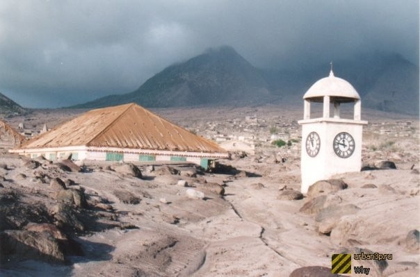
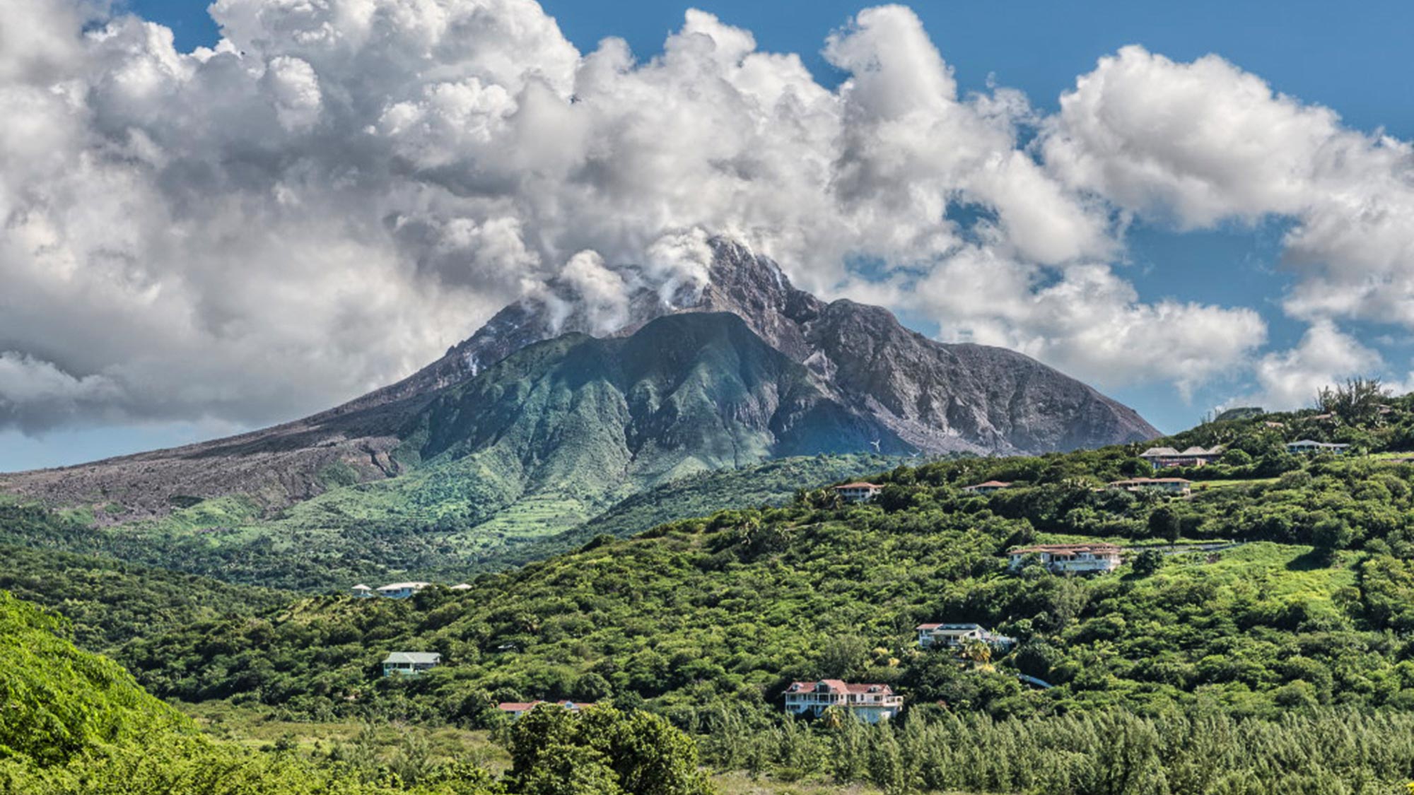
In 1995, Montserrat was devastated by the catastrophic volcanic eruptions of the Soufrière Hills, which destroyed the capital city of Plymouth, and necessitated the evacuation of a large part of the island. Many Montserratians emigrated abroad, mainly to the United Kingdom, though in recent years some have started returning. The eruptions rendered the entire southern half of the island uninhabitable, and it is currently designated an Exclusion Zone with restricted access.
Criticism of the Montserratian government’s response to the disaster led to the resignation of Chief Minister Bertrand Osborne in 1997, after only a year in office, and being replaced by David Brandt who remained in office until 2001. Since leaving office, Brandt has been the subject of criminal investigation into alleged sex offences with minors.
John Osborne returned as Chief Minister following victory in the 2001 election, being ousted by Lowell Lewis of the Montserrat Democratic Party in 2006. Reuben Meade returned to office in 2009 to 2014;[43] during his term the post of Chief Minister was replaced with that of Premier.
In the fall of 2017, Montserrat was not hit by Hurricane Irma and sustained only minor damage from Hurricane Maria.
Since November 2019, Easton Taylor-Farrell of the Movement for Change and Prosperity party has been the island’s Premier.
Geography:

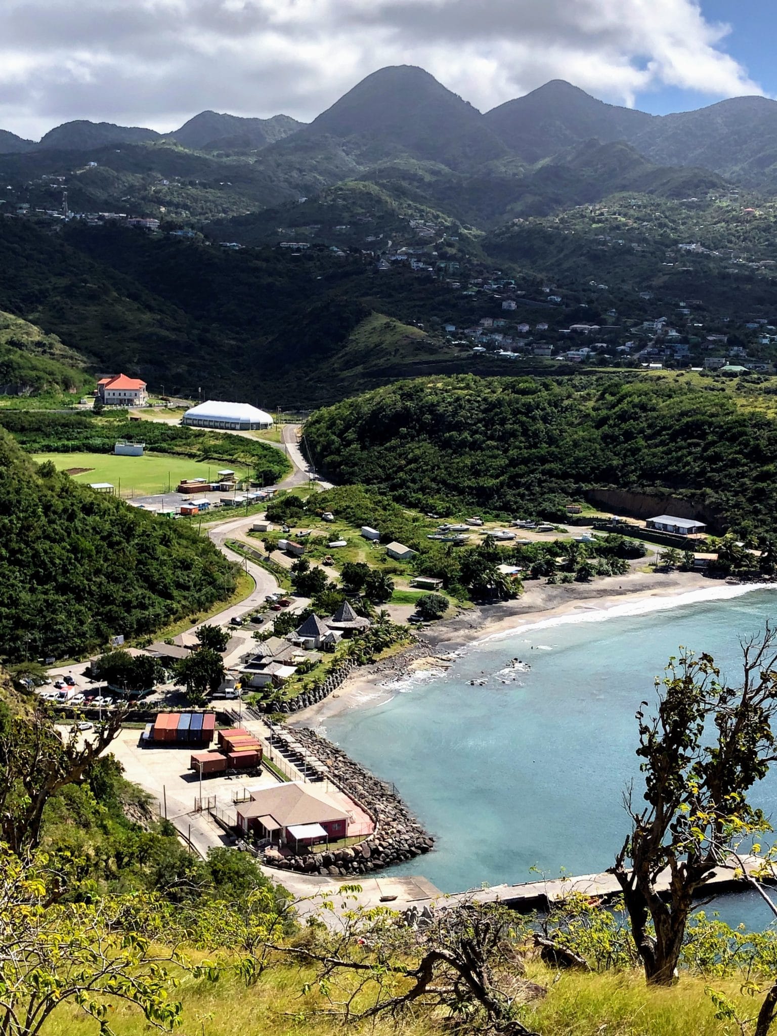
The island of Montserrat is located approximately 25 miles (40 km) south-west of Antigua, 13 miles (21 km) south-east of Redonda (a small island owned by Antigua and Barbuda), and 35 miles (56 km) north-west of the French overseas region of Guadeloupe. Beyond Redonda lies Nevis (part of St Kitts and Nevis), about 30 miles (48 km) to the north-west. It comprises 104 km2 (40 sq mi) and is gradually increasing owing to the buildup of volcanic deposits on the south-east coast. The island is 16 km (9.9 mi) long and 11 km (6.8 mi) wide and consists of a mountainous interior surrounded by a flatter littoral region, with rock cliffs rising 15 to 30 m (49 to 98 ft) above the sea and a number of smooth bottomed sandy beaches scattered among coves on the western (Caribbean Sea) side of the island. The major mountains are (from north to south) Silver Hill, Katy Hill in the Centre Hills range, the Soufrière Hills and the South Soufrière Hills. The Soufrière Hills volcano is the island’s highest point; its pre-1995 height was 915 metres (3,002 ft), however it has now grown due post-eruption due to the creation of a lava dome, with its current height being estimated at 1,050 metres (3,440 ft).