
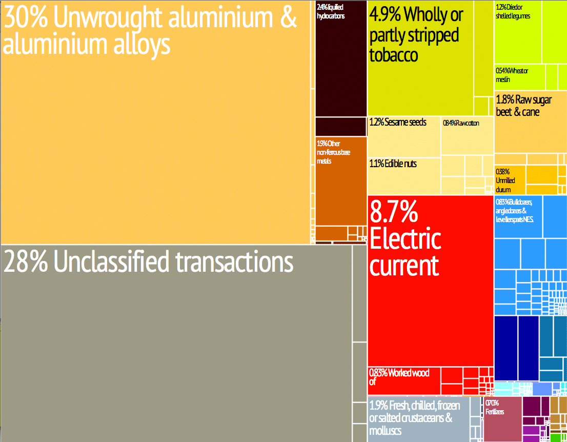
Rapid expansion in the future hinged on several major foreign investment projects, continued economic reform, and the revival of the agriculture, transportation, and tourism sectors. In 2013 about 80% of the population was employed in agriculture, the majority of whom were engaged in small-scale subsistence farming which still suffered from inadequate infrastructure, commercial networks, and investment. However, in 2012, more than 90% of Mozambique’s arable land was still uncultivated.
In 2013, a BBC article reported that, starting in 2009, Portuguese had been returning to Mozambique because of the growing economy in Mozambique and the poor economic situation in Portugal.
Transportation:
There are over 30,000 km (19,000 mi) of roads, but much of the network is unpaved. Like its Commonwealth neighbors, traffic circulates on the left.
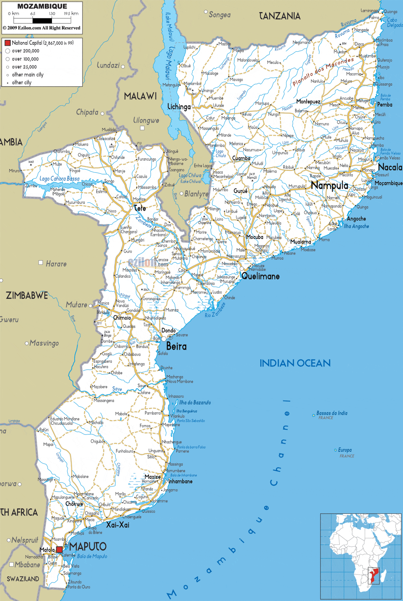
There is an international airport at Maputo, 21 other paved airports, and over 100 airstrips with unpaved runways.
On the Indian Ocean coast are several large seaports, including Nacala, Beira and Maputo, with further ports being developed. There are 3,750 km of navigable inland waterways. There are rail links serving principal cities and connecting the country with Malawi, Zimbabwe and South Africa. The Mozambican railway system developed over more than a century from three different ports on the Indian Ocean that served as terminals for separate lines to the hinterland. The railroads were major targets during the Mozambican Civil War, were sabotaged by RENAMO, and are being rehabilitated. A parastatal authority, Portos e Caminhos de Ferro de Moçambique (abbreviated CFM; in English- Mozambique Ports and Railways), oversees the railway system of Mozambique and its connected ports, but management has been largely outsourced. Each line has its own development corridor.
As of 2005 there were 3,123 km of railway track, consisting of 2,983 km of 1,067 mm (3 ft 6 in) gauge, compatible with neighbouring rail systems, and a 140 km line of 762 mm (2 ft 6 in) gauge, the Gaza Railway. The central Beira Railroad Corporation route links the port of Beira to the landlocked countries of Malawi, Zambia and Zimbabwe. To the north of this the port of Nacala is also linked by rail to Malawi, and to the south Maputo is linked to Zimbabwe and South Africa. These networks interconnect only via neighbouring countries. A new route for coal haulage between Tete and Beira was planned to come into service by 2010, and in August 2010, Mozambique and Botswana signed a memorandum of understanding to develop a 1,100 km railway through Zimbabwe, to carry coal from Serule in Botswana to a deepwater port at Techobanine Point in Mozambique.
Flag of Mozambique:
The flag of Mozambique was adopted on 1 May 1983. It includes the image of an AK-47 with a bayonet attached to the barrel crossed by a hoe, superimposed on an open book. It is one of four national flags among UN member states that feature a firearm, along with those of Guatemala, Haiti and Bolivia, but is the only one of the four to feature a modern firearm instead of cannons or muskets.