Introduction:
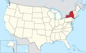
New York is a state in the northeastern United States. New York was one of the original Thirteen Colonies that formed the United States being the 11th state to ratify the Constitution, doing so on July 26, 1788.
With an estimated 19.85 million residents in 2017, it is the fourth most populous state. To differentiate from its city with the same name, it is sometimes called New York State. The state’s most populous city, New York City, makes up over 40% of the state’s population. Two-thirds of the state’s population lives in the New York metropolitan area, and nearly 40% lives on Long Island.

The state and city were both named for the 17th century Duke of York, the future King James II of England. With an estimated population of 8.55 million in 2015, New York City is the most populous city in the United States. The next four most populous cities in the state are Buffalo, Rochester, Yonkers, and Syracuse, while the state capital is Albany.
Geography:
New York has a diverse geography. The state is bordered by New Jersey and Pennsylvania to the south and Connecticut, Massachusetts, and Vermont to the east. The state has a maritime border with Rhode Island, east of Long Island, as well as an international border with the Canadian provinces of Quebec to the north and Ontario to the northwest.

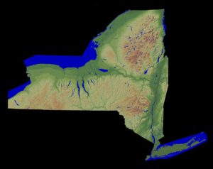
The southern part of the state is in the Atlantic Coastal Plain and includes Long Island and several smaller associated islands, as well as New York City and the lower Hudson River Valley. The large Upstate New York region comprises several ranges of the wider Appalachian Mountains, and the Adirondack Mountains in the Northeastern lobe of the state.

Two major river valleys – the north-south Hudson River Valley and the east-west Mohawk River Valley – bisect these more mountainous regions. Western New York is considered part of the Great Lakes Region and borders Lake Ontario, Lake Erie, and Niagara Falls. The central part of the state is dominated by the Finger Lakes, a popular vacation and tourist destination.

New York covers 54,555 square miles and ranks as the 27th largest state by size.
History:
The tribes in what is now New York were predominantly Iroquois and Algonquin. Long Island was divided roughly in half between the Wampanoag and Lenape. The Lenape also controlled most of the region surrounding New York Harbor. North of the Lenape was a third Algonquin nation, the Mohicans. Starting north of them, from east to west, were three Iroquoian nations: the Mohawk, the original Iroquois and the Petun. South of them, divided roughly along Appalachia, were the Susquehannock and the Erie.
In 1524, Giovanni da Verrazzano, an Italian explorer in the service of the French crown, explored the Atlantic coast of North America between the Carolinas and Newfoundland, including New York Harbor and Narragansett Bay. On April 17, 1524, Verrazzano entered New York Bay, by way of the strait now called the Narrows into the northern bay which he named Santa Margherita, in honor of the King of France’s sister. Verrazzano described it as “a vast coastline with a deep delta in which every kind of ship could pass” and he adds: “that it extends inland for a league and opens up to form a beautiful lake. This vast sheet of water swarmed with native boats”. He landed on the tip of Manhattan and possibly on the furthest point of Long Island.
