
Introduction:
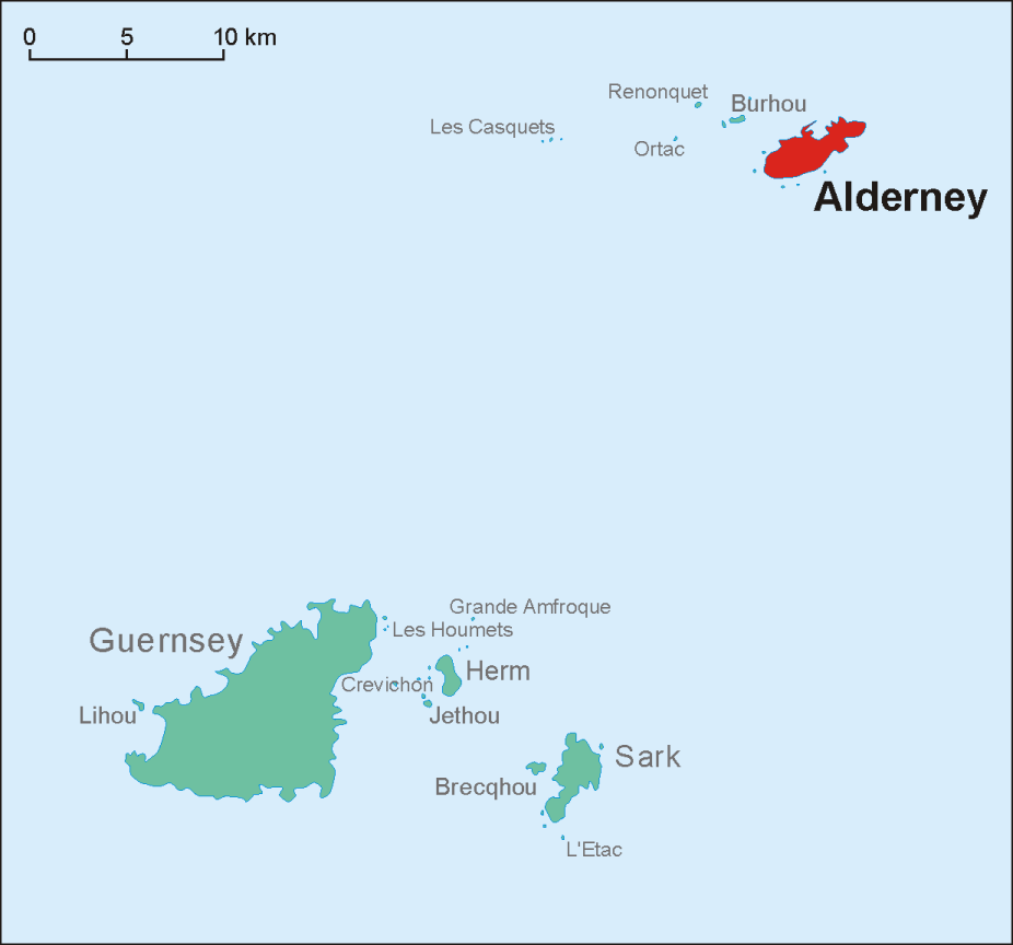
Alderney is the northernmost of the inhabited Channel Islands. It is part of the Bailiwick of Guernsey, a British Crown dependency. It is 3 miles (5 km) long and 1+1⁄2 miles (2.4 km) wide.
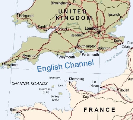
The island’s area is 3 square miles (8 km2), making it the third-largest island of the Channel Islands, and the second largest in the Bailiwick. It is around 10 miles (15 km) to the west of the La Hague on the Cotentin Peninsula, Normandy, in France, 20 miles (30 km) to the northeast of Guernsey and 60 miles (100 km) from the south coast of Great Britain. It is the closest of the Channel Islands to France and to the United Kingdom. It is separated from Cap de la Hague by the dangerous Alderney Race.
As of March 2018, the island had a population of 2,019; natives are traditionally nicknamed vaques after the cows, or else lapins after the many rabbits seen in the island. Formally, they are known as Ridunians, from the Latin Riduna.
The only parish of Alderney is the parish of St Anne, which covers the whole island.
The main town, St Anne, historically known as La Ville (“The Town”), is often referred to as “St Anne’s” by visitors and incomers, but rarely by locals (who, in normal conversation, still most frequently refer to the area centred on Victoria Street simply as “Town”). The town’s “High Street”, which formerly had a small handful of shops, is now almost entirely residential, forming a T-junction with Victoria Street at its highest point.
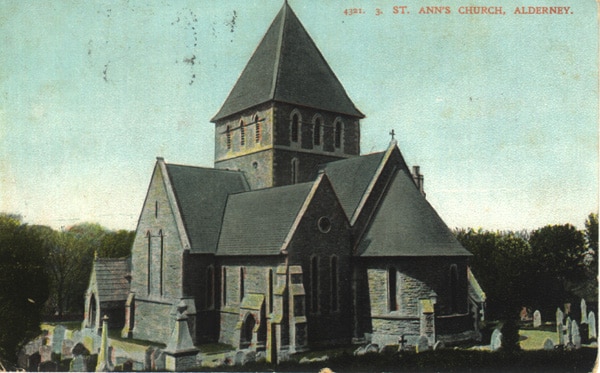
The town area features an imposing church and an unevenly cobbled main street: Victoria Street (Rue Grosnez – the English name being adopted on the visit of Queen Victoria in 1854). There is one school (providing both primary and secondary education), a post office, and hotels, as well as restaurants, banks and shops. Other settlements include Braye, Crabby, Longis, Mannez, La Banque, and Newtown.
History:
Pre-Victorian:
Alderney shares its prehistory with the other islands in the Bailiwick of Guernsey, becoming an island in the Neolithic period as the waters of the Channel rose. Formerly rich in dolmens, like the other Channel Islands, Alderney with its heritage of megaliths has suffered through the large-scale military constructions of the 19th century and also by the Germans during the World War II occupation, who left the remains at Les Pourciaux unrecognizable as dolmens. A cist survives near Fort Tourgis, and Longis Common has remains of an Iron Age site. There are traces of Roman occupation including a fort, built in the late 300s above the island’s only natural harbor.
Along with the other Channel Islands, Alderney was annexed by the Duchy of Normandy in 933. In 1042 William the Bastard, Duke of Normandy (later William the Conqueror, King of the English) granted Alderney to the Abbey of Mont Saint-Michel. In 1057 the bishop of Coutances took back control of the island.
After 1204, when mainland Normandy was incorporated into the kingdom of France, Alderney remained loyal to the English monarch in his dignity of Duke of Normandy.
Henry VIII of England undertook fortification works, but these ceased in 1554. Essex Castle perpetuates the name of the Earl of Essex, who purchased the governorship of Alderney in 1591. Prior to the Earl’s execution for treason in 1601, he leased the island to William Chamberlain, and Alderney remained in the hands of the Chamberlain family until 1643. From 1612, a Judge was appointed to assist the Governor’s administration of Alderney, along with the Jurats. The function of the Judge was similar to that of the Bailiffs of Guernsey and Jersey, and continued until 1949.