
Benin possesses a total of 6,787 km of highway, of which 1,357 km are paved. Of the paved highways in the country, there are 10 expressways. This leaves 5,430 km of unpaved road. The Trans-West African Coastal Highway crosses Benin, connecting it to Nigeria to the east, and Togo, Ghana and Ivory Coast to the west. When construction in Liberia and Sierra Leone is finished, the highway will continue west to seven other Economic Community of West African States (ECOWAS) nations. A paved highway also connects Benin northwards to Niger, and through that country to Burkina Faso and Mali to the north-west.
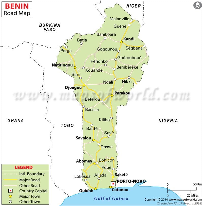
Rail transport in Benin consists of 359 miles of single track. Benin does not, at this time, share railway links with adjacent countries, but construction work has commenced on international lines connecting Benin with Niger and Nigeria, with outline plans announced for further connections to Togo and Burkina Faso. Benin will be a participant in the AfricaRail project.
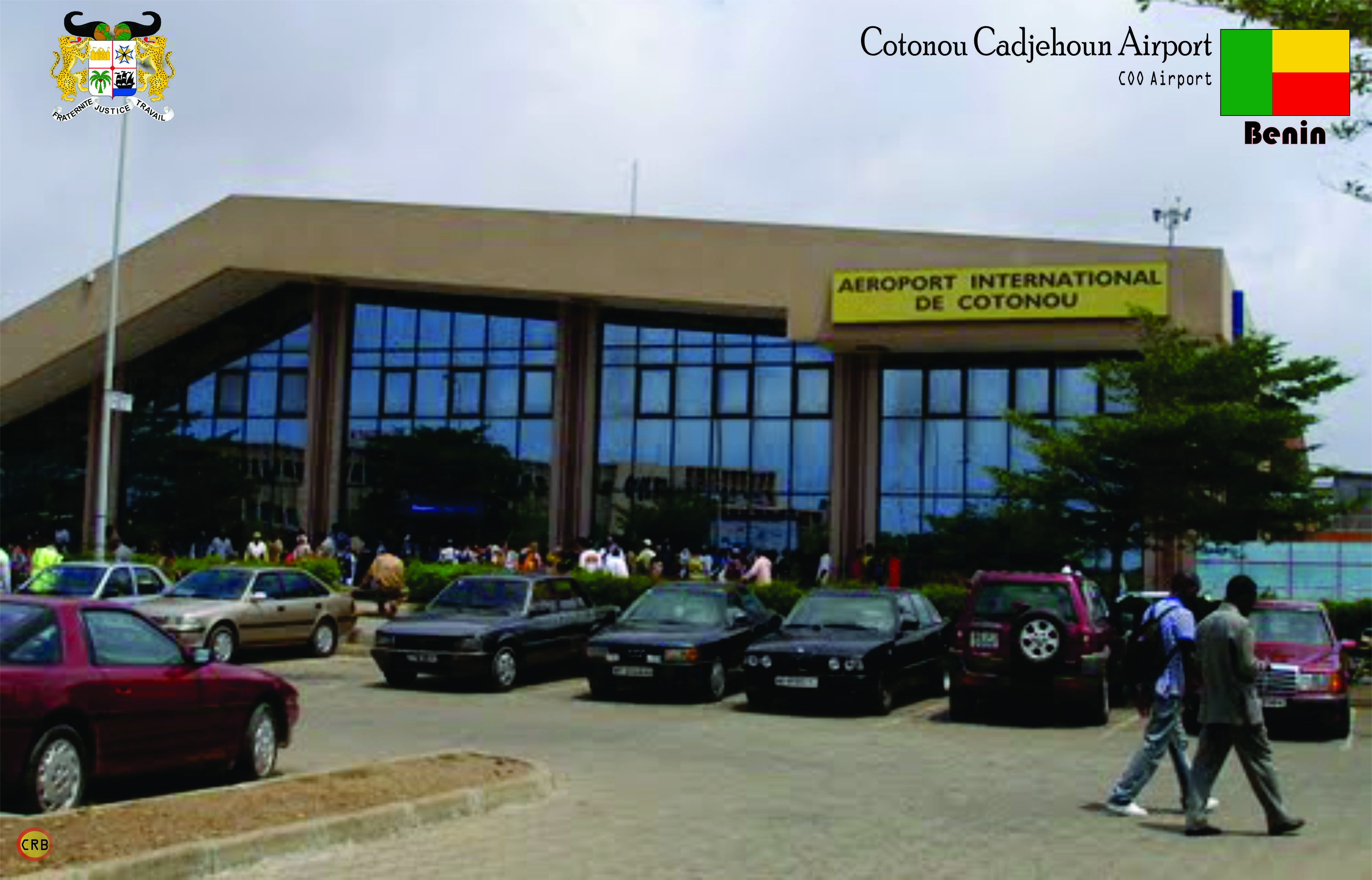
Cadjehoun Airport, located at Cotonou, has direct international jet service to Accra, Niamey, Monrovia, Lagos, Ouagadougou, Lomé, and Douala, as well as other cities in Africa. Direct services also link Cotonou to Paris, Brussels, and Istanbul.
Cotonou has the country’s only seaport and international airport. A new port is currently under construction between Cotonou and Porto Novo.
Flag of Benin:
The national flag of Benin is a flag consisting of two horizontal yellow and red bands on the fly side and a green vertical band at the hoist. Adopted in 1959 to replace the French Tricolour, it was the flag of the Republic of Dahomey until 1975, when the People’s Republic of Benin was established. The new regime renamed the country and changed the flag to a green field with a red star in the canton. This version was utilized until the regime collapsed in 1990, coinciding with the Revolutions of 1989. The new government promptly restored the original pre-1975 flag.
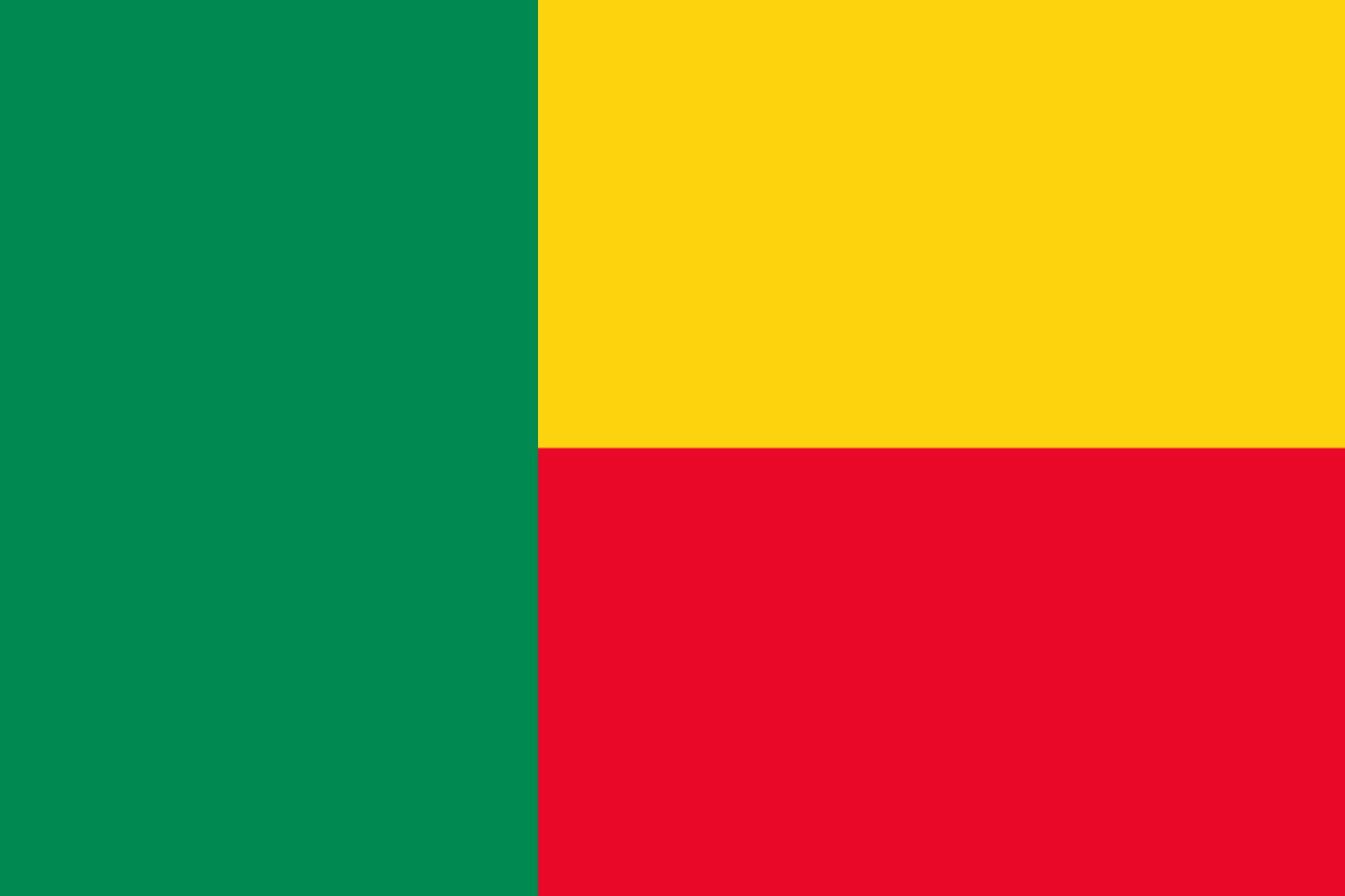
Under French colonial rule over Dahomey, French authorities forbade the colony from having its own regional flag. This was because they were worried that this could increase nationalistic sentiment and lead to calls for independence. However, with the rise of the decolonization movement in Africa, the French were obliged to grant limited autonomy to Dahomey as a self-governing republic within the French Community. This was granted on December 4, 1958, and a search for a national flag began soon after.
The new flag was chosen on November 16, 1959, and remained unchanged when Dahomey became independent less than a year later on August 1, 1960. In 1972, a coup d’état took place in the country, with the new government aligning itself with Marxist–Leninist ideals. In order to symbolize the revolutionary change, the regime renamed the country to Benin and instituted a new flag three years later. This featured a green field charged with a five-pointed red star in the top-left canton. However, the regime’s flag was never adopted by law, making it only the de facto flag of Benin.