
Protests in 2014:
On 4 February 2014, the protests against the government of the Federation of Bosnia and Herzegovina, one of the country’s two entities, dubbed the Bosnian Spring, the name being taken from the Arab Spring, began in the northern town of Tuzla. Workers from several factories that had been privatised and had gone bankrupt united to demand action over jobs, and unpaid salaries and pensions. Soon protests spread to the rest of the Federation, with violent clashes reported in close to 20 towns, the biggest of which were Sarajevo, Zenica, Mostar, Bihać, Brčko and Tuzla. The Bosnian news media reported hundreds of people had been injured during the protests, including dozens of police officers, with bursts of violence in Sarajevo, in the northern city of Tuzla, in Mostar in the south, and in Zenica in central Bosnia. The same level of unrest or activism did not occur in the Republika Srpska, but hundreds of people also gathered in support of protests in the town of Banja Luka against its separate government.
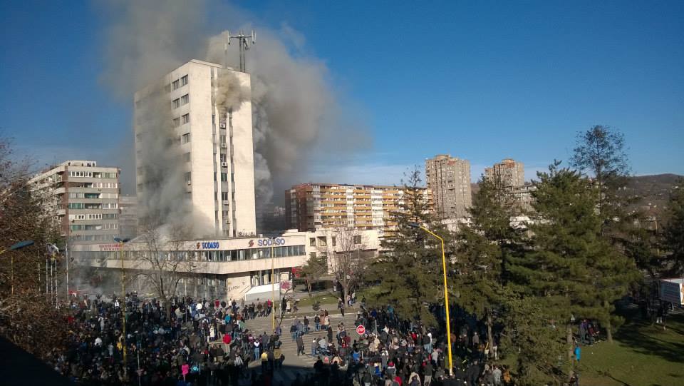
The protests marked the largest outbreak of public anger over high unemployment and two decades of political inertia in the country since the end of the Bosnian War in 1995.
Geography:
Bosnia is in the western Balkans, bordering Croatia to the north and west, Serbia to the east, and Montenegro to the southeast. It has a coastline about 12 miles long surrounding the city of Neum.
The country is mostly mountainous, encompassing the central Dinaric Alps. The northeastern parts reach into the Pannonian Plain, while in the south it borders the Adriatic. The Dinaric Alps generally run in a southeast-northwest direction, and get higher towards the south. The highest point of the country is the peak of Maglić at 7,828 feet, on the Montenegrin border. Major mountains include Kozara, Grmeč, Vlašić, Čvrsnica, Prenj, Romanija, Jahorina, Bjelašnica and Treskavica. The geological composition of the Dinaric chain of mountains in Bosnia consists primarily of limestone (including Mesozoic limestone), with deposits of iron, coal, zinc, manganese, bauxite, lead, and salt present in some areas, especially in central and northern Bosnia.
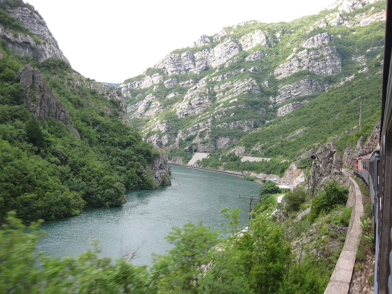
Overall, nearly 50% of Bosnia and Herzegovina is forested. Most forest areas are in the center, east and west parts of Bosnia. Herzegovina has drier Mediterranean climate, with dominant karst topography. Northern Bosnia (Posavina) contains very fertile agricultural land along the River Sava and the corresponding area is heavily farmed. This farmland is a part of the Pannonian Plain stretching into neighboring Croatia and Serbia. The country has only 12 miles of coastline, around the town of Neum in the Herzegovina-Neretva Canton. Although the city is surrounded by Croatian peninsulas, by international law, Bosnia and Herzegovina has a right of passage to the outer sea.
Sarajevo is the capital and largest city. Other major cities are Banja Luka and Bihać in the northwest region known as Bosanska Krajina, Bijeljina and Tuzla in the northeast, Zenica in the central part of Bosnia and Mostar, the largest city in Herzegovina.