
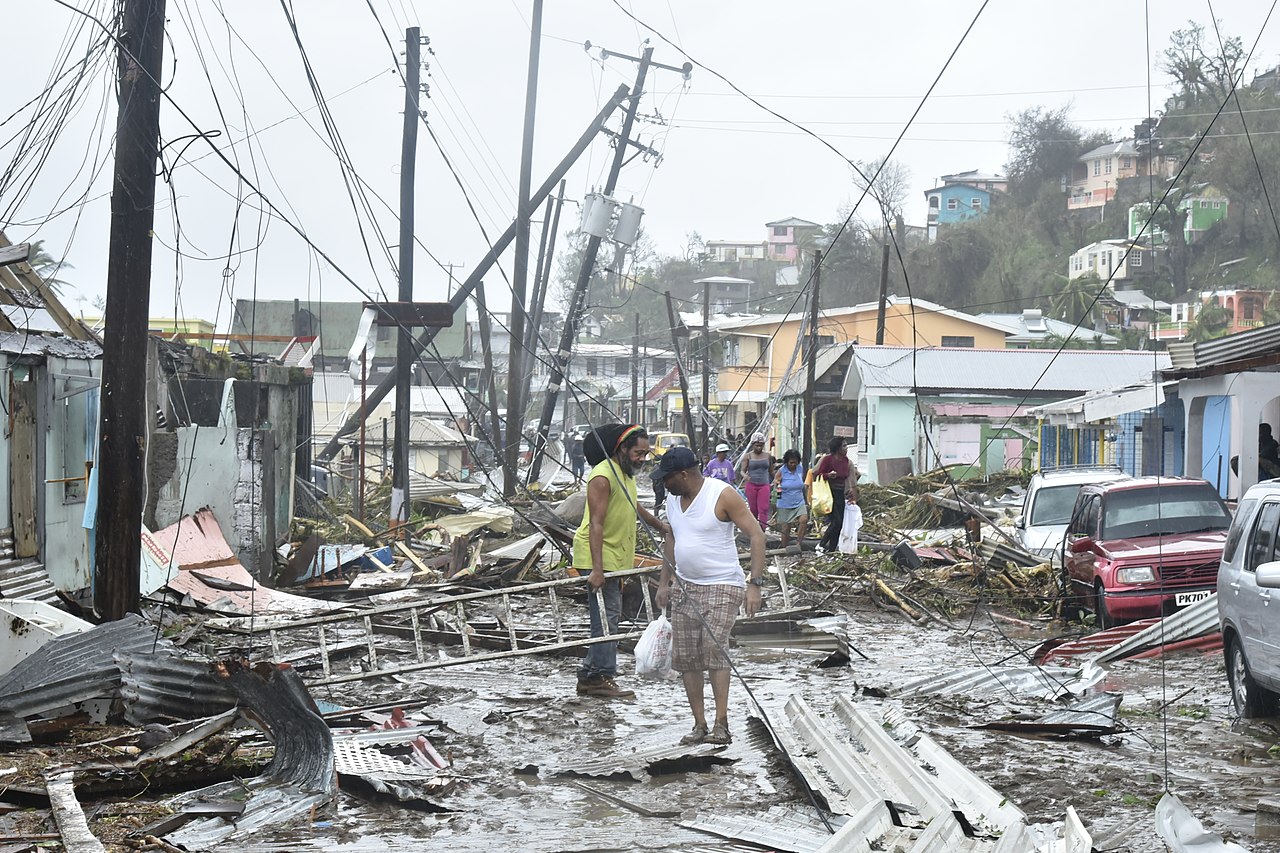
Tropical Storm Erika devastated the island in August 2015, killing 30 and causing severe environmental and economic damage. Dominica was again struck on 18 September 2017, suffering a direct landfall from Category 5 Hurricane Maria. Early estimates of damage suggested 90% of the buildings on the island had been destroyed, with infrastructure left in ruins. The UK, France and the Netherlands set up shipping and air lifts to take aid to the island; the scale of destruction having left most people homeless and desperate.
Geography:
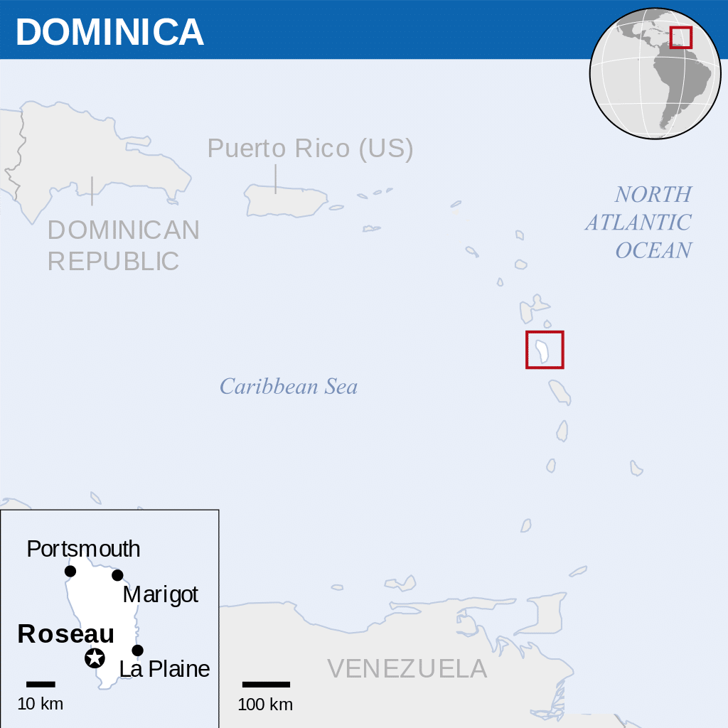
Dominica is an island in the Eastern Caribbean Sea, located about halfway between the French islands of Guadeloupe (to the north) and Martinique (to the south)
Dominica is an island nation in the Caribbean Sea, the northernmost of the Windward Islands (though it is sometimes considered the southernmost of the Leeward Islands). The size of the country is about 289.5 square miles (750 km2) and it is about 29 miles (47 km) long and 16 miles (26 km) wide.
Known as “The Nature Island of the Caribbean” due to its lush scenery and varied flora and fauna, Dominica is largely covered by rainforest and is home to the world’s second-largest hot spring, Boiling Lake. The most mountainous of the Lesser Antilles, its volcanic peaks are cones of lava craters, the largest of these being (north-to-south) Morne aux Diables, Morne Diablotins (the highest on the island at 1,447 m), Morne Trois Pitons and Morne Anglais. Morne Trois Pitons National Park is a tropical forest blended with volcanic features; it was recognized as a World Heritage Site on 4 April 1995, a distinction it shares with four other Caribbean islands. The Calibishie area in the country’s northeast has sandy beaches. Some plants and animals thought to be extinct on surrounding islands can still be found in Dominica’s forests. The island has several protected areas, including Cabrits National Park, as well as 365 rivers. For a few years the government sought to encourage the island as an ecotourism destination, although the hurricane of 2017 has since changed these plans.

There are two primary population centers: the capital Roseau (with 14,725 inhabitants in 2011) and Portsmouth (with 4,167 inhabitants in 2011). The main centers tend to be located around the coast, with the mountainous interior sparsely populated.
Dominica is especially vulnerable to hurricanes as the island is located in what is referred to as the hurricane region. In 1979, Hurricane David struck the island as a Category 4 hurricane, causing widespread and extreme damage. On 17 August 2007, Hurricane Dean, a Category 1 hurricane at the time, hit the island. A mother and her seven-year-old son died when a landslide caused by the heavy rains crushed their house. In another incident two people were injured when a tree fell on their house. Prime Minister Roosevelt Skerrit estimated that 100 to 125 homes were damaged, and that the agricultural sector was extensively damaged, in particular the banana crop. In August 2015, Tropical Storm Erika caused extensive flooding and landslides across the island. Multiple communities were evacuated and upwards of 30 people were killed. According to a Rapid Damage and Impact Assessment prepared for Dominica by the World Bank, the total damage and losses from the storm were US$484.82 million or 90% of Dominica’s yearly GDP. Category 5 Hurricane Maria struck the island in 2017 and caused losses of approximately US$930 million or 226% of GDP.