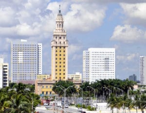
In 1939, Florida was described as “still very largely an empty State.” Subsequently, the growing availability of air conditioning, the climate, and a low cost of living made the state a haven. Migration from the Rust Belt and the Northeast sharply increased Florida’s population after 1945. In the 1960s, many refugees from Cuba fleeing Fidel Castro‘s communist regime arrived in Miami at the Freedom Tower, where the federal government used the facility to process, document and provide medical and dental services for the newcomers. As a result, the Freedom Tower was also called the “Ellis Island of the South.” In recent decades, more migrants have come for the jobs in a developing economy.

With a population of more than 18 million, according to the 2010 census, Florida is the most populous state in the southeastern United States and the third-most populous in the United States.
After Hurricane Maria devastated Puerto Rico in September 2017, a large population of Puerto Ricans began moving to Florida to escape the widespread destruction. Hundreds of thousands of Puerto Ricans arrived in Florida after Maria dissipated, with nearly half of them arriving in Orlando and large populations also moving to Tampa, Fort Lauderdale, and West Palm Beach.
Geography:
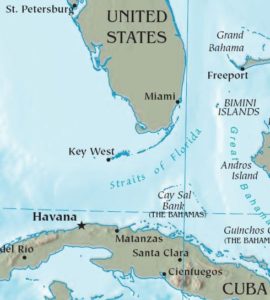
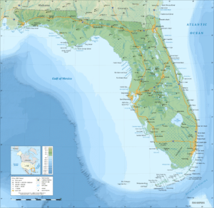
Much of Florida is on a peninsula between the Gulf of Mexico, the Atlantic Ocean and the Straits of Florida. Spanning two time zones, it extends to the northwest into a panhandle, extending along the northern Gulf of Mexico. It is bordered on the north by Georgia and Alabama, and on the west, at the end of the panhandle, by Alabama. It is the only state that borders the Atlantic Ocean and the Gulf of Mexico. Florida is west of The Bahamas and 90 miles north of Cuba. Florida is one of the largest states east of the Mississippi River, and only Alaska and Michigan are larger in water area.

At 345 feet above mean sea level, Britton Hill is the highest point in Florida and the lowest highpoint of any U.S. state. Much of the state south of Orlando lies at a lower elevation than northern Florida, and is fairly level. Much of the state is at or near sea level. However, some places such as Clearwater have promontories that rise 50 to 100 ft above the water. Much of Central and North Florida, typically 25 mi or more away from the coastline, have rolling hills with elevations ranging from 100 to 250 ft. The highest point in peninsular Florida (east and south of the Suwannee River), Sugarloaf Mountain, is a 312-foot peak in Lake County. On average, Florida is the flattest state in the United States.

Economy:
In the twentieth century, tourism, industry, construction, international banking, biomedical and life sciences, healthcare research, simulation training, aerospace and defense, and commercial space travel have contributed to the state’s economic development.
The economy is driven almost entirely by its nineteen metropolitan areas. In 2004, they had a combined total of 95.7% of the state’s domestic product.
Tourism:
Tourism makes up one of the largest sectors of the state economy, with nearly 1.4 million people employed in the tourism industry in 2016. In 2015, Florida broke the 100-million visitor mark for the first time in state history by hosting a record 105 million visitors and broke that record in 2016 with 112.8 million tourists. Florida has set tourism records for six consecutive years.
