The Japanese occupation of Guam lasted for approximately thirty-one months. During this period, the indigenous people of Guam were subjected to forced labor, family separation, incarceration, execution, concentration camps and forced prostitution. Approximately one thousand people died during the occupation. Some historians estimate that war violence killed 10% of Guam’s then 20,000 population.

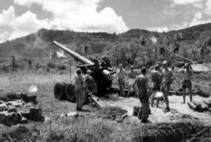
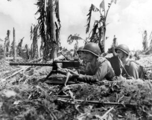
The United States returned and fought the Battle of Guam from July 21 to August 10, 1944, to recapture the island from Japanese military occupation. More than 18,000 Japanese were killed as only 485 surrendered. Sergeant Shoichi Yokoi, who surrendered in January 1972, appears to have been the last confirmed Japanese holdout for 28 years in the forested back country on Guam. The United States also captured and occupied the nearby Northern Marianas Islands.
Post-War:
After World War II, the Guam Organic Act of 1950 established Guam as an unincorporated organized territory of the United States, provided for the structure of the island’s civilian government, and granted the people U.S. citizenship. The Governor of Guam was federally appointed until 1968, when the Guam Elective Governor Act provided for the office’s popular election. Since Guam is not a U.S. state, U.S. citizens residing on Guam are not allowed to vote for president and their congressional representative is a non-voting member. They do, however, get to vote for party delegates in presidential primaries.
Vietnam War and Later:
Andersen Air Force Base played a major role in the Vietnam War.

On August 6, 1997, Guam was the site of the Korean Air Flight 801 aircraft accident. The Boeing 747–300 jetliner was preparing to land when it crashed into a hill, killing 228 of the 254 people on board.
Guam temporarily hosted 100,000 Vietnamese refugees in 1975, and 6,600 Kurdish refugees in 1996.
In August 2017, North Korea warned that it might launch mid-range ballistic missiles into waters within 18 to 24 miles of Guam, following an exchange of threats between the governments of North Korea and the United States.
Geography:
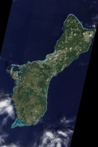
Guam is 30 miles long and 4 to 12 miles wide, giving it an area of 212 square miles or three-fourths the size of Singapore and making it the 32nd largest island of the United States.

It is the southernmost and largest island in the Marianas as well as the largest in Micronesia. Guam’s highest point is Mount Lamlam at 1,334 feet. Challenger Deep, at 35,797 feet the deepest surveyed point in the Oceans, lies southwest of Guam.
The Mariana chain of which Guam is a part was created by collision of the Pacific and Philippine Sea tectonic plates. Guam is the closest land mass to the Mariana Trench, the deep subduction zone that runs east of the Marianas. Due to its location on the Mariana Plate just westward of where the Pacific Plate subducts the Mariana and the Philippine Sea Plates, Guam occasionally experiences earthquakes. In recent years, most with epicenters near Guam have had magnitudes ranging from 5.0 to 8.7. Unlike Anatahan in the Northern Mariana Islands, Guam is not volcanically active, though vog (volcanic smog) from Anathan affects it due to proximity.
