Although today it is usually considered part of the Midwest, Missouri was historically seen by many as a border state, chiefly because of the settlement of migrants from the South and its status as a slave state before the Civil War, balanced by the influence of St. Louis. The counties that made up “Little Dixie” were those along the Missouri River in the center of the state, settled by Southern migrants who held the greatest concentration of slaves.
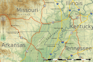
North of, and in some cases just south of, the Missouri River lie the Northern Plains that stretch into Iowa, Nebraska, and Kansas. Here, rolling hills remain from the glaciation that once extended from the Canadian Shield to the Missouri River. Missouri has many large river bluffs along the Mississippi, Missouri, and Meramec Rivers. Southern Missouri rises to the Ozark Mountains, a dissected plateau surrounding the Precambrian igneous St. Francois Mountains. This region also hosts karst topography characterized by high limestone content with the formation of sinkholes and caves.

The Missouri Bootheel region is part of the Mississippi Alluvial Plain or Mississippi embayment. This region is the lowest, flattest, warmest, and wettest part of the state. It is also among the poorest, as the economy there is mostly agricultural. It is also the most fertile, with cotton and rice crops predominant.
History:
Pre-European Contact:
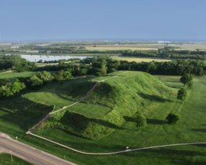
Indigenous peoples inhabited Missouri for thousands of years before European exploration and settlement. Archaeological excavations along the rivers have shown continuous habitation for more than 7,000 years. Beginning before 1000 CE, there arose the complex Mississippian culture, whose people created regional political centers at present-day St. Louis and across the Mississippi River at Cahokia, near present-day Collinsville, Illinois. Their large cities included thousands of individual residences, but they are known for their surviving massive earthwork mounds, built for religious, political and social reasons, in platform, ridgetop and conical shapes. Cahokia was the center of a regional trading network that reached from the Great Lakes to the Gulf of Mexico. The civilization declined by 1400 CE, and most descendants left the area long before the arrival of Europeans.

European Settlement:
The first European settlers were mostly ethnic French Canadians, who created their first settlement in Missouri at present-day Ste. Genevieve, about an hour south of St. Louis. They had migrated about 1750 from the Illinois Country. They came from colonial villages on the east side of the Mississippi River, where soils were becoming exhausted and there was insufficient river bottom land for the growing population. Sainte-Geneviève became a thriving agricultural center, producing enough surplus wheat, corn and tobacco to ship tons of grain annually downriver to Lower Louisiana for trade. Grain production in the Illinois Country was critical to the survival of Lower Louisiana and especially the city of New Orleans.
St. Louis was founded soon after by French fur traders, Pierre Laclède and stepson Auguste Chouteau from New Orleans in 1764. From 1764 to 1803, European control of the area west of the Mississippi to the northernmost part of the Missouri River basin, called Louisiana, was assumed by the Spanish as part of the Viceroyalty of New Spain, due to Treaty of Fontainebleau. The arrival of the Spanish in St. Louis was in September 1767.
